
BurnsvilleMS
A town of 857, settled in 1856.
Is Burnsville a good place to live?
32% of residents live below the poverty line in Burnsville, above both the Mississippi town median (21%) and the median of U.S. towns (9.6%). Only one of the 102 Mississippi towns we compare has a lower share of adults with a bachelor’s degree than Burnsville. Burnsville has fewer than 1,000 residents, too few for fair grades; the figures below are still real.
857 people, and everyone knows the way
In a town this size, neighbors are the best guide. Ask them anything.
Moving to Burnsville: who provides what
Who provides power, water and the rest in Burnsville, and how to reach them.
EPA SDWIS (Oct 9, 2026) · HIFLD + EIA-861 2025 · Census 2020 ZCTAs · NCES 2024–25 · registration: vote.gov, updated Nov 18, 2024.
The data
Ordered by what stands out in Burnsville.
The schools Burnsville’s kids attend
The public schools here belong to the Tishomingo County School District. Its one school is below. Enrollment at Burnsville’s public school: 410 students.
| School | Level | Students | Letter |
|---|---|---|---|
| Burnsville Elementary SchoolLargest public elementary schoolGrades K–8 | Grades K–8 | 410 | B− |
NCES · EDFacts
The climate in Burnsville brings mild winters and hot summers
Burnsville’s peak summer temperature is 90°F, against 91°F in Mississippi’s towns and 85°F across U.S. towns.
Typical low → high °F
NOAA U.S. Climate Normals, 1991–2020
Burnsville has 0.8 jobs per working resident, so most workers leave town for work
The average commute in Burnsville is 32 minutes. Jobs in Burnsville grew by 97 from 2013 to 2023, reaching 231. Among working residents in the town, 2.8% work locally. The top destinations are Iuka (19%), Corinth (9%) and Tupelo (7%).
| Burnsville | Mississippi towns | U.S. towns | |
|---|---|---|---|
| Average trip to work | 32 minutes | 23 minutes | 25 minutes |
| Working residents who work in town | 2.8% | 19% | 8% |
Where working residents work
Census LEHD 2023 · ACS
A typical Burnsville home is worth about $162K
Over the 12 months to September 2026, the typical home lost 2.9% of its value. 71% of households live in a home they own in Burnsville.
Typical home value
Census ACS, 2020–24 · Zillow Home Value Index · Redfin Data Center
How healthy Burnsville is
The share of adults in Burnsville who have been diagnosed with depression: 23%. This Mississippi town beats the Mississippi average on 2 of 31 CDC measures and trails it on 3. Two figures for adults in the town: 17% report frequent physical distress, 35% get no exercise outside work.
| Burnsville | Mississippi towns | U.S. towns | |
|---|---|---|---|
| Smoke cigarettes (CDC PLACES) | 20% | 18% | 14% |
| Frequent physical distress (CDC PLACES) | 17% | 16% | 14% |
| Get no exercise (CDC PLACES) | 35% | 36% | 25% |
| High blood pressure (CDC PLACES) | 42% | 45% | 35% |
| What stands out | Burnsville | MS |
|---|---|---|
| Fewer adults facing a utility shut-off | 8.5% | 11.2% |
| Fewer adults facing housing insecurity | 13% | 16.8% |
| More adults with depression | 23.2% | 19.5% |
CDC PLACES 2025 · modeled estimates for adults · CMS · HRSA
6.5% of Burnsville is conserved land
2.6 miles of trail. Among 88 Mississippi towns, just 3 have a higher trail density than Burnsville.
| Burnsville | Mississippi towns | U.S. towns | |
|---|---|---|---|
| Conserved land | 6.5% | 2.8% | 4.3% |
| Miles of trail per square mile | 0.5 miles per square mile | 0.2 | 0.4 |
Trails & parks © OpenStreetMap contributors · Conserved land: USGS PAD-US
Natural hazards: moderate risk in Burnsville, mostly inland flooding
FEMA puts 28% of Burnsville’s expected hazard losses down to inland flooding, and 22% to earthquakes. Expected storm and flood damage is higher than in 53% of U.S. communities. Federal aid has come to Burnsville households in 4 declared disasters; the latest was in 2026.
FEMA disaster declarations and aid · FEMA National Risk Index · OpenFEMA
Natchez Trace Parkway and 6 more within 40 miles
Museums, parks, gardens and other places to visit around Burnsville. Close and well known come first.
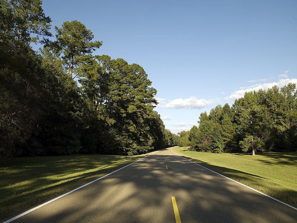 16 mi ParkwayNatchez Trace Parkway8.0M visitors a year
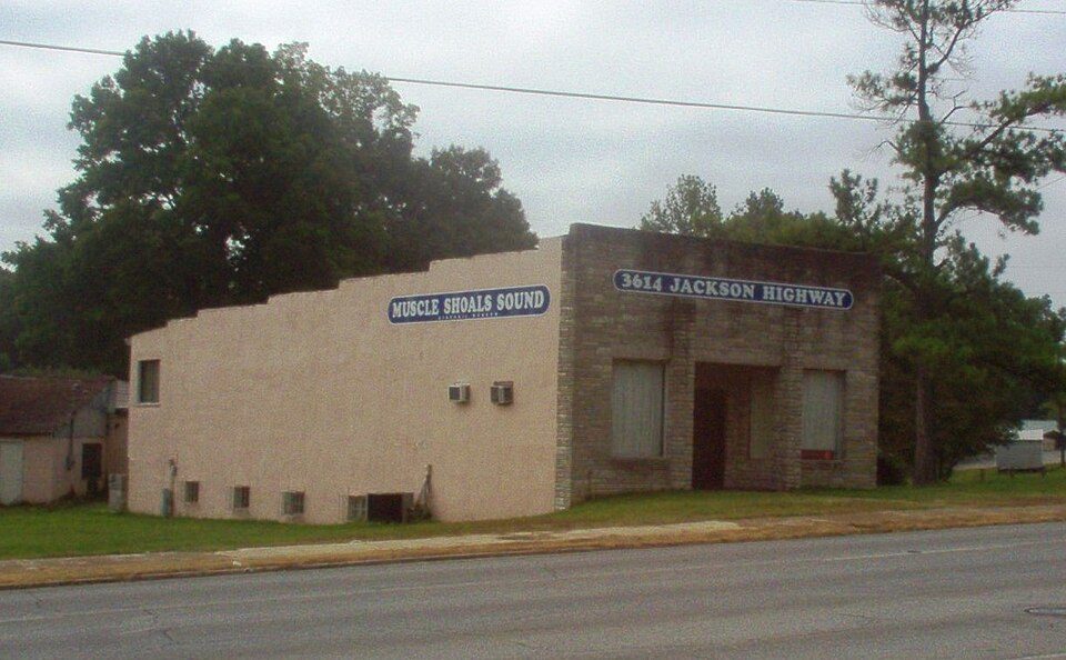 37 mi MuseumMuscle Shoals Sound Studio
 12 mi National Military ParkShiloh National Military Park347K visitors a year
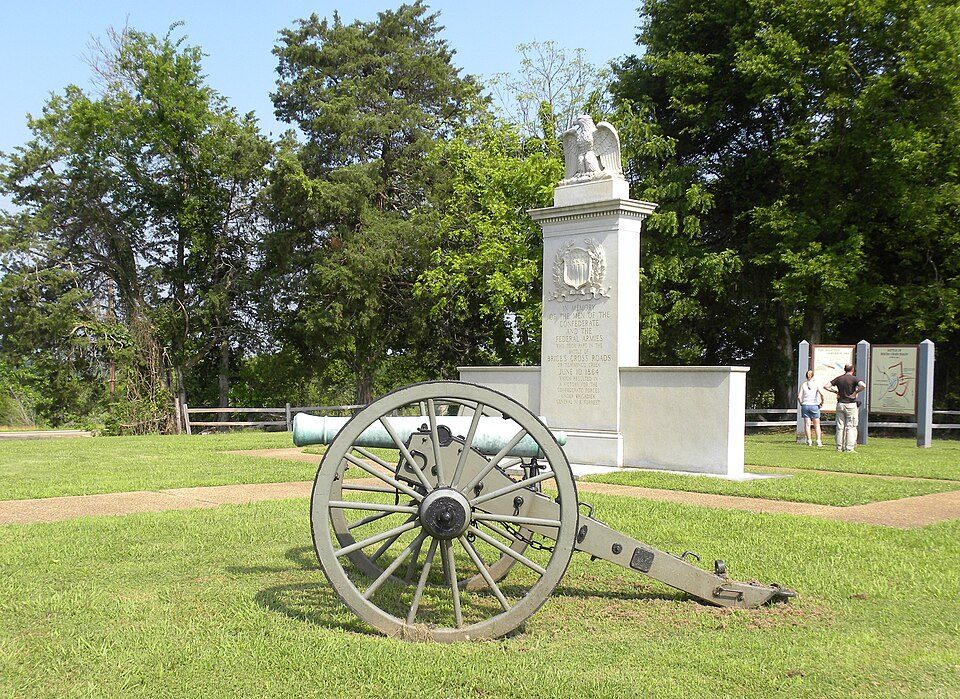 32 mi National park siteBrices Cross Roads National Battlefield Site2K visitors a year36 mi MuseumAlabama Music Hall of Fame7 mi MuseumApron Museum
Photo credits
Natchez Trace Parkway: Carol M. Highsmith (1946–), Public domain · Muscle Shoals Sound Studio: Dailynetworks, CC BY-SA 3.0 · Shiloh National Military Park: Ernest Mettendorf, Public domain · Brices Cross Roads National Battlefield Site: Wilson44691, Public domain


Everything we know about Burnsville
Colleges nearby
None within 15 miles of Burnsville; the nearest are
About 4 of every 100 Burnsville residents are enrolled in college, against 6 across Mississippi.
About Burnsville
Town in Mississippi, United States
Burnsville is a town in Tishomingo County in northeastern Mississippi, United States. As of the 2020 census, Burnsville had a population of 868.
From Wikipedia, licensed CC BY-SA 4.0 · facts via Wikidata (CC0)
- Area
- 4.8 sq mi
- Elevation
- 466 ft
- ZIP code
- 38833
- Area code
- 662
Questions about Burnsville
Short answers, built from the data on this page.
Is Burnsville, MS a good place to live?
Burnsville has fewer than 1,000 residents, too few for fair grades; the figures below are still real.