Guest, Sign inJoin

Post to St. Robert

We’ll email a one-tap link to publish your post. No password, and nothing is public until you click it.
Already a member? Sign in
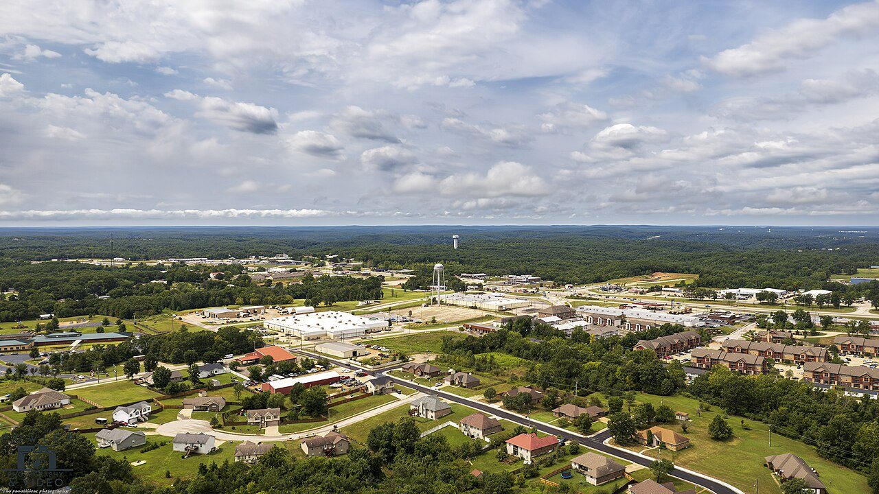
Drone footage--20240814191-Enhanced-NR 2048px
Missouri›Pulaski County

St. RobertMO

A town of 5,602. A regional job hub with 2,688 jobs.

2 bordering townsMap →
Photo: Fowlerphotography · CC BY 4.0
Photo of St. Robert

St. Robert, MO · Photo: Fowlerphotography · CC BY 4.0 · Source ↗

Is St. Robert a good place to live?

St. Robert grades C overall, 153rd of 247 graded towns in Missouri, with clear strengths and some subjects that lag. On the other side, the median household income is $63K, and 19% of residents live below the poverty line. It also does better than most on schools: its schools rank ahead of 70% of Missouri towns. Its lowest everyday mark is in health: CDC estimates put its residents' health behind 62% of the country. A typical home there costs about $240K, 3.7 years of the Fort Leonard Wood area’s $64K median household income. St. Robert’s rate of thefts and burglaries is 27 per 1,000 residents, where Missouri’s towns sit at 12.4 and U.S. towns at 9.9. On civic life, just 18 of Missouri’s 390 towns do worse. St. Robert has 2 places on the National Register.

What makes St. Robert stand out

Where St. Robert beats most towns.

A growing town

St. Robert has grown 29% since 2010

4,340 counted in 2010 and 5,192 in 2020; an estimated 5,602 in 2025.

Growth hasn’t slowed: 8.2% since 2020, after 19.6% in the decade before.

4,3402010
5,1922020
5,6022025 est.

U.S. Census 2010 & 2020 counts · Census Bureau estimate, July 1, 2025

How St. Robert grades

Each subject compared with towns across the country (schools within Missouri), ordered by how far St. Robert is from typical.

How grading works
Character Graded, but not part of the overall grade.
Described, not graded Taste, not quality: snow or an older crowd is neither good nor bad.

How TownRatings grades towns →

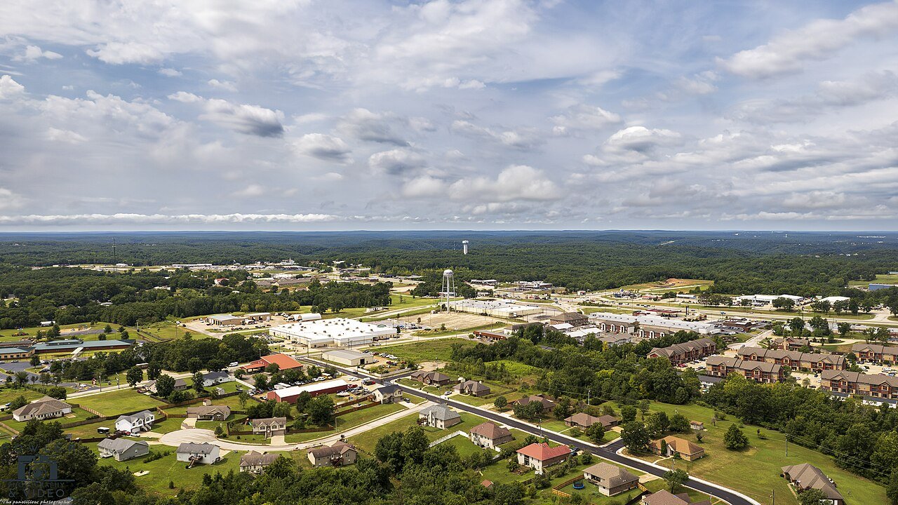
Drone footage--20240814191-Enhanced-NR 2048px
Drone footage--20240814191-Enhanced-NR 2048px, 2024
St. Robert’s story

St. Robert in pictures

Census counts: 860 in 1960, 5,192 in 2020. The archive holds 2 old photos and papers going back to 2004 and 5 maps from 1942 on.

Explore the history →
Getting set up

Moving to St. Robert: who provides what

Who provides power, water and the rest in St. Robert, and how to reach them.

The full setup list →
PowerCity of St RobertEIAHIFLD · EIA
WaterPulaski County Pwsd 2No health-based violations in 5 years · EPAEPA
Internet8 providers100% of addresses get 100/20 MbpsFCC
Trash & dumpNot on file yetWe don’t have St. Robert’s trash rules yet
SchoolsWaynesville R-VI SchoolsWhich school depends on your addressNCES
Register to voteOnlineIn Missouri you can register online until 27 days before Election Day, in person until 27 days before Election Day, or by mail (postmarked 27 days before).vote.gov
Who runs elections herePulaskiPulaski County; contacts on the Handbook page.FVAP, Feb 2025
ZIP codes65584, 6558365584 94% · 65583 6%Census 2020

EPA SDWIS (Oct 9, 2026) · HIFLD + EIA-861 2025 · Census 2020 ZCTAs · NCES 2024–25 · registration: vote.gov, updated Nov 18, 2024.
The data

Ordered by what stands out in St. Robert.

St. Robert draws workers from Waynesville and beyond and is healthier than towns with similar incomes.

Work & commuteJobs & income grade C−

About one in seven working residents works right in St. Robert

2,688 jobs are based in St. Robert, 2 for every working resident, so most of the people who work here commute in.

The top destinations are Fort Leonard Wood (15%), Waynesville (12%) and Rolla (6%). The typical journey to work in St. Robert is 19 minutes. Half the trips to work are shorter than 22 miles.

15%work in town
St. RobertMissouri townsU.S. towns
Average trip to work19 minutes22 minutes25 minutes
Working residents who work in town15%13%8%
Median household income$63,000$62,000$80,000

Where working residents work

In St. Robert15%
Fort Leonard Wood15%
Waynesville12%
Rolla6%
Springfield5%
22 mi
median commute distance
2,688
jobs based in St. Robert
A job hub
jobs vs. working residents
C+
Walkability grade: more walkable than 42% of U.S. towns

Census LEHD 2023 · ACS

SchoolsB+

St. Robert earns a B+ for schools

Its two schools are below. Waynesville R-VI runs its public schools. Enrollment at St. Robert’s public school: 954 students.

70%of MO districts it outscoresB+School Grade
SchoolLevelStudentsLetter
Freedom Elem.Largest public elementary schoolGrades K–5Grades K–5954B
Maranatha Baptist Academy PrivateLargest high schoolGrades PK–12Grades PK–12208–

NCES · EDFacts · graded within MO on state tests and graduation

Natural hazardsHazard risk grade B

St. Robert faces a low natural-hazard risk, led by inland flooding

Compared with 69% of U.S. communities, expected storm and flood damage in St. Robert is lower. Expected losses in St. Robert break down as 37% from inland flooding and 19% from cold waves. Households locally have drawn federal disaster aid in 10 declared disasters, most recently in 2019.

31risk score of 100
FEMA risk score
31Low riskLowerHigher
Inland floodingCold wavesHeat waves
1
paid flood claims since 2013
10
federal disasters paid out here

FEMA disaster declarations and aid · FEMA National Risk Index · OpenFEMA

Climate

In St. Robert, expect four seasons and hot summers

The range runs from 23° on a January night to 89° on a July afternoon, with about 10 inches of snow a winter.

10″snow a winter

Typical low → high °F

Winter26–46°
Spring44–68°
Summer65–87°
Fall46–69°
Oct 21
typical first frost
Apr 15
typical last frost
+0.8°
vs. the 20th-century average

NOAA U.S. Climate Normals, 1991–2020

OutdoorsC

Protected land: 0.7% of St. Robert

There are 2.3 miles of trail across 4 parks and preserves. The density of trails for St. Robert comes to 0.3 miles per square mile. Parks and preserves locally: 4, covering 13 acres.

#113for trails in MO
St. RobertMissouri townsU.S. towns
Conserved land0.7%2.1%4.3%
Miles of trail per square mile0.3 miles per square mile0.30.4
0.7%
conserved · 37 of 5,368 acres
2.3 mi
of trails · 0.3 per sq mi
Biggest places to walkTrailsAcres
1. Bosa Heights Park—5
2. Plattner Neighborhood Park—3
3. Saint Robert Municipal Park—3

Trails & parks © OpenStreetMap contributors · Conserved land: USGS PAD-US

Who lives here

More adults under 35 in St. Robert than across Missouri

In St. Robert, a third of adults 25 and older hold a bachelor’s degree or more. Adults 18 to 34 are 29% of residents (22% statewide); people 65 and older are 13% of residents (18% statewide). Since 2020, St. Robert has grown 8.2%, to 5,602 residents in the Census Bureau’s 2025 estimate.

32.8median age · MO 39
St. RobertMissouri townsU.S. towns
Median age32.8 years38.5 years40.5 years
Aged 65 or older13%17%18%
Bachelor’s degree or more, 25+33%22%29%
St. RobertMissouriUnited States

Ages · share of residents

Education · adults 25 and older

No diploma6%
High school25%
Some college20%
Associate’s16%
Bachelor’s24%
Graduate9%

Women and men · all residents

44% women, 56% men

About 125 men for every 100 women (the survey’s margin: ±4.6 points). Across Missouri, 50.7% of residents are women. Among residents 18 to 24, 78% are men (MO 51%).

Ages and education in St. Robert
St. RobertMOU.S.
Under 1010.5%11.9%11.6%
10 to 1711.6%10.4%10.3%
18 to 2412.6%9.1%9.1%
25 to 3416.3%13.2%13.7%
35 to 4415.9%12.8%13.2%
45 to 5412.3%11.6%12.2%
55 to 647.6%13%12.7%
65 to 746.6%10.6%10.2%
75 and older6.4%7.3%7%
No diploma6.3%8.1%10.4%
High school24.6%30.2%26%
Some college20.2%20.8%19.1%
Associate’s16.1%8.4%8.8%
Bachelor’s23.6%19.8%21.6%
Graduate9.1%12.6%14.1%

Census population estimates, 2025 · U.S. Census Bureau · ACS 2020-2024 5-year estimates

HealthC+

St. Robert earns a C+ for health

Against the 9,534 U.S. towns with household incomes like St. Robert’s, it is healthier than 56%, so that grade isn’t only a matter of income. Within Missouri it is healthier than 59% of the 247 graded towns: much of Missouri scores lower on these measures.

Among adults in St. Robert, 10% have diabetes. Against the Missouri average, St. Robert comes out ahead on 8 CDC measures out of 32, and behind on 9. In St. Robert, 31% of adults have high blood pressure, and 75% had a checkup this year.

38%healthier than U.S. townsC+Health Grade
St. RobertMissouri townsU.S. towns
Sleep under 7 hours (CDC PLACES)44%38%36%
High blood pressure (CDC PLACES)31%37%35%
Yearly checkup (CDC PLACES)75%78%79%
Diabetes (CDC PLACES)10%12%12%
32 measures vs. Missouri
8 better15 too close to call9 worse
What stands outSt. RobertMO
Fewer adults who have had cancer5%8.6%
Fewer adults with heart disease4.7%6.8%
More adults facing housing insecurity16.8%12.1%
General Leonard Wood Ach (Ft Leonard Wood)
8.6 mi away · emergency room
3 of 3
care shortages: primary care, dental, mental health
59th
percentile among MO towns

CDC PLACES 2025 · modeled estimates for adults · CMS · HRSA

Safety

Crime reported in St. Robert

For St. Robert, the level of violent crime is 0.7 per 1,000 residents. St. Robert's reported crime rate is above Missouri's. Most reported incidents are property crimes, mainly thefts.

Violent crime per 1,000 residents

St. Robert0.7
Missouri4.3
U.S.3.3

Property crime per 1,000 residents

St. Robert27
Missouri16.9
U.S.15.5
4
violent crimes reported in 2025
151
property crimes reported in 2025

FBI crime data, 2025 · crimes reported to police

HousingCost of living grade C+

St. Robert earns a C+ for cost of living

Values rose 2.3% in the 12 months to September 2026. On the market in St. Robert: a median 22 days to sell. For households locally, the share who own their home is 63%.

$240KZillow home value
St. RobertMissouri townsU.S. towns
Households that own their home63%64%73%
Median rent$1,087 a month$970 a month$1,185 a month

Typical home value

St. Robert$240K
Missouri$265K
Market temperature
Seller’s marketA strong seller's marketBuyer’sSeller’s
22
days on market
99.8%
sale-to-list price
+2.3%
value change, 1 year
11
homes sold in May

Census ACS, 2020–24 · Zillow Home Value Index · Redfin Data Center

Keep exploring

Everything we know about St. Robert

19pages on St. Robert
After high school

Colleges nearby

None within 15 miles of St. Robert; the nearest are

A job hub

Every workday, about 2,480 people come to St. Robert for work

Where St. Robert’s working residents go each day. Line width shows the share.

15% → Fort Leonard Wood Fort Leonard Wood 15% 12% → Waynesville Waynesville 12% 6% → Rolla Rolla 6% 5% → Springfield Springfield 5% 3% → Lebanon Lebanon 3% 2% → Jefferson City Jefferson City 2% St. Robert · 15% stay
2,688jobs based in St. Robert
15%of working residents work in town
22 mimedian commute distance

Census LEHD 2023

About St. Robert

City in Pulaski County, Missouri, United States

St. Robert or Saint Robert is a city in Pulaski County, Missouri, United States. The population was 5,192 at the 2020 census. It is a gateway community to the United States Army installation at Fort Leonard Wood.

From Wikipedia, licensed CC BY-SA 4.0 · facts via Wikidata (CC0)

Area
7.9 sq mi
Elevation
1,040 ft
ZIP code
65584

St. Robert’s neighbors

2 towns share a border with St. Robert.

Explore the map →
How the neighbors grade
TownMO rankOverallCostSafetySchoolsHealth
St. Robert#153CC+—B+C+
Fort Leonard Wood#86BC—B+A−
Waynesville#166CC+CB+B

St. Robert and Fort Leonard Wood report no FBI crime data of their own. Compare St. Robert with a neighbor →

Questions about St. Robert

Short answers, built from the data on this page.

Is St. Robert, MO a good place to live?

St. Robert grades C overall, better than 32% of U.S. towns and #153 of 247 in Missouri. It grades C+ for health and B+ for schools. Jobs & income is its weak spot, with a C−.

Is St. Robert, MO expensive?

Cost of living, which also weighs rents, property taxes and how many households pay 30% or more of their income for housing, grades C+.