Guest, Sign inJoin

Post to Springfield

We’ll email a one-tap link to publish your post. No password, and nothing is public until you click it.
Already a member? Sign in
AHistory
History · Springfield

Springfield’s post office opened in 1834, and 13% of its homes were built before 1940

More historic than 87% of U.S. towns · #20 of 247 in Missouri. What drives it

65 places in town are on the National Register, among them ten historic districts with 819 buildings between them. Below: 6 old photos and papers, maps from 1884 on, and the census since 1850.

1834first post office
65on the National Register
13%homes built before 1940
6old photos & papers
41famous people
From Springfield’s archive · credits on each photo
Quick answers

How Springfield began

When was Springfield founded?

1834

The Springfield post office opened in 1834, the earliest record of the town by name. Wikidata gives 1838. Five smaller post offices, North Springfield (1871), Junction City (1878) and Galloway (1883), opened inside today’s city and later closed.

First census: 415 in 18502020 census: 169,176192 years

How historic is Springfield?

A

More historic than 87% of U.S. towns, on its age, its old homes and the National Register.

What drives the grade ↓
Founding year: the first Springfield post office (Blevins & Helbock, CC0). Wikidata: 1838.The full story ↓
History grade

What drives Springfield’s History grade

On its age, its old homes and the National Register, Springfield is more historic than 87% of U.S. towns, #20 of 247 in Missouri. All 3 inputs are above most U.S. towns; its National Register listings ranks highest and its share of homes from before 1940 lowest.

A
HistoryA character grade: shown, never part of Springfield’s overall grade.
All U.S. towns we grade (21,289)Ahead of 87%
NewerOlder
Missouri towns of 2,500+ (247)Ahead of 92%

Among the 400 U.S. cities of 100,000 or more, Springfield ranks #88 on History.

Missouri towns list about as much on the Register as the country (a typical Missouri town has 2.4 per 10,000 residents, the U.S. 2.4), so Springfield’s 52.7 sits above most of its state (88% of Missouri towns have fewer) while its 895 historic buildings outnumber those of 98% of U.S. towns.

How sure. Graded on any two of the three inputs instead, the letter would range from B+ to A. The pre-1940 share (±0.8 points) is firm at this size. The founding year is the first post office, not a stated founding date; Wikidata’s 1838 falls in the same era, so the grade doesn’t depend on which one is used.

Founding year: the first post office (other dates in Quick answers). Homes: Census ACS 2020–24. National Register: National Park Service, May 2026 list; each listing counted once (boundary changes and added documentation belong to their listing), and a historic district counts its contributing buildings. How TownRatings grades history →

What stands out about Springfield’s past

Read from the archive, the National Register and the record. The page puts what stands out first.

★ What stands out · On the National Register

65 listings protect 895 historic buildings

The country’s official list of buildings and places worth saving. Boundary changes and added documentation are counted with their listing.

places listed
65
National Historic Landmarks
0
none yet
historic buildings protected
895
each building in a district counts
first listed
1976
Day House
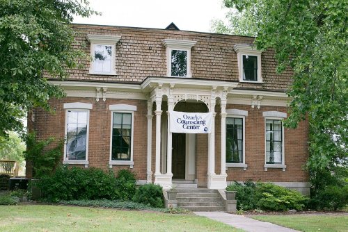
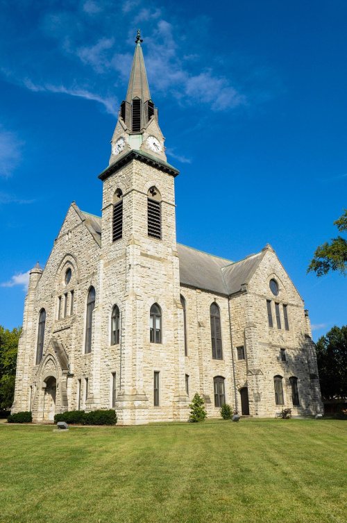
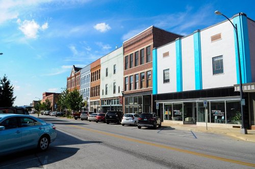
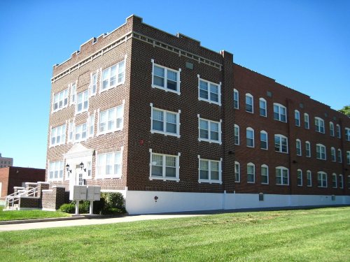
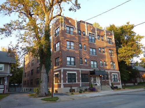
Day HouseLanders TheaterU.S. Customhouse and Post OfficeBentley HouseOld CalabosseAbou Ben Adhem Shrine MosqueStone ChapelCommercial Street Historic DistrictKeet-McElhany HouseGillioz TheaterSpringfield National CemeteryMarquette HotelLincoln SchoolHolland BuildingBenton Avenue AME ChurchOberman, D.M., Manufacturing Co. BuildingHeer's Department StorePalace HotelWise Feed Company BuildingNetter-Ullman BuildingCollege ApartmentsJefferson Street FootbridgeWoods-Evertz Stove Company Historic DistrictKite, Robert B. and Vitae A., Apartment BuildingEdward M. and Della C. Wilhoit HouseE.M. Wilhoit BuildingFinkbiner BuildingKing, J.E., Manufacturing CompanyCamp Manor Apartments, built 1916Springfield Public Square Historic DistrictHenry Schneider BuildingSpringfield Seed Co. Office and WarehouseFranklin Springfield Motor Co. BuildingGreene County CourthouseGottfried Furniture Company BuildingAmbassador Apartments, built 1928Pythian Home of MissouriRail Haven MotelFallin Brothers BuildingRoute 66 Steak 'n ShakeBailey SchoolBeverly ApartmentsProducers Ice and Manufacturing CompanyWalnut Street Historic DistrictMid-Town Historic DistrictCampbell Avenue Historic DistrictSouth Avenue Commercial Historic DistrictSpringfield Warehouse and Industrial Historic DistrictWalnut Street Commercial Historic DistrictHotel SansoneWest Walnut Street Commercial Historic DistrictSouth-McDaniel-Patton Commercial Historic DistrictRock Fountain Court Historic DistrictMarx-Hurlburt BuildingSt. John's Mercy Hospital BuildingPearl Apartments and Windsor ApartmentsSpringfield Furniture CompanyWilshire ApartmentsSt. Paul BlockProducers Produce Company PlantSpringfield Grocer Company WarehouseMcDaniel BuildingHeercleffFallin GarageRoberts Farmstead
BuildingsDistrictsSitesStructures

Architectural styles listings

Italianate8
Commercial Block7
Colonial Revival6
Queen Anne4
Factory4
Brick Front4
All 65 listings
Keet-McElhany HouseBuilding · listed 1984Gillioz TheaterBuilding · listed 1991Springfield National CemeterySite · listed 1999Marquette HotelBuilding · listed 2000Lincoln SchoolBuilding · listed 2000Holland BuildingBuilding · listed 2000Benton Avenue AME ChurchBuilding · listed 2001Oberman, D.M., Manufacturing Co. BuildingBuilding · listed 2002Heer's Department StoreBuilding · listed 2002Palace HotelBuilding · listed 2002Wise Feed Company BuildingBuilding · listed 2003Netter-Ullman BuildingBuilding · listed 2003College ApartmentsBuilding · listed 2003Jefferson Street FootbridgeStructure · listed 2003Woods-Evertz Stove Company Historic DistrictDistrict · listed 2003Kite, Robert B. and Vitae A., Apartment BuildingBuilding · listed 2004Edward M. and Della C. Wilhoit HouseBuilding · listed 2004E.M. Wilhoit BuildingBuilding · listed 2005Finkbiner BuildingBuilding · listed 2005King, J.E., Manufacturing CompanyBuilding · listed 2005Camp Manor ApartmentsBuilding · listed 2005Springfield Public Square Historic DistrictDistrict · listed 2006Henry Schneider BuildingBuilding · listed 2006Springfield Seed Co. Office and WarehouseBuilding · listed 2006Franklin Springfield Motor Co. BuildingBuilding · listed 2006Greene County CourthouseBuilding · listed 2007Gottfried Furniture Company BuildingBuilding · listed 2007Ambassador ApartmentsBuilding · listed 2008Pythian Home of MissouriBuilding · listed 2009Rail Haven MotelBuilding · listed 2010Fallin Brothers BuildingBuilding · listed 2012Route 66 Steak 'n ShakeBuilding · listed 2012Bailey SchoolBuilding · listed 2016Beverly ApartmentsBuilding · listed 2017Producers Ice and Manufacturing CompanyBuilding · listed 2018Walnut Street Historic DistrictDistrict · listed 1985Mid-Town Historic DistrictDistrict · listed 1989Campbell Avenue Historic DistrictDistrict · listed 1999South Avenue Commercial Historic DistrictDistrict · listed 1999Springfield Warehouse and Industrial Historic DistrictDistrict · listed 1999Walnut Street Commercial Historic DistrictDistrict · listed 1999Hotel SansoneBuilding · listed 2000West Walnut Street Commercial Historic DistrictDistrict · listed 2002South-McDaniel-Patton Commercial Historic DistrictDistrict · listed 2003Rock Fountain Court Historic DistrictDistrict · listed 2003Marx-Hurlburt BuildingBuilding · listed 2003St. John's Mercy Hospital BuildingBuilding · listed 2003Pearl Apartments and Windsor ApartmentsBuilding · listed 2005Springfield Furniture CompanyBuilding · listed 2006Wilshire ApartmentsBuilding · listed 2008St. Paul BlockBuilding · listed 2009Producers Produce Company PlantBuilding · listed 2010Springfield Grocer Company WarehouseBuilding · listed 2010McDaniel BuildingBuilding · listed 2014HeercleffBuilding · listed 2016Fallin GarageBuilding · listed 2023Roberts FarmsteadDistrict · listed 2025

National Park Service, National Register of Historic Places. Photos from Wikimedia Commons, credited on each place’s page.

Places that used to be

Lost post offices, old corners, places now gone and burying grounds

Springfield’s post office has been open since 1834. Five other post offices opened and closed inside today’s town.

Springfield
1834–today
North Springfield
1871–1888
Junction City
1878–1888
Galloway
1883–1943
Gates
1884–1912
Nichols
1888–1894
18301930today
Hamlets and corners on the map
GallowayKissickLangstonNicholsSequiotaValley Water Mills
Gone or out of use
Bisset SchoolschoolCrenshaw SchoolschoolKickapoo SchoolschoolLakeview SchoolschoolMount Pleasant SchoolschoolPlainview SchoolschoolPleasant View ChurchchurchProvisionlocaleSequiota SchoolschoolStar Schoolschool
13cemeteries and burying grounds inside Springfield
EastlawnGibson-PorterHazelwoodKirkwoodKlinger-Cope at RivermonteLincoln Memorial ParkMaple ParkMissouri State Veterans Cemetery - SpringfieldSaint MarysSpringfield NationalTemple IsraelWestmorelandYarbrough

US Post Offices dataset (Blevins & Helbock, CC0). Places and cemeteries from the USGS Geographic Names Information System (2021).

The story

How Springfield came to be

From Wikipedia’s history of Springfield.

Read it all →

Native American peoples had long lived in this area. In the 1830s, the native Osage Nation, the Kickapoo from Indiana, and the Lenape (Delaware) from the mid-Atlantic coast had settled in this general area trying to evade encroachment by European Americans on their lands. The Osage had been the dominant tribe for more than one century in the larger region.

On the southeastern side of the town in 1812, about 500 Kickapoo built a small village of about 100 wigwams. They abandoned the site in 1828.

Ten miles south of the site of Springfield, the Lenape had built a substantial community of houses that borrowed elements of Anglo colonial style from the mid-Atlantic, where some of their people had migrated from.

Text from Wikipedia, licensed CC BY-SA 4.0.

From the old history books

What they wrote about Springfield, 1883–1915

Passages that mention Springfield, cut from the printed page as they were published.

About six miles from Springfield, on the Springfield and James river bridge road, and on the line of the Springfield and Southern R. R., about three-quarters of a mile above Gallaway station, is a cave of considerable note. From it issues one of the finest streams of water in Greene county and the …
History of Greene County, Missouri ..1883 · page 691Read the page →
Read the text

About six miles from Springfield, on the Springfield and James river bridge road, and on the line of the Springfield and Southern R. R., about three-quarters of a mile above Gallaway station, is a cave of considerable note. From it issues one of the finest streams of water in Greene county and the Southwest, and on account of this spring it became the site of one of the earliest settlements, having been entered in 1840 by Jacob Painter. During the war it was owned by Benj. Brashears, a Confederate soldier and ranger, who is said to have contracted a

Text read by machine from the scan; it may contain errors.
In May the town of Springfield was re-incorporated, but with boundaries so indefinitely described as to be incomprehensible at this day. (See history of Springfield). In July a county tax of 20 cents on the $100 was levied.
History of Greene County, Missouri ..1883 · page 200Read the page →
Read the text

In May the town of Springfield was re-incorporated, but with boundaries so indefinitely described as to be incomprehensible at this day. (See history of Springfield). In July a county tax of 20 cents on the $100 was levied.

Text read by machine from the scan; it may contain errors.
for eighteen months; then returned to Columbus and continued his trade with his former employers there, but in time returned to Missouri and worked at the town of Pacific for the South Pacific Railroad Company from 1869 until 1871, in which year he came to Springfield as machinist for the old Atlan…
Past and present of Greene County Missouri1915Read the page →
Read the text

for eighteen months; then returned to Columbus and continued his trade with his former employers there, but in time returned to Missouri and worked at the town of Pacific for the South Pacific Railroad Company from 1869 until 1871, in which year he came to Springfield as machinist for the old Atlantic-Pacific railroad, now the Frisco, and after working at his usual trade for six months, he was transferred to St. James, Missouri, as roundhouse foreman, which position he held two years; then worked at Dixon, this state, as roundhouse foreman; then held the same position at Xewburg

Text read by machine from the scan; it may contain errors.

Scans and text from the Internet Archive. Books published in 1930 or earlier, which are in the public domain.

Timeline

Springfield, 1834 to 1996

Woven from the archive, old maps, post office records, the National Register and the people born here.

  1. 19th century
  2. 1834Post officeThe Springfield post office opens
  3. 1861In the archive"The Fremont Body-Guard - Second Charge of the Detachment, Under Major "Zagonyi, on the R…
  4. 1870In the archiveFirst Battle of Springfield 1861
  5. 1871Post officeThe North Springfield post office opens
  6. 1878Post officeThe Junction City post office opens
  7. 1888Post officeThe North Springfield post office closes
  8. 1888Post officeThe Junction City post office closes
  9. 20th century
  10. 1916BuiltCamp Manor Apartments is built
  11. 1925Born hereVirginia E. Johnson is born here
  12. 1928BuiltAmbassador Apartments is built
  13. 1935On the mapFirst mapped by the U.S. Geological Survey
  14. 1954Born hereKathleen Turner is born here
  15. 1984Born hereLucas Grabeel is born here
  16. 1996Born hereJake Wesley Rogers is born here
By decade

Springfield, decade by decade

2 decades in the archive, from the 1860s to the 1870s. Scroll each row; tap a photo for its story.

On the map

Springfield on the map, 1935 to 1996

Every edition of the U.S. Geological Survey’s map of Springfield. Tap a year, or press play to watch the town change.

Springfield on the 1935 USGS mapSpringfield on the 1960 USGS mapSpringfield on the 1970 USGS mapSpringfield on the 1996 USGS map1935Springfield sheet · 1:24,000

U.S. Geological Survey historical topographic maps (public domain), via Esri’s collection of the scans. The red ring marks the center of Springfield.

Every building

Springfield, building by building, 1884–1910

Fire insurance maps drew every building, what it was made of and what it was used for, so insurers could price the risk of fire. Pick a year, then a sheet.

Springfield fire insurance map, 1884, sheet 11884Sheet 1 of 8
Edition
BrickWoodStone

Sanborn Map Company, via the Library of Congress. Editions published in 1930 or earlier, which are in the public domain.

Then & now

Stand where they stood

No then-and-now pairs yet. Take a photo from the same spot as an old one and they appear here side by side.

"The Fremont Body-Guard - Second Charge of the Detachment, Under Major "Zagonyi, on the Retreating Rebels in the Forest…
Retake this view"The Fremont Body-Guard - Second Charge of the Detachment, Under Major "Zagonyi, on the Retreating Rebels in the Forest…, 1861

Find the spot, match the angle, and add your photo. It becomes the first then-and-now pair on Springfield’s page.

Retake this view · +15
People over time

Springfield, census by census

020,00040,00060,00080,000100,000120,000140,000160,000180,0001850190019502000169,176

Grew from 415 people in 1850 to 169,176 in 2020, more than tenfold.

18 censuses, 1850–2020.

U.S. Census Bureau decennial counts, from the census table on Springfield’s Wikipedia page.

Famous people

41 famous people were born in Springfield

Writers, athletes, leaders and more, ranked by how widely they’re known.

See all →
Help out

Finish Springfield’s story

Most archives stop around 1920. The photos from after that are in family albums, not libraries.

Decades since 1900 with photos
00s10s20s30s40s50s60s70s80s90s
0 of 10 decades. The empty ones are waiting for someone’s album.
Stories next door

History across the town line

Each neighbor’s History grade, on the same three inputs.

Questions about Springfield’s history

What year was Springfield founded?

The Springfield post office opened in 1834, the earliest record of the town by name (U.S. post office records). Wikidata gives 1838.

How does Springfield rank for history?

Springfield is more historic than 87% of U.S. towns, #20 of 247 in Missouri. The History grade combines the town’s founding era, the share of homes built before 1940 and its National Register listings. It’s a character grade, so it isn’t part of the overall grade. How it works.

What is on the National Register in Springfield?

65 listings: 50 buildings, among them the Day House (listed 1976, the first), 13 historic districts with 819 contributing buildings, 1 site, and 1 structure. 895 historic buildings in all.

How old are the homes in Springfield?

13% of Springfield’s homes were built before 1940 (Census estimate), against a typical 8.4% for a Missouri town; the median home was built in 1975.

Memory lane

What the archives can’t tell you, neighbors can.

Town Square →
Start a conversation
Sources

Where this page comes from

Founding dates: Wikidata, Wikipedia, the U.S. post office records of Blevins & Helbock (CC0) and the Census. Homes by year built: Census ACS 2020–24. National Register of Historic Places: National Park Service (list of May 22, 2026). Old photos, postcards and papers: Wikimedia Commons, the Library of Congress and other public archives, credited on each item’s page. Maps: U.S. Geological Survey historical topographic maps (via Esri) and Sanborn fire-insurance maps (Library of Congress). History text and census tables: Wikipedia (CC BY-SA 4.0). Places that used to be: USGS Geographic Names Information System (2021).

From Wikimedia Commons (6), the National Register of Historic Places (65), Wikipedia, Wikidata and Wikipedia for famous people, U.S. Geological Survey historical maps, U.S. Census counts (via Wikipedia), the US Post Offices dataset (Blevins & Helbock), the USGS Geographic Names Information System, Sanborn fire insurance maps (Library of Congress) and old county and town histories (Internet Archive). Archive images are copied here with their credits and licenses, shown on each photo’s page. Refreshed monthly.