Guest, Sign inJoin

Post to Oregon

We’ll email a one-tap link to publish your post. No password, and nothing is public until you click it.
Already a member? Sign in
–Not graded
History · Oregon

Oregon dates to 1841, and 24% of its homes were built before 1940

Below: 3 old photos and papers, maps from 1893 on, and the census since 1860.

1841founded
0on the National Register
24%homes built before 1940
3old photos & papers
From Oregon’s archive · credits on each photo
Quick answers

How Oregon began

When was Oregon founded?

1841

Oregon dates its founding to 1841 (Wikidata). The census first counted it in 1860.

First census: 720 in 18602020 census: 837185 years
Founding year: Wikidata. First post office: 1843.The full story ↓

What stands out about Oregon’s past

Read from the archive, the National Register and the record. The page puts what stands out first.

★ What stands out · Help out

Start Oregon’s collection

The first neighbors to add old photos shape how Oregon’s history is told.

Decades since 1900 with photos
00s10s20s30s40s50s60s70s80s90s
0 of 10 decades. The empty ones are waiting for someone’s album.
Every building

Oregon, building by building, 1893–1911

Fire insurance maps drew every building, what it was made of and what it was used for, so insurers could price the risk of fire. Pick a year, then a sheet.

Oregon fire insurance map, 1893, sheet 11893Sheet 1 of 1
Edition
Sheets
BrickWoodStone

Sanborn Map Company, via the Library of Congress. Editions published in 1930 or earlier, which are in the public domain.

Timeline

Oregon, 1841 to 1926

Woven from the archive, old maps, post office records, the National Register and the people born here.

  1. 19th century
  2. 1841
    FoundingOregon is established
  3. 1843Post officeThe Oregon post office opens
  4. 1894In the archivePomological Watercolor POM00002300 (cropped)
  5. 20th century
  6. 1926On the mapFirst mapped by the U.S. Geological Survey
The story

How Oregon came to be

From Wikipedia’s history of Oregon.

Read it all →

Oregon was originally called Finley, and under that name was platted in June 1841; it was replatted on October 21, 1841 as Oregon. The present name refers to the Oregon Country, which was at the time considered a prime destination of pioneer emigrants passing through the area. A post office called Oregon has been in operation since 1843. It was a significant trading post in the Platte Purchase region of Missouri for the first couple of decades of existence. In 1873, the Northwest Missouri Normal School was built in Oregon, at a cost of $22,000 ($586,000 in 2025 dollars).

Text from Wikipedia, licensed CC BY-SA 4.0.

From the old history books

What they wrote about Oregon in 1859

Passages that mention Oregon, cut from the printed page as they were published.

The American settlements in Oregon are confined to the western section of Oregon, and are principally in the beautiful and fertile Valley of the Willamette. Oregon City is two thousand three hun¬ dred miles from St. Louis, on the east bank of the Willamette, just below the falls, at the head of nav…
The Great West1859 · page 432Read the page →
Read the text

The American settlements in Oregon are confined to the western section of Oregon, and are principally in the beautiful and fertile Valley of the Willamette. Oregon City is two thousand three hun¬ dred miles from St. Louis, on the east bank of the Willamette, just below the falls, at the head of navigation, and about eighteen miles from the mouth of the river. It is the largest town in Oregon.

Text read by machine from the scan; it may contain errors.
About the same time, Captain Wyeth, of Massachusetts, at¬ tempted to establish commercial relations with the countries on the Columbia, to which the name of Oregon then began to be universally applied. Ilis plan was like that of Astor, with the additional scheme of transporting the salmon of the Or…
The Great West1859 · page 425Read the page →
Read the text

About the same time, Captain Wyeth, of Massachusetts, at¬ tempted to establish commercial relations with the countries on the Columbia, to which the name of Oregon then began to be universally applied. Ilis plan was like that of Astor, with the additional scheme of transporting the salmon of the Oregon rivers to the United States. lie made two overland expeditions to Oregon, established Fort Hall as a trading-post, and another, mainly for fishing purposes, near the mouth of the Willamette.

Text read by machine from the scan; it may contain errors.

Scans and text from the Internet Archive. Books published in 1930 or earlier, which are in the public domain.

By decade

Oregon, decade by decade

One decade in the archive so far: the 1890s. Scroll each row; tap a photo for its story.

1900s–1990snothing yet
Nothing in the archives for these yearsWeddings on Main Street, storms, parades, school pictures, the old store. If it’s in your family album, it belongs here.
Add from your album
On the map

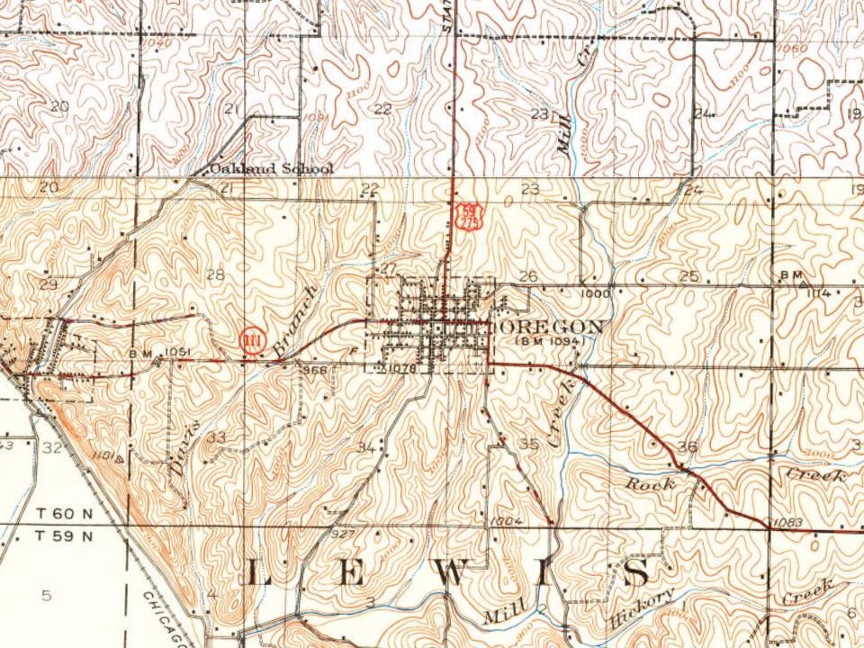
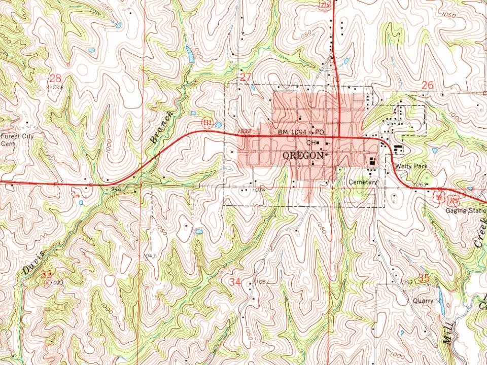
Oregon on the map, 1926 to 1959

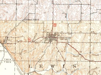
Every edition of the U.S. Geological Survey’s map of Oregon. Tap a year, or press play to watch the town change.

Oregon on the 1926 USGS mapOregon on the 1959 USGS map1926Oregon sheet · 1:62,500

U.S. Geological Survey historical topographic maps (public domain), via Esri’s collection of the scans. The red ring marks the center of Oregon.

Then & now

Stand where they stood

No then-and-now pairs yet. Take a photo from the same spot as an old one and they appear here side by side.

Pomological Watercolor POM00002300 (cropped)
Retake this viewPomological Watercolor POM00002300 (cropped), 1894

Find the spot, match the angle, and add your photo. It becomes the first then-and-now pair on Oregon’s page.

Retake this view · +15
People over time

Oregon, census by census

02004006008001,000190019502000Peak: 1,032

Between 720 and 1,032 people in every census since 1860.

17 censuses, 1860–2020.

U.S. Census Bureau decennial counts, from the census table on Oregon’s Wikipedia page.

Questions about Oregon’s history

What year was Oregon founded?

In 1841, according to Wikidata. Oregon’s post office opened in 1843, and the census of 1860 counted 720 people here.

Memory lane

What the archives can’t tell you, neighbors can.

Town Square →
Start a conversation
Sources

Where this page comes from

Founding dates: Wikidata, Wikipedia, the U.S. post office records of Blevins & Helbock (CC0) and the Census. Homes by year built: Census ACS 2020–24. National Register of Historic Places: National Park Service (list of May 22, 2026). Old photos, postcards and papers: Wikimedia Commons, the Library of Congress and other public archives, credited on each item’s page. Maps: U.S. Geological Survey historical topographic maps (via Esri) and Sanborn fire-insurance maps (Library of Congress). History text and census tables: Wikipedia (CC BY-SA 4.0). Places that used to be: USGS Geographic Names Information System (2021). How TownRatings grades history →

From Wikimedia Commons (8), Wikipedia, U.S. Geological Survey historical maps, U.S. Census counts (via Wikipedia), the US Post Offices dataset (Blevins & Helbock), the USGS Geographic Names Information System, Sanborn fire insurance maps (Library of Congress) and old county and town histories (Internet Archive). Archive images are copied here with their credits and licenses, shown on each photo’s page. Refreshed monthly.