Peaked at 275 in 1920; 122 people lived here in 2020.
15 censuses, 1880–2020.
U.S. Census Bureau decennial counts, from the census table on Jacksonville’s Wikipedia page.
From the old history books
What they wrote about Jacksonville in 1920
Passages that mention Jacksonville, cut from the printed page as they were published.
History of Randolph County, Missouri1920 · page 156Read the page →
Read the text
Mr. Lamb came in November, 1837, from Casey County, Kentucky, and followed farming and later kept a hotel in the town of Jacksonville. In 1837 there were no settlements on the prairie. A road ran north and south through the township, called the "Bee Trace," so called from the fact that it was the route traveled by the old pioneers who hunted wild honey, which was worth at that time twenty cents a gallon.
Text read by machine from the scan; it may contain errors.
History of Randolph County, Missouri1920 · page 157Read the page →
Read the text
The town of Jacksonville is located on the Wabash Railway, 19 milea northwest of Huntsville, and 12 miles north of Moberly. The town site was owned by William McCanne, Jr., John W. McCanne, St., and Henry Owen, who donated 50 acres to the railroad company, provided they would locate a depot upon it. This was about the year 1858.
Text read by machine from the scan; it may contain errors.
Scans and text from the Internet Archive. Books published in 1930 or earlier, which are in the public domain.
Timeline
Jacksonville, 1837 to 1920
Woven from the archive, old maps, post office records, the National Register and the people born here.
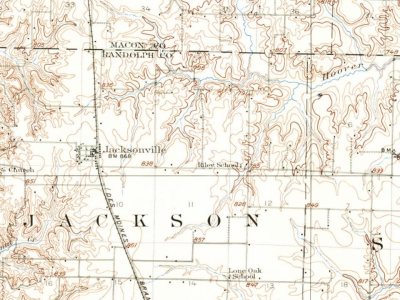
Founding dates: Wikidata, Wikipedia, the U.S. post office records of Blevins & Helbock (CC0) and the Census. Homes by year built: Census ACS 2020–24. National Register of Historic Places: National Park Service (list of May 22, 2026). Old photos, postcards and papers: Wikimedia Commons, the Library of Congress and other public archives, credited on each item’s page. Maps: U.S. Geological Survey historical topographic maps (via Esri) and Sanborn fire-insurance maps (Library of Congress). History text and census tables: Wikipedia (CC BY-SA 4.0). Places that used to be: USGS Geographic Names Information System (2021). How TownRatings grades history →
From Wikipedia, U.S. Geological Survey historical maps, U.S. Census counts (via Wikipedia), the US Post Offices dataset (Blevins & Helbock), the USGS Geographic Names Information System and old county and town histories (Internet Archive). Archive images are copied here with their credits and licenses, shown on each photo’s page. Refreshed monthly.