Boonville dates to 1817, and 25% of its homes were built before 1940
More historic than 95% of U.S. towns · #8 of 247 in Missouri. What drives it
30 places in town are on the National Register, among them seven historic districts with 331 buildings between them. Below: 5 old photos and papers, maps from 1885 on, and the census since 1850.
Founding year: Wikidata. First post office: 1819.The full story ↓
History grade
What drives Boonville’s History grade
On its age, its old homes and the National Register, Boonville is more historic than 95% of U.S. towns, #8 of 247 in Missouri. All 3 inputs are above most U.S. towns; its National Register listings ranks highest and its age lowest.
A
HistoryA character grade: shown, never part of Boonville’s overall grade.
Missouri towns list about as much on the Register as the country (a typical Missouri town has 2.4 per 10,000 residents, the U.S. 2.4), so Boonville’s 470 sits above most of its state (98% of Missouri towns have fewer) while its 361 historic buildings outnumber those of 96% of U.S. towns.
How sure. Graded on any two of the three inputs instead, the letter would range from A− to A+. The pre-1940 share is a Census survey estimate (±4.8 points). Two sources give 1817.
Founding year: Wikidata (other dates in Quick answers). Homes: Census ACS 2020–24. National Register: National Park Service, May 2026 list; each listing counted once (boundary changes and added documentation belong to their listing), and a historic district counts its contributing buildings. How TownRatings grades history →
What stands out about Boonville’s past
Read from the archive, the National Register and the record. The page puts what stands out first.
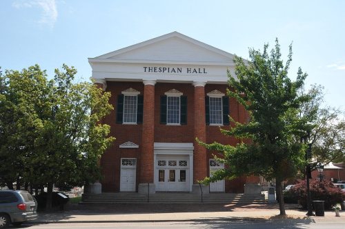
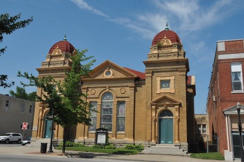
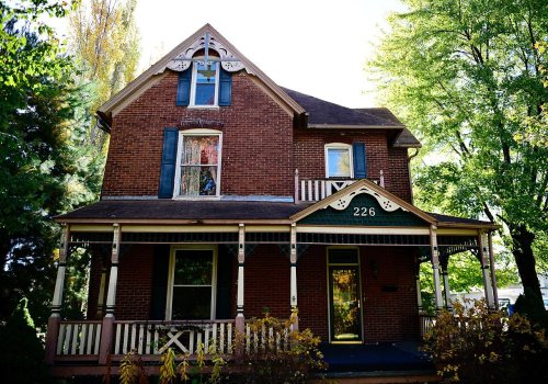
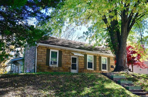
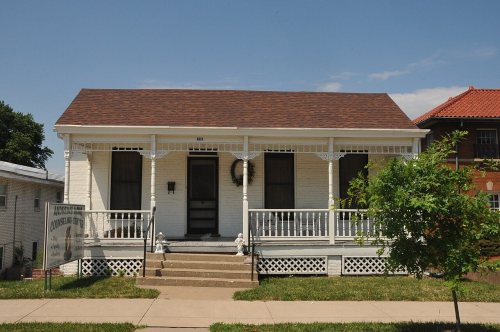
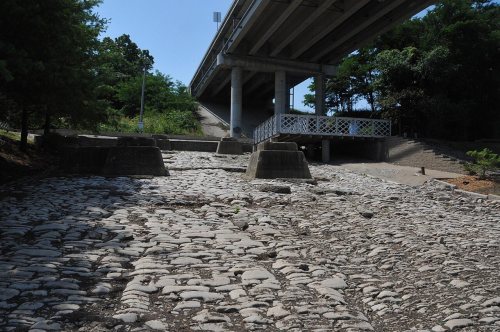
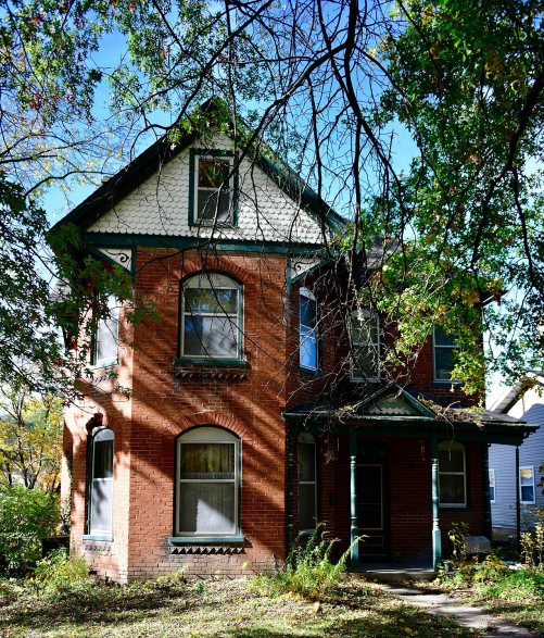
National Park Service, National Register of Historic Places. Photos from Wikimedia Commons, credited on each place’s page.
Every building
Boonville, building by building, 1885–1917
Fire insurance maps drew every building, what it was made of and what it was used for, so insurers could price the risk of fire. Pick a year, then a sheet.
The community derives its name from Nathan and Daniel Morgan Boone, who were the sons of Daniel Boone and established their salt business near the community in the early 1800s, delivering their product from salt licks to St. Louis. The area has been called "Boone's Lick" and the route from the lick to St. Charles/St. Louis, Missouri is called the Boone's Lick Trail. The eastern terminus near Boonville at Franklin, Missouri is considered the original start of the Santa Fe Trail.
Passages that mention Boonville, cut from the printed page as they were published.
History of Cooper County, Missouri1919 · page 155Read the page →
Read the text
When Messrs. Morgan and Lucas laid out the town of Boonville, they donated fifty acres to the county on condition that the commissioners selected to locate the county seat would locate the same at Boonville. The commissioners, named in the preceding chapter, located the county seat at Boonville, deeming it the best place to hold the courts. A part of the land donated by Morgan and Lucas was sold by the county, and the County Court thereupon commenced the building of a court house, which was located on the land donated to the county. It was adequate for the courts
Text read by machine from the scan; it may contain errors.
A history of Cooper County, Missouri, from the first visit by white men in February, 1804, to the fifth day of July, 18761876 · page 213Read the page →
Read the text
There are three railroads running through the county ; one a branch road, called the Osage Valley and Southern Kansas railroad, connecting Boonville with the Pacific Railroad at Tipton ; the Missouri, Kansas and Texas railroad, running diagonally across the county from Boonville to the Pettis county line; and on the south, the Pacific railroad runs about six miles through the county, making in all, fiftyfour miles of railroad within the limits of Cooper
Text read by machine from the scan; it may contain errors.
History of Cooper County, Missouri1919 · page 94Read the page →
Read the text
It was in the building of the Missouri Pacific railway, that Boonville, and Cooper county, in all probability, lost her great opportunity. Boonville had the advantage of water transportation, and was the most important and most popular town or city in this section of the state, and some of its business men, though farsighted and prosperous, thought that any railroad coming west from St. Louis through a region of country surrounding Boonville, or within 20 or 30 miles of its proposed route, would naturally deflect from its course, and take in Boonville. Efforts to secure
Text read by machine from the scan; it may contain errors.
Scans and text from the Internet Archive. Books published in 1930 or earlier, which are in the public domain.
Timeline
Boonville, 1817 to 1971
Woven from the archive, old maps, post office records, the National Register and the people born here.
In 1817, according to Wikidata. Boonville’s post office opened in 1819, and the census of 1850 counted 2,326 people here.
How does Boonville rank for history?
Boonville is more historic than 95% of U.S. towns, #8 of 247 in Missouri. The History grade combines the town’s founding era, the share of homes built before 1940 and its National Register listings. It’s a character grade, so it isn’t part of the overall grade. How it works.
What is on the National Register in Boonville?
30 listings: 22 buildings, among them the Lyric Theater (listed 1969, the first), 7 historic districts with 331 contributing buildings, and 1 structure. 361 historic buildings in all.
How old are the homes in Boonville?
25% of Boonville’s homes were built before 1940 (Census estimate, ±4.8 points), against a typical 8.4% for a Missouri town; the median home was built in 1965.
Founding dates: Wikidata, Wikipedia, the U.S. post office records of Blevins & Helbock (CC0) and the Census. Homes by year built: Census ACS 2020–24. National Register of Historic Places: National Park Service (list of May 22, 2026). Old photos, postcards and papers: Wikimedia Commons, the Library of Congress and other public archives, credited on each item’s page. Maps: U.S. Geological Survey historical topographic maps (via Esri) and Sanborn fire-insurance maps (Library of Congress). History text and census tables: Wikipedia (CC BY-SA 4.0). Places that used to be: USGS Geographic Names Information System (2021).
From Wikimedia Commons (5), Wikidata (1), the National Register of Historic Places (30), Wikipedia, Wikidata and Wikipedia for famous people, U.S. Geological Survey historical maps, U.S. Census counts (via Wikipedia), the US Post Offices dataset (Blevins & Helbock), the USGS Geographic Names Information System, Sanborn fire insurance maps (Library of Congress) and old county and town histories (Internet Archive). Archive images are copied here with their credits and licenses, shown on each photo’s page. Refreshed monthly.







 1875
 1875
 1876


