Guest, Sign inJoin

Post to Atlanta

We’ll email a one-tap link to publish your post. No password, and nothing is public until you click it.
Already a member? Sign in
–Not graded
History · Atlanta

Atlanta dates to 1858, and 31% of its homes were built before 1940

Below: maps from 1908 on and the census since 1910.

1858founded
0on the National Register
31%homes built before 1940
Quick answers

How Atlanta began

When was Atlanta founded?

1858

Atlanta dates its founding to 1858 (Wikipedia’s history). The census first counted it in 1910.

First census: 523 in 19102020 census: 379168 years
Founding year: Wikipedia. First post office: 1868.The full story ↓

What stands out about Atlanta’s past

Read from the archive, the National Register and the record. The page puts what stands out first.

★ What stands out · Help out

Start Atlanta’s collection

The first neighbors to add old photos shape how Atlanta’s history is told.

Decades since 1900 with photos
00s10s20s30s40s50s60s70s80s90s
0 of 10 decades. The empty ones are waiting for someone’s album.
The story

How Atlanta came to be

From Wikipedia’s history of Atlanta.

Read it all →

Atlanta was platted in 1858. The community was named after Atlanta, Georgia. A post office called Atlanta has been in operation since 1868.

On May 6, 1935, TWA Flight 6, a TWA DC-2 en route from Los Angeles, California, to Washington, D.C., became lost in heavy fog near Atlanta. Running out of fuel, the pilot attempted an emergency landing but crashed, which killed four and injured several others. Among the dead was Senator Bronson Cutting of New Mexico. The crash made national headlines and prompted Congress to commission the Copeland Committee report on air traffic safety.

Text from Wikipedia, licensed CC BY-SA 4.0.

From the old history books

What they wrote about Atlanta in 1910

Passages that mention Atlanta, cut from the printed page as they were published.

siderable fund of general information, with special acquisitions concerning agricultural life and the live-stock industry, in both of which he is energetically engaged. He has a fine farm of 120 acres, not far from the town of Atlanta, and in its condition of advanced development, rich productivene…
General history of Macon County, Missouri1910 · page 413Read the page →
Read the text

siderable fund of general information, with special acquisitions concerning agricultural life and the live-stock industry, in both of which he is energetically engaged. He has a fine farm of 120 acres, not far from the town of Atlanta, and in its condition of advanced development, rich productiveness and high state of improvement it is very creditable as a product of his enterprise and wisdom, good taste and breadth of view, and is also creditable to the township in which it is located as one of its representative country homes.

Text read by machine from the scan; it may contain errors.
however strong, to lead him away from it, and he has won the usual reward of constancy and fidelity, success in his undertakings and a firm hold on the regard and good will of his fellow-men. His farm of ninety acres, located near the town of Atlanta, with its ample improvements and full equipment,…
General history of Macon County, Missouri1910 · page 419Read the page →
Read the text

however strong, to lead him away from it, and he has won the usual reward of constancy and fidelity, success in his undertakings and a firm hold on the regard and good will of his fellow-men. His farm of ninety acres, located near the town of Atlanta, with its ample improvements and full equipment, has risen to great value under his careful and intelligent management, and is one of the attractive and desirable country homes of the townshii). His live-stock industry also flourishes, giving him good returns for his labor in connection

Text read by machine from the scan; it may contain errors.

Scans and text from the Internet Archive. Books published in 1930 or earlier, which are in the public domain.

Timeline

Atlanta, 1858 to 1908

Woven from the archive, old maps, post office records, the National Register and the people born here.

  1. 19th century
  2. 1858
    FoundingAtlanta is established
  3. 1868Post officeThe Atlanta post office opens
  4. 20th century
  5. 1908On the mapFirst mapped by the U.S. Geological Survey
By decade

Atlanta, decade by decade

On the map

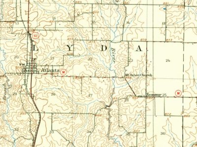
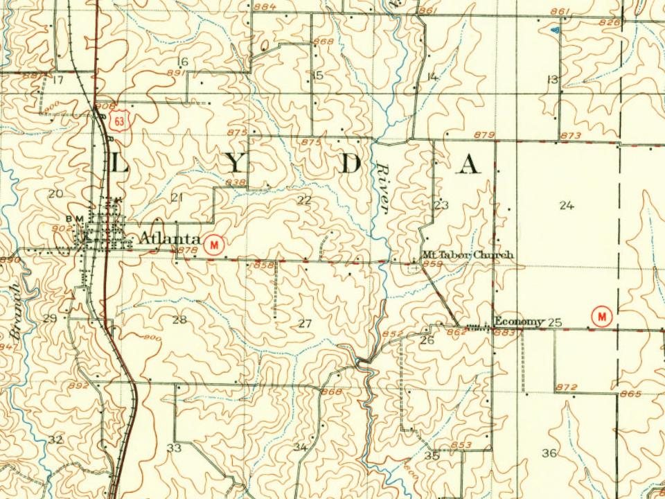
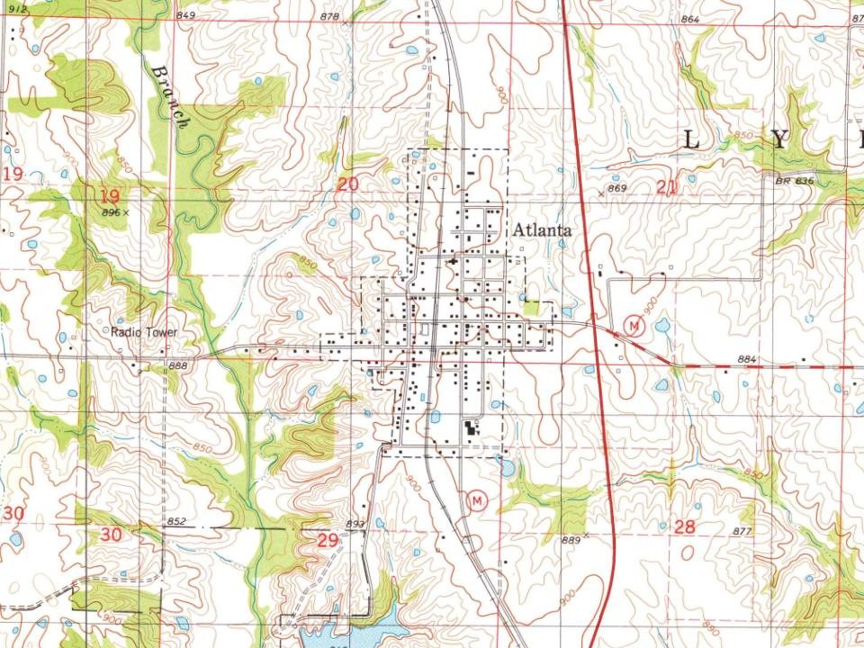
Atlanta on the map, 1908 to 1979

Every edition of the U.S. Geological Survey’s map of Atlanta. Tap a year, or press play to watch the town change.

Atlanta on the 1908 USGS mapAtlanta on the 1979 USGS map1908Atlanta sheet · 1:62,500

U.S. Geological Survey historical topographic maps (public domain), via Esri’s collection of the scans. The red ring marks the center of Atlanta.

Every building

Atlanta, building by building, 1918

Fire insurance maps drew every building, what it was made of and what it was used for, so insurers could price the risk of fire. Pick a sheet.

Atlanta fire insurance map, 1918, sheet 11918Sheet 1 of 1
Sheets
BrickWoodStone

Sanborn Map Company, via the Library of Congress. Editions published in 1930 or earlier, which are in the public domain.

People over time

Atlanta, census by census

0100200300400500600192019401960198020002020Peak: 536

Between 377 and 536 people in every census since 1910.

12 censuses, 1910–2020.

U.S. Census Bureau decennial counts, from the census table on Atlanta’s Wikipedia page.

Famous people

Famous people close to Atlanta

Nobody well known was born in Atlanta itself, so here are the best known from just nearby.

See all →

Questions about Atlanta’s history

What year was Atlanta founded?

In 1858, according to Wikipedia’s history of the town. Atlanta’s post office opened in 1868, and the census of 1910 counted 523 people here.

Memory lane

What the archives can’t tell you, neighbors can.

Town Square →
Start a conversation
Sources

Where this page comes from

Founding dates: Wikidata, Wikipedia, the U.S. post office records of Blevins & Helbock (CC0) and the Census. Homes by year built: Census ACS 2020–24. National Register of Historic Places: National Park Service (list of May 22, 2026). Old photos, postcards and papers: Wikimedia Commons, the Library of Congress and other public archives, credited on each item’s page. Maps: U.S. Geological Survey historical topographic maps (via Esri) and Sanborn fire-insurance maps (Library of Congress). History text and census tables: Wikipedia (CC BY-SA 4.0). Places that used to be: USGS Geographic Names Information System (2021). How TownRatings grades history →

From Wikimedia Commons (1), Wikipedia, U.S. Geological Survey historical maps, U.S. Census counts (via Wikipedia), the US Post Offices dataset (Blevins & Helbock), the USGS Geographic Names Information System, Sanborn fire insurance maps (Library of Congress) and old county and town histories (Internet Archive). Archive images are copied here with their credits and licenses, shown on each photo’s page. Refreshed monthly.