Independence was first counted by the census in 1860
More historic than 27% of U.S. towns · #184 of 273 in Minnesota. What drives it
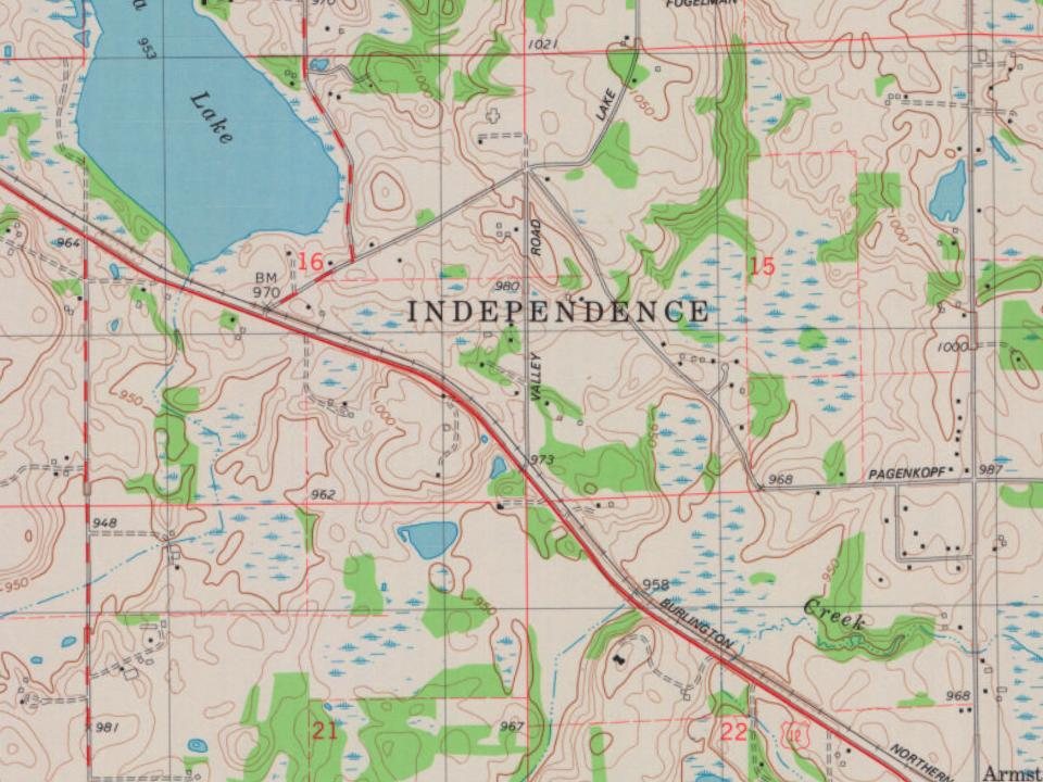
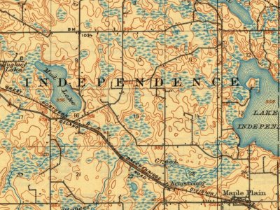
Most of Independence was built recently: 9% of its homes predate 1940 and the median home dates from 1989. Below: maps from 1909 on and the census since 1860.
Independence first appears in the census in 1860. Three smaller post offices, Perkinsville (1856), Hogbo (1892) and Lyndale (1892), opened inside today’s city and later closed.
First census: 223 in 18602020 census: 3,755166 years
How historic is Independence?
C
More historic than 27% of U.S. towns, on its age, its old homes and the National Register.
On its age, its old homes and the National Register, Independence is more historic than 27% of U.S. towns, #184 of 273 in Minnesota. Its share of homes from before 1940 holds the grade up; its National Register listings pull it down.
C
HistoryA character grade: shown, never part of Independence’s overall grade.
Minnesota towns list about as much on the Register as the country (a typical Minnesota town has 2.1 per 10,000 residents, the U.S. 2.4), so Independence’s 0.0 sits below most of its state (23% of Minnesota towns have fewer) while its 0 listings outnumber those of 23% of U.S. towns.
How sure. Graded on any two of the three inputs instead, the letter would range from C− to C. The pre-1940 share is a Census survey estimate (±4.2 points).
Founding year: the first census (other dates in Quick answers). Homes: Census ACS 2020–24. National Register: National Park Service, May 2026 list; each listing counted once (boundary changes and added documentation belong to their listing), and a historic district counts its contributing buildings. How TownRatings grades history →
What stands out about Independence’s past
Read from the archive, the National Register and the record. The page puts what stands out first.
The city's origins begin when settlers organized Independence Township in 1858 as a result of the Treaty of Traverse des Sioux. Independence Township was incorporated as the Village of Independence in 1957, eventually being reincorporated as a city in 1974.
tinued his exertions until he arrived at his destination on Pioneer Creek; thus becoming the first settler in the future town of Independence, the scene of which was in section 22, now the premises of Robert M. Mills, and the road thus opened by Moffat was the first road opened to, and within
Text read by machine from the scan; it may contain errors.
History of Hennepin county and the city of Minneapolis, including the Explorers and pioneers of Minnesota1881 · page 267Read the page →
Read the text
enlisted in the Xintli Indiana Cavalry, and served until the fall of 1865. He then came to Itlinnesota and purchased a farm in the town of Independence. This farm, located on section twenty-two, was entered by Job Moffat, and was the first claim taken within the present limits of the town. He married Miss Maria Batdorf in June, 1866. They have one cliild. William D.,
Text read by machine from the scan; it may contain errors.
The following parties, whose names have not as yet been presented, were 1855 settlers, of Independence, namely: James Wilson, B. Barnhart and Thos. Thornton, their locations being near Job Moffat’s and Pioneer Creek, and Frank Sutton was first an 1855 settler of Independence, locating on the west
Text read by machine from the scan; it may contain errors.
History of Hennepin county and the city of Minneapolis, including the Explorers and pioneers of Minnesota1881 · page 263Read the page →
Read the text
Independence is situated in the western part of the county, and derives its name from Lake Independence, a large lalce lying partly in this town and partly in Medina. The surface is mainly rolling and timbered. A l)elt of nearly level land, however, extends around Maple Plain, and to the southwest. The town is well supplied with wild meadow land, and has many small marshes.
Text read by machine from the scan; it may contain errors.
Scans and text from the Internet Archive. Books published in 1930 or earlier, which are in the public domain.
Timeline
Independence, 1856 to 1934
Woven from the archive, old maps, post office records, the National Register and the people born here.
The Independence post office opened in 1860, the earliest record of the town by name (U.S. post office records).
How does Independence rank for history?
Independence is more historic than 27% of U.S. towns, #184 of 273 in Minnesota. The History grade combines the town’s founding era, the share of homes built before 1940 and its National Register listings. It’s a character grade, so it isn’t part of the overall grade. How it works.
How old are the homes in Independence?
9% of Independence’s homes were built before 1940 (Census estimate, ±4.2 points), against a typical 8.1% for a Minnesota town; the median home was built in 1989.
Founding dates: Wikidata, Wikipedia, the U.S. post office records of Blevins & Helbock (CC0) and the Census. Homes by year built: Census ACS 2020–24. National Register of Historic Places: National Park Service (list of May 22, 2026). Old photos, postcards and papers: Wikimedia Commons, the Library of Congress and other public archives, credited on each item’s page. Maps: U.S. Geological Survey historical topographic maps (via Esri) and Sanborn fire-insurance maps (Library of Congress). History text and census tables: Wikipedia (CC BY-SA 4.0). Places that used to be: USGS Geographic Names Information System (2021).
From Wikimedia Commons (1), Wikipedia, U.S. Geological Survey historical maps, U.S. Census counts (via Wikipedia), the US Post Offices dataset (Blevins & Helbock), the USGS Geographic Names Information System and old county and town histories (Internet Archive). Archive images are copied here with their credits and licenses, shown on each photo’s page. Refreshed monthly.




 2007


