Guest, Sign inJoin

Post to Franklin

We’ll email a one-tap link to publish your post. No password, and nothing is public until you click it.
Already a member? Sign in
–Not graded
History · Franklin

Franklin’s post office opened in 1869, and 23% of its homes were built before 1940

Below: 2 old photos and papers, maps from 1952 on, and the census since 1890.

1869first post office
0on the National Register
23%homes built before 1940
2old photos & papers
From Franklin’s archive · credits on each photo
Quick answers

How Franklin began

When was Franklin founded?

1869

The Franklin post office opened in 1869, the earliest record of the town by name.

First census: 284 in 18902020 census: 493157 years
Founding year: the first Franklin post office (Blevins & Helbock, CC0).The full story ↓

What stands out about Franklin’s past

Read from the archive, the National Register and the record. The page puts what stands out first.

★ What stands out · Help out

Start Franklin’s collection

The first neighbors to add old photos shape how Franklin’s history is told.

Decades since 1900 with photos
00s10s20s30s40s50s60s70s80s90s
1 of 10 decades. The empty ones are waiting for someone’s album.
The story

How Franklin came to be

From Wikipedia’s history of Franklin.

Read it all →

Franklin was platted in 1882. The city was named for Benjamin Franklin.

The 1862 Battle of Redwood Ferry took place just outside what would later become the town of Franklin.

Text from Wikipedia, licensed CC BY-SA 4.0.

From the old history books

What they wrote about Franklin in 1916

Passages that mention Franklin, cut from the printed page as they were published.

The Franklin Lutheran Cemetery is located in the southwest corner of section 8, in Camp township. The school house is located in the extreme southwest corner of the section, and north of the school grounds is the cemetery. The cemetery is controlled by the Norwegian Lutheran church of Franklin and …
The history of Renville County, Minnesota1916 · page 873Read the page →
Read the text

The Franklin Lutheran Cemetery is located in the southwest corner of section 8, in Camp township. The school house is located in the extreme southwest corner of the section, and north of the school grounds is the cemetery. The cemetery is controlled by the Norwegian Lutheran church of Franklin and was laid out in the winter of 1867.

Text read by machine from the scan; it may contain errors.
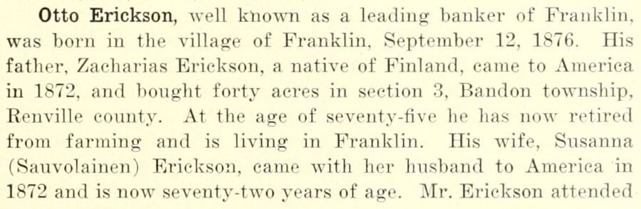
Otto Erickson, well known as a leading banker of Franklin, was born in the village of Franklin. September 12, 1876. His father, Zaeharias Erickson, a native of Finland, came to America in 1872, and bought forty acres in section 3, Bandon township, Renville county. At the age of seventy-five he has …
The history of Renville County, Minnesota1916Read the page →
Read the text

Otto Erickson, well known as a leading banker of Franklin, was born in the village of Franklin. September 12, 1876. His father, Zaeharias Erickson, a native of Finland, came to America in 1872, and bought forty acres in section 3, Bandon township, Renville county. At the age of seventy-five he has now retired from farming and is living in Franklin. His wife, Susanna (Sauvolainen) Erickson, came with her husband to America in 1872 and is now seventy-two years of age. Mr. Erickson attended

Text read by machine from the scan; it may contain errors.

Scans and text from the Internet Archive. Books published in 1930 or earlier, which are in the public domain.

Timeline

Franklin, 1869 to 1952

Woven from the archive, old maps, post office records, the National Register and the people born here.

  1. 19th century
  2. 1869Post officeThe Franklin post office opens
  3. 1891In the archiveFt. Ridgely and Dale Lutheran Church, Franklin, Minnesota - DPLA - c46b75bec5e4007e491dca…
  4. 20th century
  5. 1900In the archiveJohn Bergley's house, Franklin, Minnesota - DPLA - 08564876f42772dd5ea5d43c5e42399e
  6. 1952On the mapFirst mapped by the U.S. Geological Survey
By decade

Franklin, decade by decade

2 decades in the archive, from the 1890s to the 1900s. Scroll each row; tap a photo for its story.

On the map

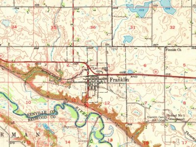
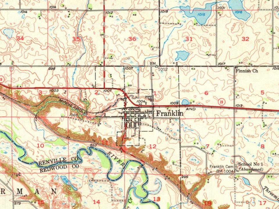
Franklin on the map, 1952 to 1983

Every edition of the U.S. Geological Survey’s map of Franklin. Tap a year, or press play to watch the town change.

Franklin on the 1952 USGS mapFranklin on the 1983 USGS map1952Morton sheet · 1:62,500

U.S. Geological Survey historical topographic maps (public domain), via Esri’s collection of the scans. The red ring marks the center of Franklin.

Then & now

Stand where they stood

No then-and-now pairs yet. Take a photo from the same spot as an old one and they appear here side by side.

Ft. Ridgely and Dale Lutheran Church, Franklin, Minnesota - DPLA - c46b75bec5e4007e491dca4afdb39d7d
Retake this viewFt. Ridgely and Dale Lutheran Church, Franklin, Minnesota - DPLA - c46b75bec5e4007e491dca4afdb39d7d, 1891

Find the spot, match the angle, and add your photo. It becomes the first then-and-now pair on Franklin’s page.

Retake this view · +15
People over time

Franklin, census by census

01002003004005006001900192019401960198020002020Peak: 557

Between 284 and 557 people in every census since 1890.

14 censuses, 1890–2020.

U.S. Census Bureau decennial counts, from the census table on Franklin’s Wikipedia page.

Famous people

Famous people close to Franklin

Nobody well known was born in Franklin itself, so here are the best known from just nearby.

See all →

Questions about Franklin’s history

What year was Franklin founded?

The Franklin post office opened in 1869, the earliest record of the town by name (U.S. post office records).

Memory lane

What the archives can’t tell you, neighbors can.

Town Square →
Start a conversation
Sources

Where this page comes from

Founding dates: Wikidata, Wikipedia, the U.S. post office records of Blevins & Helbock (CC0) and the Census. Homes by year built: Census ACS 2020–24. National Register of Historic Places: National Park Service (list of May 22, 2026). Old photos, postcards and papers: Wikimedia Commons, the Library of Congress and other public archives, credited on each item’s page. Maps: U.S. Geological Survey historical topographic maps (via Esri) and Sanborn fire-insurance maps (Library of Congress). History text and census tables: Wikipedia (CC BY-SA 4.0). Places that used to be: USGS Geographic Names Information System (2021). How TownRatings grades history →

From Wikimedia Commons (13), Wikipedia, U.S. Geological Survey historical maps, U.S. Census counts (via Wikipedia), the US Post Offices dataset (Blevins & Helbock), the USGS Geographic Names Information System and old county and town histories (Internet Archive). Archive images are copied here with their credits and licenses, shown on each photo’s page. Refreshed monthly.