124 years in pictures
Census counts: 1,097 in 1910, a peak of 1,435 in 1920, 750 in 2020. The archive holds 3 old photos and papers going back to 1935 and 4 maps from 1915 on.
- 1902South Range is settled
Each edition grades its towns against each other only.

A town of 741, settled in 1902.
South Range’s average trip to work is 11 minutes, against 25 minutes in Michigan’s towns and 25 minutes across U.S. towns. South Range’s trail density is 3.0 miles per square mile, where Michigan’s towns sit at 0.3 and U.S. towns at 0.4. South Range has fewer than 1,000 residents, too few for fair grades; the figures below are still real.
In a town this size, neighbors are the best guide. Ask them anything.
Census counts: 1,097 in 1910, a peak of 1,435 in 1920, 750 in 2020. The archive holds 3 old photos and papers going back to 1935 and 4 maps from 1915 on.
Who provides power, water and the rest in South Range, and how to reach them.
EPA SDWIS (Oct 9, 2026) · HIFLD + EIA-861 2025 · Census 2020 ZCTAs · NCES 2024–25 · registration: vote.gov, updated Sep 12, 2025.
Ordered by what stands out in South Range.
Expected storm and flood damage is lower than in 84% of U.S. communities.
FEMA National Risk Index · OpenFEMA
The July high in South Range is 77°F. South Range has cold winters and pleasant summers.
NOAA U.S. Climate Normals, 1991–2020
Most working residents leave South Range for work: only 2% work in town. 24% of South Range residents live below the poverty line. Jobs based in South Range grew to 213 in 2021, 108 more than in 2011.
| South Range | Michigan towns | U.S. towns | |
|---|---|---|---|
| Below the poverty line | 24% | 8.9% | 9.6% |
| Median household income | $59,000 | $77,000 | $80,000 |
| Working residents who work in town | 2.3% | 5.9% | 8% |
Census LEHD 2021 · ACS
South Range beats the Michigan average on 8 of 32 CDC measures and trails it on 1. 30% of adults sleep under 7 hours in South Range.
| South Range | Michigan towns | U.S. towns | |
|---|---|---|---|
| Sleep under 7 hours (CDC PLACES) | 30% | 34% | 36% |
| Get no exercise (CDC PLACES) | 20% | 25% | 25% |
| Frequent physical distress (CDC PLACES) | 13% | 14% | 14% |
| Fair or poor health (CDC PLACES) | 16% | 19% | 19% |
| What stands out | South Range | MI |
|---|---|---|
| Fewer adults facing food insecurity | 10.1% | 15.4% |
| Fewer adults facing a utility shut-off | 5.9% | 8.7% |
| More adults who have had cancer | 10% | 8.9% |
CDC PLACES 2025 · modeled estimates for adults · CMS · HRSA
Trails & parks © OpenStreetMap contributors · Conserved land: USGS PAD-US
Museums, parks, gardens and other places to visit around South Range. Close and well known come first.
32 mi MountainMount Arvon
5 mi National Historical ParkKeweenaw National Historical Park35K visitors a year
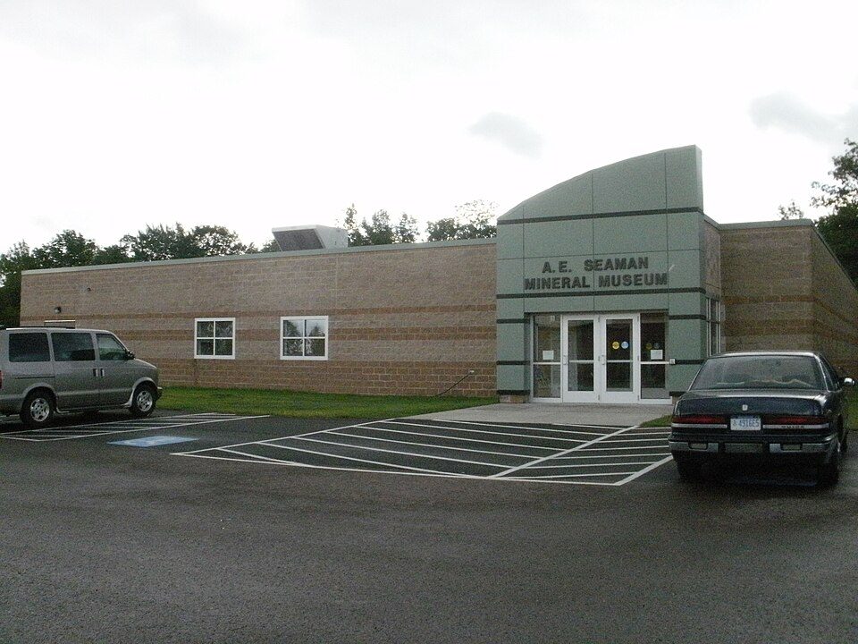
5 mi MuseumA. E. Seaman Mineral Museum37 mi Ski areaMount Bohemia21 runs · 814 ft vertical
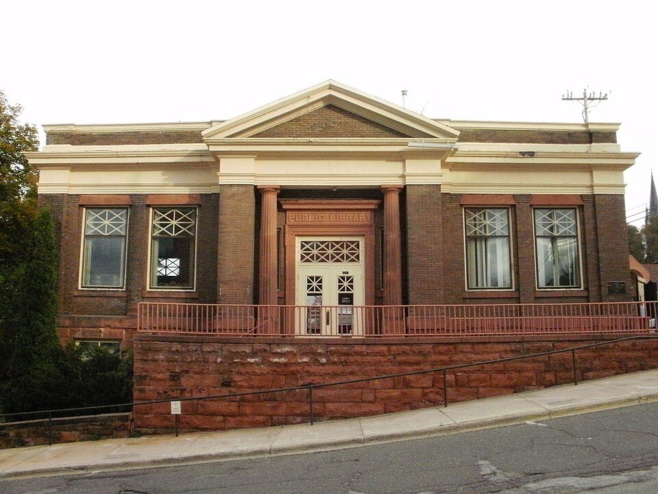
5 mi MuseumCarnegie Museum of the KeweenawMount Arvon: Yinan Chen, Public Domain · Keweenaw National Historical Park: Andrew Jameson, CC BY-SA 3.0 · A. E. Seaman Mineral Museum: Chris857, CC BY-SA 3.0 · Carnegie Museum of the Keweenaw: Chris857, CC BY-SA 3.0
1 within 15 miles of the center of South Range
About 7 of every 100 South Range residents are enrolled in college, about the same as Michigan.
Village in Michigan, United States
South Range is a village in Adams Township, Houghton County in the U.S. state of Michigan. It is bordered on the east by the unincorporated community of Baltic. It is about five miles southwest of Houghton on M-26. As of the 2020 census, South Range had a population of 750. The ZIP code for South Range is 49963. It is a "cooperating community of the Keweenaw National Historical Park."
From Wikipedia, licensed CC BY-SA 4.0 · facts via Wikidata (CC0)
Short answers, built from the data on this page.
South Range has fewer than 1,000 residents, too few for fair grades; the figures below are still real.