Guest, Sign inJoin

Post to Peninsula Township

We’ll email a one-tap link to publish your post. No password, and nothing is public until you click it.
Already a member? Sign in
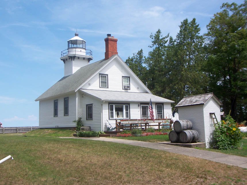
OldMission-MI-lighthousePhoto: User: (WT-shared) Haem85 at wts wikivoyage · CC BY-SA 3.0
AOutdoors
Outdoors in Peninsula Township

Peninsula Township has 1,158 acres of parks, 190 for every 1,000 residents

18% of Peninsula Township’s land is conserved, about 3,243 acres. 33 miles of mapped trail cross Peninsula Township, 1.2 per square mile of land. The biggest trail networks: Old Mission State Park (13.2 mi), Power Island Wilderness Park (5.8 mi), Pelizzari Natural Area (2.8 mi).

Ahead of 92% of U.S. towns · #58 of 701 in Michigan. What drives it

Conserved land
18%
3,243 acres · of 27.9 sq mi of land
Trails
33 mi
1.2 per sq mi of land
Park land
1,158 ac
190 acres per 1,000 residents
Near a park
65%
of residents within ½ mile
Highest peak
840 ft
Carpenter Hill
Lakes & rivers
3
9 beaches · 4 boat launches

What kind of outdoors town is Peninsula Township?

Read from the map. The page puts what stands out first.

Outdoors grade

How much outdoors does Peninsula Township have?

On conserved land, trails, park land and how close residents live to a park, Peninsula Township is ahead of 92% of U.S. towns, #58 of 701 in Michigan. All four inputs are above most U.S. towns; park acres per resident rank highest, the share of residents near a park lowest.

A
OutdoorsA character grade: shown, never part of Peninsula Township’s overall grade.
All U.S. towns we grade (21,298)Ahead of 92%
LessMore
Michigan towns of 2,500+ (701)Ahead of 92%

Water is 13% of Peninsula Township’s area (4 of 32 square miles), so every share here is of land; over land and water together, the conserved share would read 16%.

How sure. Graded on any three of the four inputs instead, the letter would still be A. Trails and many small parks come from OpenStreetMap, mapped by volunteers, so coverage varies from town to town; the half mile is a straight line from each census block, so a river or highway in the way isn’t counted against it.

PAD-US, OpenStreetMap (© OpenStreetMap contributors), Census 2025 Gazetteer and 2020 blocks; details in Sources below. How TownRatings grades the outdoors →

The map

Conserved land, trails & bike routes

Tap a number to zoom to a park. Tap a layer to hide it.

12345678
Easements protect land from building but are usually private.© OpenStreetMap contributors · USGS PAD-US
Places to walk

Pick a walk

The longest trail network is Old Mission State Park, with 13.2 miles. Directions go to the nearest trailhead or public parking.

Old Mission State Park

Managed by Peninsula Township
667 acres13.2 mi of trail
Old Mission LoopInner TrailAccess TrailConnector Trail+1
Dog rules not recorded
Directionsto the parking lotWebsite ↗

Power Island Wilderness Park

Managed by Grand Traverse County Parks and Recreation
202 acres5.8 mi of trail
Dogs on leash
No trailhead mapped yetWebsite ↗

Pelizzari Natural Area

Managed by Penninsula Township
63 acres2.8 mi of trail
Dog rules not recorded
Directionsto the parking lotWebsite ↗

Pyatt Lake: The Bill Carls Nature Preserve

Managed by Grand Traverse Regional Land Conservancy
176 acres1.6 mi of trail
Dog rules not recorded
Directionsto the parking lotWebsite ↗

Bowers Harbor Park

Managed by Peninsula Township
77 acres1.5 mi of trail
Dog rules not recorded
Directionsto the parking lot

The Bluffs Common Area

Managed by Bluffs Association Inc.
36 acres0.9 mi of trail
Dog rules not recorded
Directionsto the parking lot

Dougherty Mission House Historic Site

Managed by Penninsula Township
17 acres0.6 mi of trail
Heritage Trail
Dog rules not recorded
Directionsto the trail sign

Mission Point Lighthouse Park

Park
7 acres0.6 mi of trail
Old Mission Loop
Dog rules not recorded
Directionsto the parking lot
All 31 parks & preserves
Old Mission State Park667 acres · 13.2 mi of trail · Peninsula Township
Directions
Power Island Wilderness Park202 acres · 5.8 mi of trail · Grand Traverse County Parks and Recreation
Pelizzari Natural Area63 acres · 2.8 mi of trail · Penninsula Township
Directions
Pyatt Lake: The Bill Carls Nature Preserve176 acres · 1.6 mi of trail · Grand Traverse Regional Land Conservancy
Directions
Bowers Harbor Park77 acres · 1.5 mi of trail · Peninsula Township
Directions
The Bluffs Common Area36 acres · 0.9 mi of trail · Bluffs Association Inc.
Directions
Dougherty Mission House Historic Site17 acres · 0.6 mi of trail · Penninsula Township
Directions
Mission Point Lighthouse Park7 acres · 0.6 mi of trail
Directions
Leffingwell Forest Preserve86 acres · 0.3 mi of trail
Grand Traverse Bay Underwater Preserve2,699 acres · 0.2 mi of trail
Directions
Old Mission Estates Common Area14 acres · 0.2 mi of trail
Brinkman Bog Nature Sanctuary55 acres · Grand Traverse Regional Land Conservancy
Directions
Kelley Park8 acres
Bowers Harbor Boating Access Site6 acres · Michigan Department of Natural Resources
Directions
Stickney Estates Common Area5 acres
Directions
Franklin Woods Park3 acres
Eagle's Landing Common Area2 acres · Eagle's Landing Development
Directions
Harbor Park2 acres
Horizon Park2 acres
East Grand Traverse Bay Access Site2 acres · Michigan Department of Natural Resources
Directions
Haserot Park2 acres
Directions
Peninsula Knolls Common Area2 acres
Lin-Dale Estates Park1 acres
Archie Park1 acres · Peninsula Township
Directions
Eagle's Landing Beach1 acres
Directions
Island Park1 acres
Aledco Park1 acres
Bluewater Bluffs Common Area1 acres
Island View Park1 acres
Directions
Old Mission Estates Beach1 acres
Directions
Bayside Woods Beach1 acres
Who protects it

3,243 conserved acres

18% of Peninsula Township’s land. Water is left out: Peninsula Township has 27.9 square miles of land and 4.0 of water, so the share counts land only. Who manages Peninsula Township’s conserved land, from the USGS Protected Areas Database. Approximate, because parcels can overlap.

Land trusts & nonprofits1,851 ac
USDA easements (NRCS)795 ac
State parks679 ac
Town or city97 ac
Joint74 ac
Unknown Easement · 1,396 acAgricultural Easement · 1,053 acState Park · 679 acPrivate Conservation · 191 acOther Easement · 80 ac
Good to know

Conserved doesn’t always mean open to visitors. 2,276 acres are conservation easements, usually private land. The walks above are places people visit.

The biggest protected parcels
Parcel (PAD-US)Managed byAcresPublic access
Old Mission Peninsula State Park
State Park
State parks679Open
Pyatt Lake Nature Preserve
Private Conservation
Land trusts & nonprofits153Open
Leffingwell forest Preserve
Local Conservation Area
Town or city78Open
Brinkman Bog
Private Conservation
Land trusts & nonprofits38Open
Bowers Harbor Park
Local Park
Town or city14Open
Hasarot Beach Park
Local Park
Town or city2Open
Archie Park
Local Park
Town or city2Open
Things to do

29 places to go in Peninsula Township

Beaches, playgrounds, peaks, falls and more. Pick a kind.

Campgrounds in Peninsula Township
Bassett Island CampgroundFee · In Power Island Wilderness Park · Grand Traverse County
Directions
South Beach CampgroundFee · In Power Island Wilderness Park · Grand Traverse County
Directions
Trails & water

6 named trails and 3 lakes & rivers

Named trails
Open to bikes · 2.6 miHorses · 2.6 miUnpaved · 25.9 mi
Old Mission Loop3.6 mi
Inner Trail2.6 mi
Access Trail1.2 mi
Connector Trail0.8 mi
Old Murray Road Trail0.6 mi
Heritage Trail0.4 mi
Lakes & rivers tap for directions
Biking & sports

0.0 miles of bike routes

Bike lanes are often missing from the map in smaller towns, so that number is likely low.

Courts & fields
25Tennis
3Baseball
3Basketball
1Pickleball
1Beach volleyball

Includes school and college facilities, which aren’t always open to the public.

History along the way

3 places on the National Register

The country’s official list of places worth saving (National Park Service). The map also marks 3 historic points from OpenStreetMap: plaques, memorials and old buildings.

History →
Hedden HallBuilding · listed 1982
About it
Dougherty Mission HouseBuilding · listed 2011
About it
Stickney Summer House-Bowers Harbor InnBuilding · listed 2011
About it
When to get out

The best walking months in Peninsula Township: May to August

NOAA’s 1991–2020 normals for the town and the daylight at its latitude. Outlined months have long days, highs of 59 to 86 °F and little rain for the place.

JanFebMarAprMayJunJulAugSepOctNovDec
Daylight (h)9.110.411.813.414.815.615.314.112.510.99.58.8
High (°F)293040526575797871574534
Rain (in)2.01.31.72.83.02.82.73.03.53.92.62.1

February is the driest month (1.3 in) and July the warmest (highs of 79 °F). 3.9 inches fall in October, the wettest month. The climate in Peninsula Township →

Next door

Peninsula Township and its neighbors

Peninsula Township has the most mapped trails of the 2 towns around it. Tap a town to see its outdoors.

TownConserved
of land
Trail mi
per sq mi
Park acres
per 1,000
Near a park
½ mile
Outdoors
Peninsula Township18%1.219065%A
Traverse City3%1.41399%A−

The four inputs of the Outdoors grade, from the engine; shares are of land, not water.

Questions about parks and trails in Peninsula Township

Where can I hike in Peninsula Township?

The longest trail networks: Old Mission State Park, 13.2 miles; Power Island Wilderness Park, 5.8 miles; Pelizzari Natural Area, 2.8 miles; Pyatt Lake: The Bill Carls Nature Preserve, 1.6 miles. Each one is on the map above, with directions to the nearest trailhead or parking.

How much of Peninsula Township is conserved land?

18% of its land, against a typical 5% for a Michigan town and 4% nationally (PAD-US). Conserved doesn’t always mean open to visitors: easements are usually private land.

Are dogs allowed on Peninsula Township’s trails?

OpenStreetMap records dogs as welcome at Power Island Wilderness Park (on leash). For the rest, check the signs at the trailhead.

Is there public land near Peninsula Township?

9,253 acres of parks and open public land lie inside Peninsula Township or within 10 miles of it (PAD-US), 1,158 of them inside the town line.

How much outdoors does Peninsula Township have?

Ahead of 92% of U.S. towns on the Outdoors grade, #58 of 701 in Michigan. The grade combines the share of land that is conserved, miles of mapped trail per square mile of land, park acres per 1,000 residents and the share of residents within a half mile of a park. It’s a character grade, so it isn’t part of the overall grade. How it works.

Trail talk

Conditions, parking and favorite walks from Peninsula Township neighbors.
Town Square →
Share a tip
Sources

Where this page comes from

Conserved and public land: USGS Protected Areas Database of the United States (PAD-US), service updated July 2026. Parks, trails, playgrounds, beaches and other places: OpenStreetMap (© OpenStreetMap contributors, ODbL), map data as of 2026-10-28. Land and water area: Census 2025 Gazetteer. Residents near a park: 2020 Census blocks. National Register: National Park Service. How TownRatings grades the outdoors →