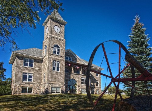
The Onaway post office opened in 1890, the earliest record of the town by name. Two smaller post offices, Shaw (1882) and Adalaska (1893), opened inside today’s city and later closed.
First census: 1,204 in 19002020 census: 890136 years
Founding year: the first Onaway post office (Blevins & Helbock, CC0).The full story ↓
What stands out about Onaway’s past
Read from the archive, the National Register and the record. The page puts what stands out first.
This farming community received a post office open on October 23, 1882 with civil engineer Thomas E. Shaw as postmaster. This office was named Shaw for him. Arriving in 1886, Merritt Chandler had platted the community under the name of Onaway. Chandler took over as postmaster with it changing its name to Onaway on March 29, 1890. On August 18, 1893, Shaw took back the postmaster position and changed the office's name to Adalaska. Once again, the post office was renamed back to Onaway on November 15, 1897. Onaway was incorporated as a village in 1899. Onaway soon became a city in 1903.
Every edition of the U.S. Geological Survey’s map of Onaway. Tap a year, or press play to watch the town change.
1957Onaway sheet · 1:62,500
U.S. Geological Survey historical topographic maps (public domain), via Esri’s collection of the scans. The red ring marks the center of Onaway.
Every building
Onaway, building by building, 1903–1915
Fire insurance maps drew every building, what it was made of and what it was used for, so insurers could price the risk of fire. Pick a year, then a sheet.
Founding dates: Wikidata, Wikipedia, the U.S. post office records of Blevins & Helbock (CC0) and the Census. Homes by year built: Census ACS 2020–24. National Register of Historic Places: National Park Service (list of May 22, 2026). Old photos, postcards and papers: Wikimedia Commons, the Library of Congress and other public archives, credited on each item’s page. Maps: U.S. Geological Survey historical topographic maps (via Esri) and Sanborn fire-insurance maps (Library of Congress). History text and census tables: Wikipedia (CC BY-SA 4.0). Places that used to be: USGS Geographic Names Information System (2021). How TownRatings grades history →
From Wikimedia Commons (1), Wikidata (1), the National Register of Historic Places (1), Wikipedia, Wikidata and Wikipedia for famous people, U.S. Geological Survey historical maps, U.S. Census counts (via Wikipedia), the US Post Offices dataset (Blevins & Helbock), the USGS Geographic Names Information System and Sanborn fire insurance maps (Library of Congress). Archive images are copied here with their credits and licenses, shown on each photo’s page. Refreshed monthly.

 2005