More historic than 32% of U.S. towns · #549 of 701 in Michigan. What drives it
Most of Macomb Township was built recently: 1% of its homes predate 1940 and the median home dates from 2000. Below: maps from 1929 on and old-book passages.
The Macomb Township post office opened in 1835, the earliest record of the town by name. Four smaller post offices, Macomb (1835), Vienna (1838) and Waldenburg (1860), opened inside today’s town and later closed.
2020 census: 91,663191 years
How historic is Macomb Township?
C
More historic than 32% of U.S. towns, on its age, its old homes and the National Register.
Founding year: the first Macomb Township post office (Blevins & Helbock, CC0).The full story ↓
History grade
What drives Macomb Township’s History grade
On its age, its old homes and the National Register, Macomb Township is more historic than 32% of U.S. towns, #549 of 701 in Michigan. Its age holds the grade up; its share of homes from before 1940 pulls it down.
C
HistoryA character grade: shown, never part of Macomb Township’s overall grade.
Few Michigan towns list much on the Register (a typical Michigan town has 0.0 per 10,000 residents, the U.S. 2.4), so Macomb Township’s 0.0 sits below most of its state (32% of Michigan towns have fewer) while its 0 listings outnumber those of 23% of U.S. towns.
How sure. Graded on any two of the three inputs instead, the letter would range from D to B−. The pre-1940 share (±0.5 points) is firm at this size. The founding year is the first post office, not a stated founding date.
Founding year: the first post office (other dates in Quick answers). Homes: Census ACS 2020–24. National Register: National Park Service, May 2026 list; each listing counted once (boundary changes and added documentation belong to their listing), and a historic district counts its contributing buildings. How TownRatings grades history →
What stands out about Macomb Township’s past
Read from the archive, the National Register and the record. The page puts what stands out first.
The founders of Macomb Township arrived in the early 19th century in search of flat and fertile farmland, like that near the Clinton River. Many of these early settlers were of German descent, and the German influences remain today. The Township of Macomb was officially approved by the Legislative Council on March 7, 1834.
The township was named in honor of General Alexander Macomb, who was a highly decorated veteran of the War of 1812; his successful mercantile family owned most of Macomb County at one time.
Passages that mention Macomb Township, cut from the printed page as they were published.
History of Macomb County, Michigan, containing an account of its settlement, growth, development and resources...churches, schools and societies1882 · page 901Read the page →
Read the text
The fractional township of Chesterfield was organized in the year 1842. It was taken from Macomb Township, and the first election was ordered to be held at the schoolhouse near the x-esidence of Charles B. Matthews. TOWN ROSTEE.
Text read by machine from the scan; it may contain errors.
History of Macomb County, Michigan, containing ... biographical sketches, portraits of prominent men and early settlers1882Read the page →
Read the text
mental purposes to the town of Ray. March 9, 1833, the north half of Washington was formed into a new township to be called Bruce. April 22, 1833, town 5, N. of Ranges 13 and 14 E., were laid off under the name of Arrnadia. By the Act of March 7, 1834, Macomb Township was established, the boundaries of Ray were extended, and the town line between Clinton and Harrison straightened. March 17, 1835, town 2, N. of R. 12, E. was laid off as the township of Jefferson. Hickory and Grange townships were laid off March 11, 1837; Lenox was established March 20, 1837, and seven days previously the village of Mt. Clemens was incorporated.
Text read by machine from the scan; it may contain errors.
History of Macomb County, Michigan, containing an account of its settlement, growth, development and resources...churches, schools and societies1882 · page 303Read the page →
Read the text
mental purposes to the town of Ray. March 9, 1838, the north half of Washington was formed into a new township to be called Bruce. April 22, 1833, town 5, N. of Ranges 13 and 14 E., were laid off under the name of Armadia. By the Act of March 7, 1834, Macomb Township was established, the boundaries of Ray were extended, and the town line between Clinton and Harrison straightened. March 17, 1835, town 2, N. of R. 12, E. was laid off as the township of Jefferson. Hickory and Grange townships were laid off March 11, 1837; Lenox was established March 20, 1837, and seven days previously the village of Mt. Clemens was incorporated.
Text read by machine from the scan; it may contain errors.
Scans and text from the Internet Archive. Books published in 1930 or earlier, which are in the public domain.
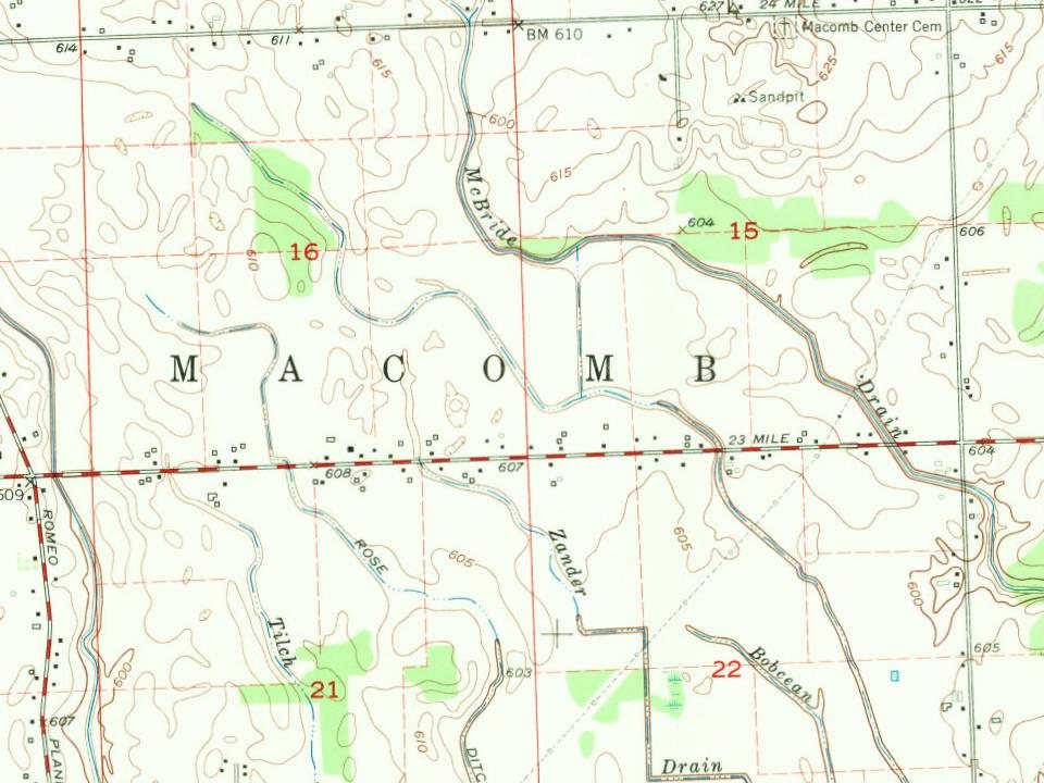
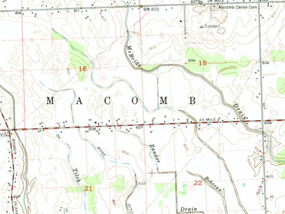
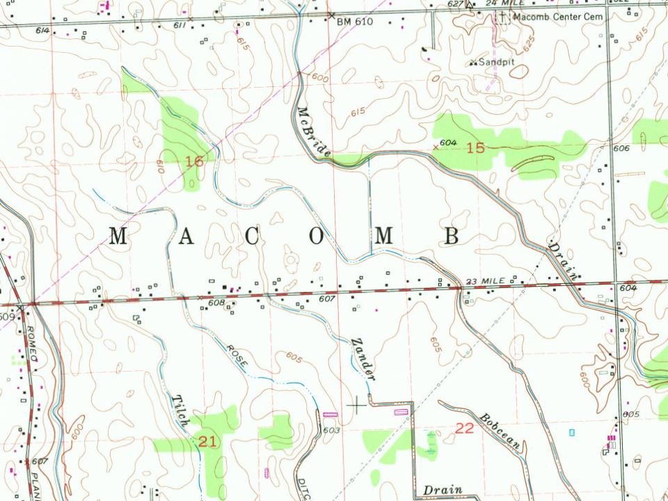
Every edition of the U.S. Geological Survey’s map of Macomb Township. Tap a year, or press play to watch the town change.
1929Mt Clemens sheet · 1:62,500
U.S. Geological Survey historical topographic maps (public domain), via Esri’s collection of the scans. The red ring marks the center of Macomb Township.
Famous people
4 famous people were born in Macomb Township
Writers, athletes, leaders and more, ranked by how widely they’re known.
The Macomb Township post office opened in 1835, the earliest record of the town by name (U.S. post office records).
How does Macomb Township rank for history?
Macomb Township is more historic than 32% of U.S. towns, #549 of 701 in Michigan. The History grade combines the town’s founding era, the share of homes built before 1940 and its National Register listings. It’s a character grade, so it isn’t part of the overall grade. How it works.
How old are the homes in Macomb Township?
1% of Macomb Township’s homes were built before 1940 (Census estimate), against a typical 12% for a Michigan town; the median home was built in 2000.
Founding dates: Wikidata, Wikipedia, the U.S. post office records of Blevins & Helbock (CC0) and the Census. Homes by year built: Census ACS 2020–24. National Register of Historic Places: National Park Service (list of May 22, 2026). Old photos, postcards and papers: Wikimedia Commons, the Library of Congress and other public archives, credited on each item’s page. Maps: U.S. Geological Survey historical topographic maps (via Esri) and Sanborn fire-insurance maps (Library of Congress). History text and census tables: Wikipedia (CC BY-SA 4.0). Places that used to be: USGS Geographic Names Information System (2021).
From Wikimedia Commons (1), Wikipedia, Wikidata and Wikipedia for famous people, U.S. Geological Survey historical maps, the US Post Offices dataset (Blevins & Helbock), the USGS Geographic Names Information System and old county and town histories (Internet Archive). Archive images are copied here with their credits and licenses, shown on each photo’s page. Refreshed monthly.





 2017