Guest, Sign inJoin

Post to Lansing

We’ll email a one-tap link to publish your post. No password, and nothing is public until you click it.
Already a member? Sign in
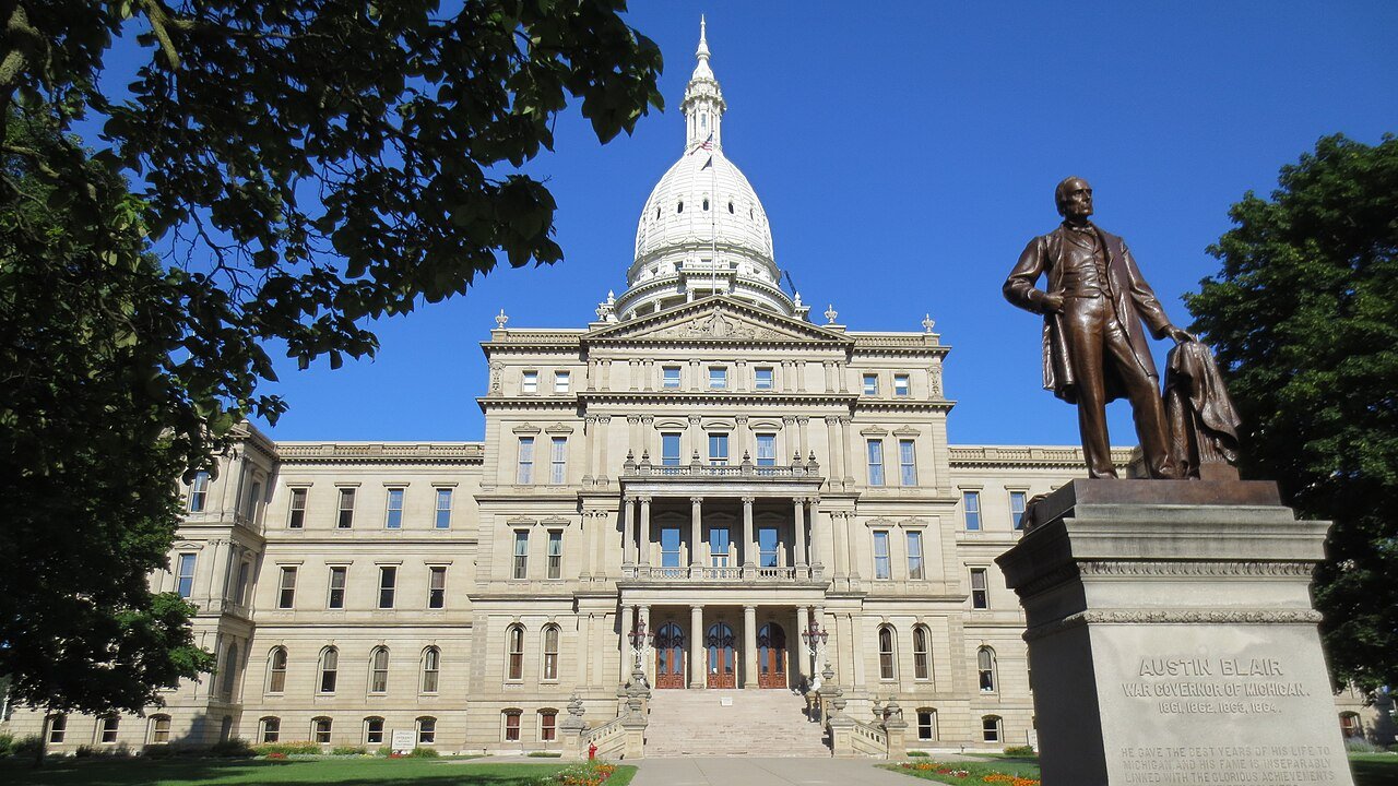
State Capital and Statue - panoramioPhoto: Andrew Martin · CC BY 3.0
AOutdoors
Outdoors in Lansing

8% of Lansing’s land is conserved, and 98% of residents live within a half mile of a park

38 miles of mapped trail cross Lansing, 1.0 per square mile of land. The biggest trail networks: Fenner Nature Center (3.7 mi), Fine Park (3.2 mi), Hawk Island County Park (1.9 mi). 2,172 acres are parks and preserves, 19 per 1,000 residents.

Ahead of 88% of U.S. towns · #104 of 701 in Michigan. What drives it

Conserved land
8%
1,999 acres · of 39.4 sq mi of land
Trails
38 mi
1.0 per sq mi of land
Park land
2,172 ac
19 acres per 1,000 residents
Near a park
98%
of residents within ½ mile
Bike routes
63 mi
30 mi lanes · 31 mi paths
Lakes & rivers
7
2 beaches · 4 boat launches

What kind of outdoors town is Lansing?

Read from the map. The page puts what stands out first.

Outdoors grade

How much outdoors does Lansing have?

On conserved land, trails, park land and how close residents live to a park, Lansing is ahead of 88% of U.S. towns, #104 of 701 in Michigan. All four inputs are above most U.S. towns; the share of residents near a park ranks highest, park acres per resident lowest.

A
OutdoorsA character grade: shown, never part of Lansing’s overall grade.
All U.S. towns we grade (21,298)Ahead of 88%
LessMore
Michigan towns of 2,500+ (701)Ahead of 85%

Among the 400 U.S. cities of 100,000 or more, Lansing ranks #110 on Outdoors.

How sure. Graded on any three of the four inputs instead, the letter would range from A− to A. Trails and many small parks come from OpenStreetMap, mapped by volunteers, so coverage varies from town to town; the half mile is a straight line from each census block, so a river or highway in the way isn’t counted against it.

PAD-US, OpenStreetMap (© OpenStreetMap contributors), Census 2025 Gazetteer and 2020 blocks; details in Sources below. How TownRatings grades the outdoors →

The map

Conserved land, trails & bike routes

Tap a number to zoom to a park. Tap a layer to hide it.

12345678
Easements protect land from building but are usually private.© OpenStreetMap contributors · USGS PAD-US
Places to walk

Pick a walk

The longest trail network is Fenner Nature Center, with 3.7 miles. Directions go to the nearest trailhead or public parking.

Fenner Nature Center

Nature preserve
132 acres3.7 mi of trail
Turner TrailOak Ridge TrailTamarack TrailSugar Maple Trail
Dog rules not recorded
Directionsto the parking lot

Fine Park

Park
40 acres3.2 mi of trail
Dog rules not recorded
Directionsto the trailhead

Hawk Island County Park

Managed by Ingham County
122 acres1.9 mi of trail
Dog rules not recorded
Directionsto the parking lotWebsite ↗

Hunters Ridge Park

Managed by City of Lansing
36 acres1.9 mi of trail
Dog rules not recorded
Directionsto the trailhead

Theo Fulton Park

Managed by City of Lansing
27 acres1.1 mi of trail
Dog rules not recorded
Directionsto the trailhead

Scott Woods Park

Managed by City of Lansing
99 acres0.9 mi of trail
Dog rules not recorded
Directionsto the parking lot

Bancroft Park

Managed by City of Lansing
35 acres0.6 mi of trail
Dogs on leash
Directionsto the parking lotWebsite ↗

Benjamin Davis Park

Managed by City of Lansing
49 acres0.5 mi of trail
Dog rules not recorded
Directionsto the parking lot
All 106 parks & preserves
Fenner Nature Center132 acres · 3.7 mi of trail
Directions
Fine Park40 acres · 3.2 mi of trail
Directions
Hawk Island County Park122 acres · 1.9 mi of trail · Ingham County
Directions
Hunters Ridge Park36 acres · 1.9 mi of trail · City of Lansing
Directions
Theo Fulton Park27 acres · 1.1 mi of trail · City of Lansing
Directions
Scott Woods Park99 acres · 0.9 mi of trail · City of Lansing
Directions
Bancroft Park35 acres · 0.6 mi of trail · City of Lansing
Directions
Benjamin Davis Park49 acres · 0.5 mi of trail · City of Lansing
Directions
Holly Park23 acres · 0.5 mi of trail · City of Lansing
Capitol Walkway Park2 acres · 0.5 mi of trail
Directions
Tecumseh Park48 acres · 0.4 mi of trail
Directions
Gier Park25 acres · 0.4 mi of trail · City of Lansing
Directions
Shubel Park15 acres · 0.4 mi of trail
Directions
Hope Soccer Complex136 acres · 0.3 mi of trail · City of Lansing
Directions
Parcel B74 acres · 0.3 mi of trail · City of Lansing
Directions
Frances Park44 acres · 0.3 mi of trail · City of Lansing
Directions
Ranney Park22 acres · 0.3 mi of trail · City of Lansing
Directions
Risdale Park15 acres · 0.3 mi of trail
Directions
Porter Park11 acres · 0.3 mi of trail · City of Lansing
Keegan Park7 acres · 0.3 mi of trail
Bassett Park4 acres · 0.3 mi of trail
Crego Park199 acres · 0.2 mi of trail · City of Lansing
Directions
Rudolph & Dorothy Wilson Park30 acres · 0.2 mi of trail · City of Lansing
Directions
Adado Riverfront Park13 acres · 0.2 mi of trail · City of Lansing
Directions
Burchard Park10 acres · 0.2 mi of trail · City of Lansing
Directions
Riverside Park8 acres · 0.2 mi of trail
Georgetown Park7 acres · 0.2 mi of trail · City of Lansing
Directions
Kingsley Park4 acres · 0.2 mi of trail · City of Lansing
Directions
Stabenow Park48 acres · 0.1 mi of trail · City of Lansing
Directions
Attwood Park27 acres · 0.1 mi of trail · City of Lansing
Directions
Moores Park21 acres · 0.1 mi of trail · City of Lansing
Directions
Hunter Park15 acres · 0.1 mi of trail · City of Lansing
Directions
Kendon Park11 acres · 0.1 mi of trail · City of Lansing
Directions
Quentin Park11 acres · 0.1 mi of trail · City of Lansing
Marshall Park9 acres · 0.1 mi of trail · City of Lansing
Directions
Pleasant Grove Park9 acres · 0.1 mi of trail · City of Lansing
Ferris Park7 acres · 0.1 mi of trail · City of Lansing
Directions
Michigan Veterans' Memorial Park7 acres · 0.1 mi of trail
Directions
Marscot Park5 acres · 0.1 mi of trail · City of Lansing
Clifford Park4 acres · 0.1 mi of trail
Directions
Walsh Park4 acres · 0.1 mi of trail · City of Lansing
Scott Park4 acres · 0.1 mi of trail · City of Lansing
Directions
Beacon Park3 acres · 0.1 mi of trail · City of Lansing
Directions
Ormond Park3 acres · 0.1 mi of trail
Directions
Osborn Park3 acres · 0.1 mi of trail · City of Lansing
Directions
Kaynorth Park2 acres · 0.1 mi of trail · City of Lansing
Directions
The Darryl J. Parsell Memorial Garden1 acres · 0.1 mi of trail
Directions
Bear Lake Natural Area130 acres
Directions
Willoughby Park50 acres · City of Lansing
Grand River Park34 acres · City of Lansing
Directions
Kircher Park28 acres · City of Lansing
Directions
Biggie Munn Park26 acres
Directions
Cavanaugh Park26 acres · City of Lansing
Directions
Saint Joseph Park18 acres · City of Lansing
Directions
Potter Park18 acres · City of Lansing
Directions
McKinch Park16 acres · City of Lansing
Directions
Kimberly Park15 acres · City of Lansing
Directions
Poxson Park14 acres · City of Lansing
Ingham Park13 acres · City of Lansing
Directions
Oak Park11 acres · City of Lansing
Directions
Beck Park11 acres · City of Lansing
Sycamore Park10 acres · City of Lansing
Directions
Elmhurst Park10 acres · City of Lansing
Directions
Gerald W. Graves Park9 acres · City of Lansing
Comstock Park9 acres
Directions
Forest View Park9 acres
Directions
Averill Park9 acres · City of Lansing
Directions
Elm Street Park8 acres
Directions
Wainwright Park7 acres · City of Lansing
Directions
Hillborn Park7 acres
Lyons Park7 acres
Directions
Reasoner Park6 acres
Directions
Cherry Hill Park6 acres
Directions
Horsebrook Park5 acres · City of Lansing
Directions
River Point Park5 acres
Directions
Wilson Park5 acres · City of Lansing
Directions
Turner-Dodge Park5 acres
Directions
Regent Park4 acres · City of Lansing
Maguire Park4 acres
Directions
Woodcreek Park4 acres
Everett Park4 acres · City of Lansing
Directions
Bluebell Park4 acres · City of Lansing
Directions
Lewton Park3 acres · City of Lansing
Directions
Reutter Park3 acres · City of Lansing
Directions
Durant Park3 acres
Directions
Dietrich Park3 acres · City of Lansing
Directions
Rotary Park3 acres · City of Lansing
Directions
Red Cedar Natural Area2 acres
Directions
Foster Park2 acres
Directions
Glen Eden Park2 acres
Harold A. Moore Park2 acres
Directions
Tammany Park2 acres
Elizabeth Park1 acres · Lansing Charter Township
Directions
Caesar Donora Park1 acres · City of Lansing
Directions
Seventh Park1 acres
Directions
Krueger's Landing1 acres · City of Lansing
Directions
Stabler Park1 acres · City of Lansing
Greencroft Park1 acres · City of Lansing
Hull Court Park1 acres
Directions
Hillsdale Park1 acres · City of Lansing
Trager Park1 acres · City of Lansing
Directions
Kalamazoo Plaza1 acres
Directions
Reola Park1 acres · City of Lansing
Directions
Wentworth Park1 acres
Directions
Jones Lake Park1 acres · City of Lansing
Directions
Larch Park1 acres · City of Lansing
Directions
Who protects it

1,999 conserved acres

8% of Lansing’s land. Who manages Lansing’s conserved land, from the USGS Protected Areas Database. Approximate, because parcels can overlap.

Town or city1,676 ac
Private owners218 ac
County94 ac
Other state land10 ac
Regional agency3 ac
Not recorded4 ac
Local Park · 1,356 acPrivate Park · 368 acLocal Recreation Area · 235 acLocal Historic or Cultural Area · 33 acConservation Easement · 10 ac
Good to know

Conserved doesn’t always mean open to visitors. 4 acres are conservation easements, usually private land. The walks above are places people visit.

The biggest protected parcels
Parcel (PAD-US)Managed byAcresPublic access
Crego Park
Local Park
Town or city204Open
Lansing Country Club
Private Park
Private owners150Restricted
Fenner Nature Center
Local Recreation Area
Town or city130Open
Scott Woods Park
Local Park
Town or city101Open
Grosebeck Golf Course
Private Park
Town or city99Restricted
Hawk Island Park
Local Park
County94Open
Hope Sports Complex
Local Recreation Area
Town or city84Open
Forest Akers Golf Course
Private Park
Private owners64Restricted
Municipal Park
Local Park
Town or city61Open
Sycamore Golf Course
Private Park
Town or city51Restricted

5 smaller protected places aren’t shown.

Things to do

251 places to go in Lansing

Beaches, playgrounds, peaks, falls and more. Pick a kind.

Community gardens in Lansing
Community Raspberry Patch
Directions
Demonstration Gardens
Directions
Foster Garden
Directions
North School Community Garden
Directions
Paradise Community Garden
Directions
Poppin Fresh Community Garden
Directions
TillUtopia
Directions

Plus 7 community gardens without a name on the map.

Trails & water

7 named trails and 7 lakes & rivers

Named trails
Open to bikes · 11.3 miUnpaved · 19.2 mi
Ryan's Loop0.8 mi
Turner Trail0.5 mi
Oak Ridge Trail0.5 mi
Tamarack Trail0.4 mi
Lansing River Trail0.3 mi
Sugar Maple Trail0.3 mi
Sycamore Trail / Lansing River Trail0.1 mi
Lakes & rivers tap for directions
Biking & sports

63 miles of bike routes

Bike lanes are often missing from the map in smaller towns, so that number is likely low.

30 mi
painted or protected bike lanes
31 mi
off-road bike paths
2.3 mi
shoulders & shared lanes
West Lansing TrailBike route
7.2 mi
Lansing River TrailBike route
1.8 mi
Courts & fields
87Basketball
56Tennis
35Baseball
29Soccer
14Beach volleyball
5Football
3Tracks
2Softball

Includes school and college facilities, which aren’t always open to the public.

History along the way

35 places on the National Register, one a National Historic Landmark

The country’s official list of places worth saving (National Park Service). The map also marks 18 historic points from OpenStreetMap: plaques, memorials and old buildings.

History →
★
Michigan State CapitolNational Historic Landmark · Building · listed 1971
About it
Dodge MansionBuilding · listed 1972
About it
Grand Trunk Western Rail Station/Lansing DepotBuilding · listed 1980
About it
Smith-Turner HouseBuilding · listed 1980
About it
Central Methodist Episcopal ChurchBuilding · listed 1980
About it
Federal BuildingBuilding · listed 1980
About it
First Baptist ChurchBuilding · listed 1980
About it
Lansing Woman's Club BuildingBuilding · listed 1980
About it
Masonic Temple BuildingBuilding · listed 1980
About it
Michigan Millers Mutual Fire Insurance Company BuildingBuilding · listed 1980
About it
Mutual BuildingBuilding · listed 1980
About it
Strand Theatre and ArcadeBuilding · listed 1980
About it

23 more on the History page.

When to get out

The best walking months in Lansing: July and September

NOAA’s 1991–2020 normals for the town and the daylight at its latitude. Outlined months have long days, highs of 59 to 86 °F and little rain for the place.

JanFebMarAprMayJunJulAugSepOctNovDec
Daylight (h)9.410.511.813.314.615.315.013.912.411.09.79.1
High (°F)303344576979828073604735
Rain (in)2.21.92.23.43.93.83.33.62.93.42.62.0

February is the driest month (1.9 in) and July the warmest (highs of 82 °F). 3.9 inches fall in May, the wettest month. The climate in Lansing →

Next door

Lansing and its neighbors

Lansing has the most mapped trails of the 8 towns around it. Tap a town to see its outdoors.

TownConserved
of land
Trail mi
per sq mi
Park acres
per 1,000
Near a park
½ mile
Outdoors
Lansing8%1.01998%A
Lansing Township6%0.61498%A−
East Lansing10%2.31298%A
Delta Township6%0.83856%B+
DeWitt Township6%0.52157%B+
Delhi Township6%0.62766%B+
Okemos— not graded: under 1,000 residents or part of its town
Edgemont Park— not graded: under 1,000 residents or part of its town

The four inputs of the Outdoors grade, from the engine; shares are of land, not water.

Questions about parks and trails in Lansing

Where can I hike in Lansing?

The longest trail networks: Fenner Nature Center, 3.7 miles; Fine Park, 3.2 miles; Hawk Island County Park, 1.9 miles; Hunters Ridge Park, 1.9 miles. Each one is on the map above, with directions to the nearest trailhead or parking.

How much of Lansing is conserved land?

8% of its land, against a typical 5% for a Michigan town and 4% nationally (PAD-US). Conserved doesn’t always mean open to visitors: easements are usually private land.

Are dogs allowed on Lansing’s trails?

OpenStreetMap records dogs as welcome at Bancroft Park (on leash). For the rest, check the signs at the trailhead.

Where can I bike in Lansing?

63 miles of bike routes are on the map: 30 of painted or protected lanes, 31 of off-road paths and 2.3 of shoulders and shared lanes. Named routes: West Lansing Trail and Lansing River Trail.

Is there public land near Lansing?

16,715 acres of parks and open public land lie inside Lansing or within 10 miles of it (PAD-US), 2,172 of them inside the city line.

How much outdoors does Lansing have?

Ahead of 88% of U.S. towns on the Outdoors grade, #104 of 701 in Michigan. The grade combines the share of land that is conserved, miles of mapped trail per square mile of land, park acres per 1,000 residents and the share of residents within a half mile of a park. It’s a character grade, so it isn’t part of the overall grade. How it works.

Trail talk

Conditions, parking and favorite walks from Lansing neighbors.

Town Square →
Share a tip
Sources

Where this page comes from

Conserved and public land: USGS Protected Areas Database of the United States (PAD-US), service updated July 2026. Parks, trails, playgrounds, beaches and other places: OpenStreetMap (© OpenStreetMap contributors, ODbL), map data as of 2026-10-28. Land and water area: Census 2025 Gazetteer. Residents near a park: 2020 Census blocks. National Register: National Park Service. How TownRatings grades the outdoors →