Guest, Sign inJoin

Post to Kentwood

We’ll email a one-tap link to publish your post. No password, and nothing is public until you click it.
Already a member? Sign in
Veteran's Memorial Park
Michigan›Kent County

KentwoodMI

A city of 54,776, settled in 1967.

Trash & recycling
7 bordering townsMap →
Photo: Gpwitteveen · CC BY-SA 3.0
Photo of Kentwood

Kentwood, MI · Photo: Gpwitteveen · CC BY-SA 3.0 · Source ↗

Is Kentwood a good place to live?

Kentwood grades C+ overall, 453rd of 697 graded towns in Michigan, with clear strengths and some subjects that lag. Natural-hazard risk is low and it is easier to get around on foot or by transit than 79% of U.S. towns. On the other side, its crime rate is higher than 86% of U.S. towns, with 209 violent crimes reported to the FBI in 2024. On history, just 1 of Michigan’s 1,279 towns do worse. Kentwood’s property crime rate is 21.8 per 1,000 residents, above both Michigan’s towns (9.3) and U.S. towns (11.5). On civic life, just 82 of Michigan’s 1,265 towns do worse.

What makes Kentwood stand out

Where Kentwood beats most towns.

A growing town

Kentwood has grown 12% since 2010

48,707 counted in 2010 and 54,304 in 2020; an estimated 54,776 in 2025.

Growth has leveled off: within 1% of 2020, after 11.5% in the decade before.

48,7072010
54,3042020
54,7762025 est.

U.S. Census 2010 & 2020 counts · Census Bureau estimate, July 1, 2025

How Kentwood grades

Each subject compared with towns across the country (schools within Michigan), ordered by how far Kentwood is from typical.

How grading works
Character Graded, but not part of the overall grade.
Described, not graded Taste, not quality: snow or an older crowd is neither good nor bad.

How TownRatings grades towns →

M-6, Kalamazoo Ave Interchange cropped
M-6, Kalamazoo Ave Interchange cropped, 2004
Kentwood’s story

59 years in pictures

Census counts: 20,310 in 1970, 54,304 in 2020. The archive holds 17 old photos and papers going back to 2004 and 3 maps from 1914 on.

  • 1967Kentwood is settled
Explore the history →
Getting set up

Moving to Kentwood: who provides what

Who provides power, water and the rest in Kentwood, and how to reach them.

The full setup list →
PowerDTE20.2¢/kWh · EIA 2025HIFLD · EIA
WaterKentwood water systemNo health-based violations in 5 years · EPAEPA
Internet6 providers100% of addresses get 100/20 MbpsFCC
Trash & dumpHire your ownNo town pickup: you hire a private haulerTown site
SchoolsKentwood Public SchoolsWhich school depends on your addressNCES
Register to voteOnlineIn Michigan you can register online until 15 days before Election Day, in person up to and including Election Day, or by mail (postmarked 15 days before).vote.gov
Who runs elections hereKentwood City ClerkThe town itself; contacts on the Handbook page.FVAP, Nov 2025
ZIP codes49508, 49512, 49548, 4954649508 40% · 49512 32% · 49548 20% · 49546 8%Census 2020

EPA SDWIS (Oct 9, 2026) · HIFLD + EIA-861 2025 · Census 2020 ZCTAs · NCES 2024–25 · registration: vote.gov, updated Sep 12, 2025.

The data

Ordered by what stands out in Kentwood.

Kentwood draws workers from Grand Rapids and beyond and has seen reported crime fall by a fifth or more.

Work & commuteJobs & income grade B

About one in seven working residents works right in Kentwood

49,203 jobs are based in Kentwood, 2.1 for every working resident, so most of the people who work here commute in.

Most working residents leave Kentwood for work: only 14% work in town. Kentwood’s average trip to work is 20 minutes. Since 2011, Kentwood has added 6,476 jobs, to 49,203 in 2021.

14%work in town
KentwoodMichigan townsU.S. towns
Average trip to work20 minutes25 minutes25 minutes
Working residents who work in town14%5.9%8%
Below the poverty line10%8.9%9.6%
Work from home12%10%11%

Where working residents work

In Kentwood14%
Grand Rapids24%
Cascade Township11%
Wyoming9%
Gaines Township3%
6 mi
median commute distance
49,203
jobs based in Kentwood
A job hub
jobs vs. working residents
A−
Walkability grade: more walkable than 79% of U.S. towns

Census LEHD 2021 · ACS

SchoolsB

Kentwood’s schools rank ahead of 59% of Michigan districts

Its public schools are run by the Kentwood Public Schools. Three of its 19 schools are below, each with why it’s listed.

59%of MI districts it outscoresBSchool Grade
SchoolLevelStudentsLetter
Crestwood Middle SchoolLargest public middle schoolGrades 6–8Grades 6–8700B−
Grand River Preparatory High SchoolLargest public high schoolGrades 9–12Grades 9–12635C
Meadow Brook Elementary SchoolTop results in townGrades K–4Grades K–4431A

NCES · EDFacts · graded within MI on state tests and graduation

OutdoorsB+

4.2% of Kentwood is conserved land

17 miles of trail in 15 parks and preserves. The trail density in Kentwood is 0.8 miles per square mile. Covenant Park, at 115 acres with 3.3 miles of trail, is the biggest park or preserve.

#182for trails in MI
KentwoodMichigan townsU.S. towns
Miles of trail per square mile0.8 miles per square mile0.30.4
Conserved land4.2%4.4%4.3%
4.2%
conserved · 555 of 13,338 acres
17 mi
of trails · 0.8 per sq mi
Biggest places to walkTrailsAcres
1. Covenant Park3.3 mi115
2. Paris Park1.3 mi72
3. Kellogg Woods Park0.6 mi20

Trails & parks © OpenStreetMap contributors · Conserved land: USGS PAD-US

SafetyD

Kentwood’s grade for safety is a D

Reported crimes fell from 1,770 to 1,333 over the last three FBI years, a drop beyond ordinary year-to-year swings.

Kentwood reports more crime per resident than most U.S. towns we grade: about 86% report less.

14%of U.S. towns report more crimeDSafety Grade

Violent crime per 1,000 residents

Kentwood3.9
Michigan4.4
U.S.3.6

Property crime per 1,000 residents

Kentwood21.8
Michigan14.3
U.S.17.7
14th
percentile among U.S. towns we grade
16th
percentile among MI towns
209
violent crimes reported in 2024
1,176
property crimes reported in 2024

FBI crime data, 2024 · crimes reported to police

Natural hazardsHazard risk grade A

Very low risk in Kentwood, with inland flooding at the top

Expected storm and flood damage is lower than in 89% of U.S. communities. Since 1981, 4 flood insurance claims have been paid out in Kentwood.

11risk score of 100
FEMA risk score
11Very low riskLowerHigher
Inland floodingTornadoesStrong wind
4
paid flood claims since 1981
5
federal disasters paid out here

FEMA flood insurance claims · FEMA National Risk Index · OpenFEMA

HousingCost of living grade C+

The typical home in Kentwood is valued at about $332K

The typical Kentwood home is worth about $332,000, up 3.9% in a year, 26% above the Michigan typical home. 61% of Kentwood households own their home.

$332KZillow home value
KentwoodMichigan townsU.S. towns
Households that own their home61%84%73%
Median rent$1,260 a month$1,045 a month$1,185 a month

Typical home value

Kentwood$332K
Michigan$264K
Market temperature
Seller’s marketA strong seller's marketBuyer’sSeller’s
8
days on market
101.1%
sale-to-list price
+3.9%
value change, 1 year
61
homes sold in May

Census ACS, 2020–24 · Zillow Home Value Index · Redfin Data Center

Climate

Snowy winters and pleasant summers in Kentwood

Kentwood has chilly, snowy winters and pleasant summers. July afternoons reach 83°, January nights drop to 17° and about 78 inches of snow falls in a winter.

78″snow a winter

Typical low → high °F

Winter20–34°
Spring36–57°
Summer59–81°
Fall41–61°
Oct 20
typical first frost
Apr 29
typical last frost
+1.5°
vs. the 20th-century average

NOAA U.S. Climate Normals, 1991–2020

HealthB

Kentwood ranks healthier than 62% of the country’s towns

Kentwood beats the Michigan average on 7 of 32 CDC measures and trails it on 2. 34% of adults feel lonely in Kentwood.

62%healthier than U.S. townsBHealth Grade
KentwoodMichigan townsU.S. towns
Feel lonely (CDC PLACES)34%32%33%
High blood pressure (CDC PLACES)33%36%35%
Food insecurity (CDC PLACES)17%14%14%
Depression (CDC PLACES)26%27%23%
32 measures vs. Michigan
7 better23 too close to call2 worse
What stands outKentwoodMI
Fewer adults with heart disease5.7%7%
Fewer adults with COPD6.6%8.1%
More uninsured adults8.2%6.9%
Mercy Health Saint Mary's
6.3 mi away · emergency room
None
primary care, dental or mental-health shortage
64th
percentile among MI towns

CDC PLACES 2025 · modeled estimates for adults · CMS · HRSA

Who lives here

More young adults than Michigan overall

Adults 18 to 34 are 27% of residents (22% statewide); people 65 and older are 15% of residents (19% statewide). 37% of adults 25 and older have a bachelor’s degree or more, vs 32% across Michigan.

35.1median age · MI 40.2
KentwoodMichigan townsU.S. towns
Median age35.1 years42.5 years40.5 years
Aged 65 or older15%19%18%
Bachelor’s degree or more, 25+37%26%29%
Under 1823%21%22%
KentwoodMichiganUnited States

Ages · share of residents

Education · adults 25 and older

No diploma11%
High school25%
Some college19%
Associate’s9%
Bachelor’s25%
Graduate12%

Women and men · all residents

51% women, 49% men

That’s an even split within the survey’s margin of ±1.5 points. Across Michigan, 50.4% of residents are women. Median age: women 36.7, men 33.5.

Ages and education in Kentwood
KentwoodMIU.S.
Under 1013.2%11.2%11.6%
10 to 1710.1%10.1%10.3%
18 to 249.1%9.2%9.1%
25 to 3417.4%13.2%13.7%
35 to 4414%12.2%13.2%
45 to 5411.1%12%12.2%
55 to 6410.4%13.6%12.7%
65 to 748.8%11.2%10.2%
75 and older5.8%7.4%7%
No diploma10.6%7.9%10.4%
High school24.7%28%26%
Some college19.1%21.9%19.1%
Associate’s8.8%9.8%8.8%
Bachelor’s25%19.7%21.6%
Graduate11.7%12.7%14.1%

U.S. Census Bureau · ACS 2020-2024 5-year estimates

Nearby attractions

Gerald R. Ford Presidential Museum and 8 more within 40 miles

Museums, parks, gardens and other places to visit around Kentwood. Close and well known come first.

All 33 attractions →
Sources: National Park Service · ski areas © OpenSkiMap / OpenStreetMap contributors · Wikidata · Wikipedia readership · photos via Wikimedia Commons
Photo credits

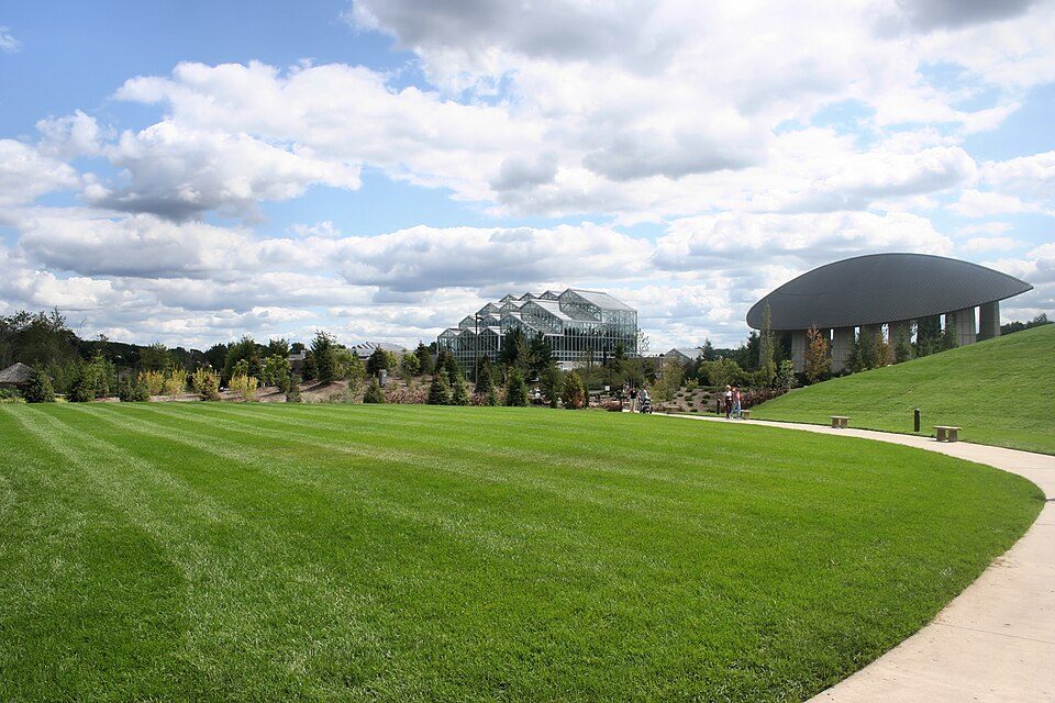
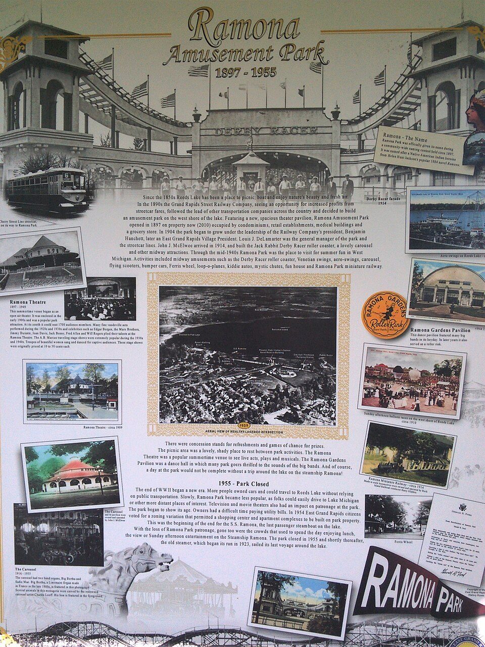
Gerald R. Ford Presidential Museum: Staff of the Gerald R. Ford Presidential Museum, Public domain · North Country Trail: Huron-Manistee National Forests, Public domain · Frederik Meijer Gardens & Sculpture Park: User Jeffness on en.wikipedia, CC BY-SA 2.5 · Ramona Park: Gpwitteveen, CC BY-SA 3.0 · John Ball Zoo: Gpwitteveen, CC BY-SA 3.0

Keep exploring

Everything we know about Kentwood

20pages on Kentwood
After high school

Colleges nearby

8 within 15 miles of the center of Kentwood

A job hub

Every workday, about 45,852 people come to Kentwood for work

Where Kentwood’s working residents go each day. Line width shows the share.

24% → Grand Rapids Grand Rapids 24% 11% → Cascade Township Cascade Township 11% 9% → Wyoming Wyoming 9% 3% → Gaines Township Gaines Township 3% 3% → Walker Walker 3% 2% → Byron Township Byron Township 2% Kentwood · 14% stay
49,203jobs based in Kentwood
14%of working residents work in town
6 mimedian commute distance

Census LEHD 2021

About Kentwood

City in Michigan, United States

Official town website ↗

Kentwood is a city in Kent County in the U.S. state of Michigan. The population was 54,304 as of the 2020 census. The city is bordered on the northwest by Grand Rapids and is the third most-populated municipality in the Grand Rapids metropolitan area.

From Wikipedia, licensed CC BY-SA 4.0 · facts via Wikidata (CC0)

Established
1967
Area
21 sq mi
Elevation
699 ft
ZIP code
49500–49599
Area code
616

Kentwood’s neighbors

7 towns share a border with Kentwood.

Explore the map →
How the neighbors grade
TownMI rankOverallCostSafetySchoolsHealth
Kentwood#453C+C+DBB
Grand Rapids#583C−C+DCB
Cascade Township#61AC−—A+A
Wyoming#386B−B−C−B+B−
Forest Hills——————
Gaines Township#44AC+—A+A−
Grand Rapids Township#43AC−—A+A
Ada Township#34AC−—A+A+

Cascade Township, Gaines Township, Grand Rapids Township and Ada Township report no FBI crime data of their own. Forest Hills isn’t graded (fewer than 1,000 residents, or not enough data). Compare Kentwood with a neighbor →

Questions about Kentwood

Short answers, built from the data on this page.

Is Kentwood, MI a good place to live?

Kentwood grades C+ overall, better than 43% of U.S. towns and #453 of 697 in Michigan. It grades B for health, D for safety and B for schools. Safety is its weak spot, with a D.

Is Kentwood, MI expensive?

That is 4 years of the area's median household income ($82,874 across the Grand Rapids-Wyoming-Kentwood, MI metro area). Cost of living, which also weighs rents, property taxes and how many households pay 30% or more of their income for housing, grades C+.

What is Kentwood, MI known for?

2 notable people were born here, including Brian Hyde and Robert VanderLaan.