Hamtramck’s post office opened in 1828, and 63% of its homes were built before 1940
Among the most historic 1% of U.S. towns · #3 of 701 in Michigan. What drives it
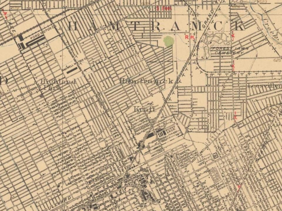
3 places in town are on the National Register, among them two historic districts with 762 buildings between them. Below: 1 old photo or paper, maps from 1905 on, and the census since 1910.
On its age, its old homes and the National Register, Hamtramck is among the most historic 1% of U.S. towns, #3 of 701 in Michigan. All 3 inputs are above most U.S. towns; its share of homes from before 1940 ranks highest and its age lowest.
A+
HistoryA character grade: shown, never part of Hamtramck’s overall grade.
Few Michigan towns list much on the Register (a typical Michigan town has 0.0 per 10,000 residents, the U.S. 2.4), so Hamtramck’s 276 sits above most of its state (97% of Michigan towns have fewer) while its 765 historic buildings outnumber those of 98% of U.S. towns.
How sure. Graded on any two of the three inputs instead, the letter would still be A+. The pre-1940 share is a Census survey estimate (±4.6 points). The founding year is the first post office, not a stated founding date; Wikidata gives 1901.
Founding year: the first post office (other dates in Quick answers). Homes: Census ACS 2020–24. National Register: National Park Service, May 2026 list; each listing counted once (boundary changes and added documentation belong to their listing), and a historic district counts its contributing buildings. How TownRatings grades history →
What stands out about Hamtramck’s past
Read from the archive, the National Register and the record. The page puts what stands out first.
Hamtramck was originally settled by German farmers, but Polish immigrants moved into the area when the Dodge Brothers plant opened in 1914. Poles previously made up a large proportion of the population. It is sometimes confused with Poletown, a traditional Polish neighborhood, which used to lie mostly in the city of Detroit and includes a small part of Hamtramck. As of the 2010 American Community Survey, 14.5% of Hamtramck's population is of Polish origin whereas in 1970 it was 90% Polish.
Passages that mention Hamtramck, cut from the printed page as they were published.
The history of Detroit and Michigan, or, The metropolis illustrated [microform]1884 · page 127Read the page →
Read the text
it was diminished by taking from it certain territory, which was added to Springwells. ‘The Acts of 1832 and 1836, enlarging the limits of the city, took certain territory from Hamtramck, a portion of which was restored in 1842. In 1857 and in 1875 other territory from Hamtramck was added to Detroit.
Text read by machine from the scan; it may contain errors.
The history of Detroit and Michigan1884 · page 127Read the page →
Read the text
to Wayne, and on January 26, 1848, was changed back again to Romulus. Taylor was created out of Ecorce, on April i, 1847, and Grosse Pointe out of Hamtramck on April i, 1848. On March 3, 1849, Grosse Pointe was increased in size by the addition of territory from Hamtramck. On April 2, 1850, Greenfield was enlarged by the addition of territory from Springwells, and on March 25, 1873,
Text read by machine from the scan; it may contain errors.
The history of Detroit and Michigan, or, The metropolis illustrated [microform]1884 · page 550Read the page →
Read the text
church life is the grotto erected “in memory of the apparition at Lourdes.” It is near the Church of the Assumption, in the township of Hamtramck, about seven miles from Detroit on the Gratiot road. It was built) through the exertions of Rev. Father Amandus Vandendriessche, who has been in charge of the parish The grotto is located at the end of
Text read by machine from the scan; it may contain errors.
The history of Detroit and Michigan1884 · page 73Read the page →
Read the text
All the smaller parks have been much used and appreciated since they were thrown open. Linden Park, located in the township of Hamtramck, is three miles from the City Hall, about three fourths of a mile beyond the eastern limits of the city, and half a mile north of the river, between Lincoln and Baldwin Avenues. It contains twenty-five and seventy one-hundredths acres. It was given to the city by
Text read by machine from the scan; it may contain errors.
Scans and text from the Internet Archive. Books published in 1930 or earlier, which are in the public domain.
Timeline
Hamtramck, 1828 to 1949
Woven from the archive, old maps, post office records, the National Register and the people born here.
Nothing in the archives for these yearsWeddings on Main Street, storms, parades, school pictures, the old store. If it’s in your family album, it belongs here.
Hamtramck had its own post office from 1828 to 1836. Another post office, Hamtramck, opened and closed inside today’s town.
Hamtramck
1828–1836
Hamtramck
1905–1915
18201920today
1cemetery inside Hamtramck
Beth Olem
US Post Offices dataset (Blevins & Helbock, CC0). Places and cemeteries from the USGS Geographic Names Information System (2021).
Questions about Hamtramck’s history
What year was Hamtramck founded?
The Hamtramck post office opened in 1828, the earliest record of the town by name (U.S. post office records). Wikidata gives 1901.
How does Hamtramck rank for history?
Hamtramck is among the most historic 1% of U.S. towns, #3 of 701 in Michigan. The History grade combines the town’s founding era, the share of homes built before 1940 and its National Register listings. It’s a character grade, so it isn’t part of the overall grade. How it works.
What is on the National Register in Hamtramck?
Three places: the St. Florian Historic District (listed 1984), the Hamtramck Stadium (2012) and the Campau, Jos., Historic District (2012).
How old are the homes in Hamtramck?
63% of Hamtramck’s homes were built before 1940 (Census estimate, ±4.6 points), against a typical 12% for a Michigan town; the median home was built in 1938.
Founding dates: Wikidata, Wikipedia, the U.S. post office records of Blevins & Helbock (CC0) and the Census. Homes by year built: Census ACS 2020–24. National Register of Historic Places: National Park Service (list of May 22, 2026). Old photos, postcards and papers: Wikimedia Commons, the Library of Congress and other public archives, credited on each item’s page. Maps: U.S. Geological Survey historical topographic maps (via Esri) and Sanborn fire-insurance maps (Library of Congress). History text and census tables: Wikipedia (CC BY-SA 4.0). Places that used to be: USGS Geographic Names Information System (2021).
From Wikimedia Commons (6), the National Register of Historic Places (3), Wikipedia, Wikidata and Wikipedia for famous people, U.S. Geological Survey historical maps, U.S. Census counts (via Wikipedia), the US Post Offices dataset (Blevins & Helbock), the USGS Geographic Names Information System and old county and town histories (Internet Archive). Archive images are copied here with their credits and licenses, shown on each photo’s page. Refreshed monthly.


 2009
 2009
 2008
 2008
 2005