Founding year: Wikidata. First post office: 1839.The full story ↓
History grade
What drives Flushing’s History grade
On its age, its old homes and the National Register, Flushing is more historic than 62% of U.S. towns, #263 of 701 in Michigan. Its age holds the grade up; its National Register listings pull it down.
B
HistoryA character grade: shown, never part of Flushing’s overall grade.
Few Michigan towns list much on the Register (a typical Michigan town has 0.0 per 10,000 residents, the U.S. 2.4), so Flushing’s 0.0 sits below most of its state (32% of Michigan towns have fewer) while its 0 listings outnumber those of 23% of U.S. towns.
How sure. Graded on any two of the three inputs instead, the letter would range from B− to A−. The pre-1940 share is a Census survey estimate (±6.4 points). Two sources give 1835.
Founding year: Wikidata (other dates in Quick answers). Homes: Census ACS 2020–24. National Register: National Park Service, May 2026 list; each listing counted once (boundary changes and added documentation belong to their listing), and a historic district counts its contributing buildings. How TownRatings grades history →
What stands out about Flushing’s past
Read from the archive, the National Register and the record. The page puts what stands out first.
Fire insurance maps drew every building, what it was made of and what it was used for, so insurers could price the risk of fire. Pick a year, then a sheet.
When European settlers first arrived, the area was primarily occupied by bands of the Chippewa (Ojibwa) and Ottawa nations, with the Chippewa being the more numerous and recognized as the original proprietors of the Saginaw Valley. According to Chippewa tradition, their occupation of the region was relatively recent, as the territory had previously been held by the Sauks and Onottoways, who were eventually expelled by a confederation of Chippewa and Ottawa warriors. The principal Sauk village was located on the west side of the Saginaw River, but their domain extended as far south as the headwaters of the Shiawassee and Genesee Counties. The Chippewa and their allies launched a surprise attack, now known as the Battle of Skull Island, resulting in the near destruction of the Sauk and Onottoway tribes, with only a remnant escaping westward. According to the tradition, a reinforcement of …
Passages that mention Flushing, cut from the printed page as they were published.
History of Genesee county, Michigan. With illustrations and biographical sketches of its prominent men and pioneers1879 · page 274Read the page →
Read the text
The village was incorporated March 21, 1877, by the following " Act to Incorporate the Village of Flushing:" "Sec. 1. The Pvojih nf the Sliile nf Mkhit/iiu enact, Tbilt the following lands and territory in the township of Flushing, county of tienesee, and described as follows, to wit: The southeast quarter of section 27, and all that part of the southwest quarter of section 26 as lies northerly of Flint River, and all the land on said section 26 lying between Flint Uiver and Chamberlain Street, as said street is laid out,
Text read by machine from the scan; it may contain errors.
History of Genesee county, Michigan. With illustrations and biographical sketches of its prominent men and pioneers1879 · page 269Read the page →
Read the text
TOWNSHIP- The township of Flushing was formed in 1838, and originally included the whole of townships 7 and 8 north, in range 5 east, and the west half of townships 7 and 8 north, in range (3 east. This territory has been subdivided until the present town of Flushing includes only township 8 north, in range 5 east, as designated on the United States government survey.
Text read by machine from the scan; it may contain errors.
History of Genesee county Michigan1916 · page 299Read the page →
Read the text
Soon after his marriage, Grant Delbridge rented a farm west of New Lathrop, where he lived vintil he rented another farm north of Flushing, where he and his family lived for over nine years. They later resided on a farm east of Flushing for one year, and then, for seven years, on a farm near Flushing. In 1908 they purchased a farm of eighty acres in section 25.
Text read by machine from the scan; it may contain errors.
History of Genesee county Michigan1916 · page 557Read the page →
Read the text
many years. He later bought a farm in Richfield county where he lived for a number of years, before he purchased the farm in Groveland Center, Oakland county, where the children grew to manhood and womanhood. He then moved to a farm in Flushing township, and later to the village of Flushing, where he lived for a few years before henioved to the farm where his death occurred on February 5, 1916.
Text read by machine from the scan; it may contain errors.
Scans and text from the Internet Archive. Books published in 1930 or earlier, which are in the public domain.
By decade
Flushing, decade by decade
4 decades in the archive, from the 1870s to the 1900s. Scroll each row; tap a photo for its story.
Nothing in the archives for these yearsWeddings on Main Street, storms, parades, school pictures, the old store. If it’s in your family album, it belongs here.
In 1835, according to Wikidata. Flushing’s post office opened in 1839, and the census of 1860 counted 406 people here.
How does Flushing rank for history?
Flushing is more historic than 62% of U.S. towns, #263 of 701 in Michigan. The History grade combines the town’s founding era, the share of homes built before 1940 and its National Register listings. It’s a character grade, so it isn’t part of the overall grade. How it works.
How old are the homes in Flushing?
19% of Flushing’s homes were built before 1940 (Census estimate, ±6.4 points), against a typical 12% for a Michigan town; the median home was built in 1965.
Founding dates: Wikidata, Wikipedia, the U.S. post office records of Blevins & Helbock (CC0) and the Census. Homes by year built: Census ACS 2020–24. National Register of Historic Places: National Park Service (list of May 22, 2026). Old photos, postcards and papers: Wikimedia Commons, the Library of Congress and other public archives, credited on each item’s page. Maps: U.S. Geological Survey historical topographic maps (via Esri) and Sanborn fire-insurance maps (Library of Congress). History text and census tables: Wikipedia (CC BY-SA 4.0). Places that used to be: USGS Geographic Names Information System (2021).
From Wikimedia Commons (6), Wikipedia, Wikidata and Wikipedia for famous people, U.S. Geological Survey historical maps, U.S. Census counts (via Wikipedia), the US Post Offices dataset (Blevins & Helbock), the USGS Geographic Names Information System, Sanborn fire insurance maps (Library of Congress) and old county and town histories (Internet Archive). Archive images are copied here with their credits and licenses, shown on each photo’s page. Refreshed monthly.


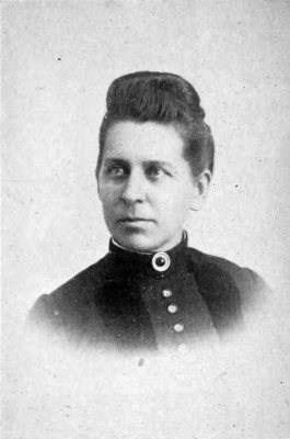


 c. 1888
 c. 1900