Guest, Sign inJoin

Post to South Thomaston

We’ll email a one-tap link to publish your post. No password, and nothing is public until you click it.
Already a member? Sign in
South Thomaston
Maine›Knox County

South ThomastonME

2.8 times the library visits per person than the typical Maine town.

5 bordering townsMap →
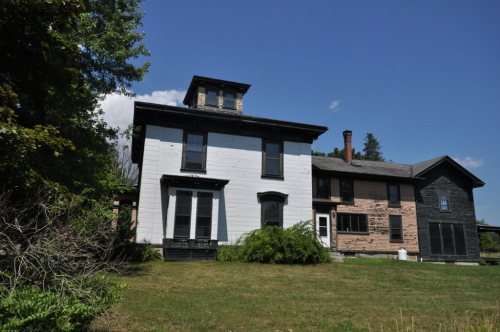
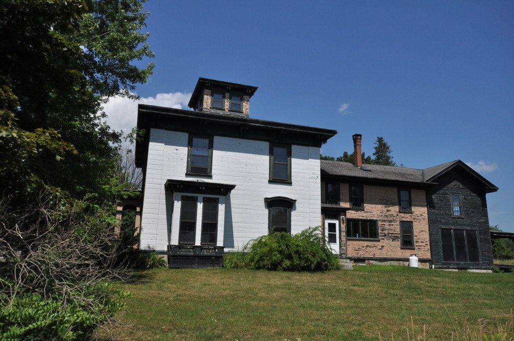
George Thorndike House · Photo: Magicpiano · CC BY-SA 4.0
Photo of South Thomaston

South Thomaston, ME · George Thorndike House · Photo: Magicpiano · CC BY-SA 4.0

Is South Thomaston a good place to live?

The best of South Thomaston’s subject grades are an A− for health and history and an A for civic life; the weakest is a C for schools. South Thomaston has 2 places on the National Register of Historic Places, among them George Thorndike House and Finnish Congregational Church and Parsonage. South Thomaston has fewer than 2,500 residents, so it gets subject grades but no overall grade.

What makes South Thomaston stand out

Where South Thomaston beats most towns.

By the sea

South Thomaston lives by the ocean

Coastal flooding makes up 20% of the storm damage FEMA expects here.

20%of expected storm damage is coastal flooding
99thpercentile for coastal flood risk nationally
4paid flood-insurance claims since 2010
2storm & flood disasters paid out here
On the water
  • R. Waldo Tyler (Weskeag Marsh) Wildlife Management Area

FEMA National Risk Index · OpenFEMA · OpenStreetMap

How South Thomaston grades

Each subject compared with towns across the country (schools within Maine), ordered by how far South Thomaston is from typical.

How grading works

Character Graded, but not part of the overall grade.
Described, not graded Taste, not quality: snow or an older crowd is neither good nor bad.

How TownRatings grades towns →

George Thorndike House
George Thorndike House · National Register of Historic Places
South Thomaston’s story

178 years in pictures

Census counts: 1,420 in 1850, a low of 538 in 1940, 1,511 in 2020. The archive holds 4 old photos and papers going back to 2015 and 4 maps from 1904 on.

2 places on the National Register of Historic Places.

  • 1848South Thomaston is settled
Explore the history →
Getting set up

Moving to South Thomaston: who provides what

Who provides power, water and the rest in South Thomaston, and how to reach them.

The full setup list →
PowerCentral Maine Power27.4¢/kWh · EIA 2025HIFLD · EIA
WaterFour Winds Homeowners Assn water systemNo health-based violations in 5 years · EPAEPA
Internet7 providers98% of addresses get 100/20 MbpsFCC
Trash & dumpNearest public drop-offOHSTT Transfer Station, 3 miOpenStreetMap
SchoolsRegion School Unit 13Which school depends on your addressNCES
Register to voteOnlineIn Maine you can register online until 21 days before Election Day, in person up to and including Election Day, or by mail (received 21 days before).vote.gov
Who runs elections hereSouth Thomaston Registrar of VotersThe town itself; contacts on the Handbook page.FVAP, Oct 2026
ZIP code0485804858 99%Census 2020

EPA SDWIS (Oct 9, 2026) · HIFLD + EIA-861 2025 · Census 2020 ZCTAs · NCES 2024–25 · registration: vote.gov, updated Aug 3, 2026.

The data

Ordered by what stands out in South Thomaston.

HealthA−

On CDC estimates, South Thomaston is healthier than 79% of U.S. towns

28% of adults sleep under 7 hours in South Thomaston. The town beats the Maine average on 9 of 32 CDC measures and trails it on 1. In South Thomaston, 15% of adults report frequent mental distress, and 28% have obesity.

79%healthier than U.S. townsA−Health Grade
South ThomastonMaine townsU.S. towns
Sleep under 7 hours (CDC PLACES)28%33%36%
Frequent mental distress (CDC PLACES)15%18%17%
Obesity (CDC PLACES)28%33%35%
Feel lonely (CDC PLACES)29%32%33%
32 measures vs. Maine
9 better22 too close to call1 worse
What stands outSouth ThomastonME
Fewer adults facing food insecurity7.8%10.7%
Fewer adults without reliable transportation6.1%7.8%
More adults who have had cancer11.3%9.9%
Mainehealth Pen Bay Hospital
7.4 mi away · emergency room
None
primary care, dental or mental-health shortage

CDC PLACES 2025 · modeled estimates for adults · CMS · HRSA

Work & commuteJobs & income grade B

South Thomaston has 0.4 jobs for every working resident, so most commute out

In South Thomaston, 8.3% of workers work remotely from home. Most working residents leave South Thomaston for work: only 4% work in town. The town’s average commute stands at 16 minutes, below both Maine’s towns (25 minutes) and U.S. towns (25 minutes). The top destinations are Rockland (29%), Rockport (11%) and Thomaston (7%).

4%work in town
South ThomastonMaine townsU.S. towns
Average trip to work16 minutes25 minutes25 minutes
Below the poverty line4.2%9%9.6%
Work from home8.3%14%11%
Working residents who work in town4.1%12%8%

Where working residents work

In South Thomaston4%
Rockland29%
Rockport11%
Thomaston7%
Owls Head5%
8 mi
median commute distance
206
jobs based in South Thomaston
A commuter town
jobs vs. working residents
C
Walkability grade: more walkable than 33% of U.S. towns

Census LEHD 2023 · ACS

Who lives here

Older than Maine overall

For South Thomaston, the midpoint age is 54.3 years. People 65 and older are 35% of residents (22% statewide); adults 35 to 64 are 33% of residents (40% statewide). Among residents here, 14% are under 18. South Thomaston: 45% of adults 25 and older hold a bachelor’s degree or more, against 32% in Maine’s towns and 29% across U.S. towns.

54.3median age · ME 44.8
South ThomastonMaine townsU.S. towns
Median age54.3 years44.9 years40.5 years
Under 1814%18%22%
Bachelor’s degree or more, 25+45%32%29%
South ThomastonMaineUnited States

Ages · share of residents

Education · adults 25 and older

No diploma3%
High school36%
Some college14%
Associate’s2%
Bachelor’s29%
Graduate16%

Women and men · all residents

54% women, 46% men

About 84 men for every 100 women (the survey’s margin: ±2.6 points). Across Maine, 50.7% of residents are women.

Ages and education in South Thomaston
South ThomastonMEU.S.
Under 107.7%9.5%11.6%
10 to 176.1%8.5%10.3%
18 to 247.7%8%9.1%
25 to 3410.9%12%13.7%
35 to 445.1%12.2%13.2%
45 to 5412.8%12.2%12.2%
55 to 6414.8%15.1%12.7%
65 to 7418.2%13.4%10.2%
75 and older16.6%8.9%7%
No diploma3.1%5.2%10.4%
High school36%30.1%26%
Some college14%18.1%19.1%
Associate’s2.3%10.4%8.8%
Bachelor’s28.9%22.5%21.6%
Graduate15.7%13.7%14.1%

U.S. Census Bureau · ACS 2020-2024 5-year estimates · in a town of 1,500, single groups can be off by several points

Climate

South Thomaston stands out in Maine and nationally: a typical July afternoon there is cooler

The seasons in South Thomaston: cold, snowy winters, cool summers, with plenty of rain. July afternoons reach 75°, January nights drop to 15° and about 53 inches of snow falls in a winter.

53″snow a winter

Typical low → high °F

Winter18–33°
Spring34–50°
Summer56–72°
Fall42–56°
Oct 25
typical first frost
Apr 27
typical last frost
+1.7°
vs. the 20th-century average

NOAA U.S. Climate Normals, 1991–2020

Natural hazardsHazard risk grade B

Top of a low hazard risk in South Thomaston: hurricanes

Paid flood insurance claims in South Thomaston since 2010: 4. Compared with 65% of U.S. communities, expected storm and flood damage locally is lower. Just over a third of the town’s expected losses from natural hazards come from hurricanes, followed by inland flooding at 22%. Households locally have drawn federal disaster aid in 2 declared disasters, most recently in 2024.

35risk score of 100
FEMA risk score
35Low riskLowerHigher
HurricanesInland floodingCoastal flooding
4
paid flood claims since 2010
2
federal disasters paid out here

FEMA flood insurance claims · FEMA disaster declarations and aid · FEMA National Risk Index · OpenFEMA

OutdoorsB

South Thomaston keeps 10% of its land conserved

The trail network density for South Thomaston comes to 0.2 miles per square mile. Trails run 3.5 miles in 4 parks and preserves. The biggest park or preserve is Riverview Hayfields Preserve, at 305 acres.

10%conserved
South ThomastonMaine townsU.S. towns
Conserved land10%4.7%4.3%
Miles of trail per square mile0.2 miles per square mile0.70.4
10%
conserved · 1,146 of 11,419 acres
3.5 mi
of trails · 0.2 per sq mi
Biggest places to walkTrailsAcres
1. Weskeag Headlands Preserve1.1 mi36
2. Weskeag Preserve1 mi138
3. R. Waldo Tyler (Weskeag Marsh) Wildlife Management Area0.1 mi487

Trails & parks © OpenStreetMap contributors · Conserved land: USGS PAD-US

HousingCost of living grade C+

Homes in South Thomaston are worth about $454K, by Zillow’s estimate

For households in South Thomaston, the share who own their home is 93%. In the year to September 2026, typical home values climbed 1.1%.

$454KZillow home value

Typical home value

South Thomaston$454K
Maine$412K
+1.1%
value change, 1 year

Census ACS, 2020–24 · Zillow Home Value Index · Redfin Data Center

Nearby attractions

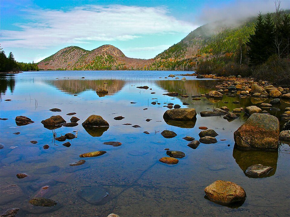
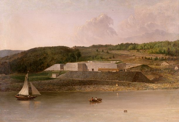
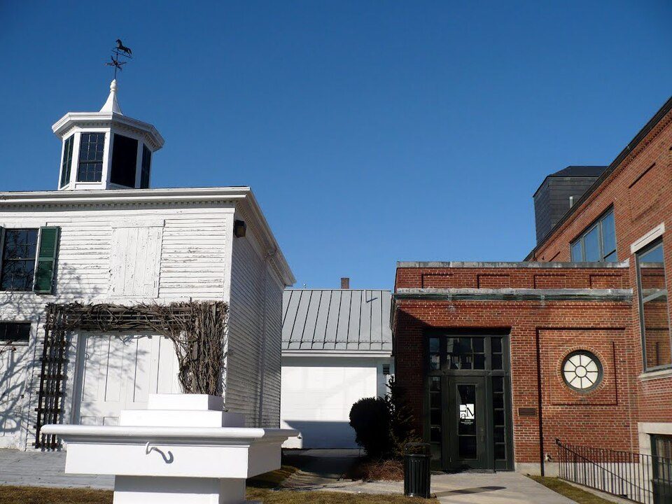
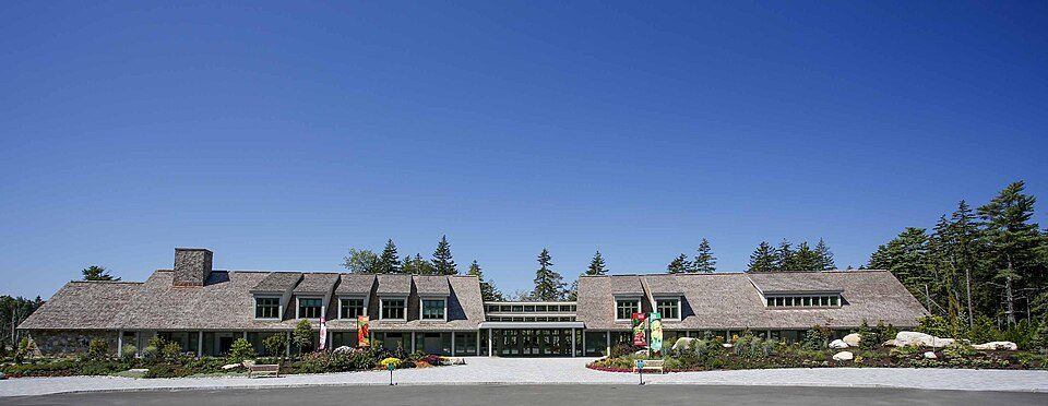
Acadia National Park and 14 more within 40 miles

Museums, parks, gardens and other places to visit around South Thomaston. Close and well known come first.

All 27 attractions →
Sources: National Park Service · ski areas © OpenSkiMap / OpenStreetMap contributors · Wikidata · Wikipedia readership · photos via Wikimedia Commons
Photo credits

Acadia National Park: Plh1234us, CC BY-SA 3.0 · Fort Knox: Unknown, Public domain · Farnsworth Art Museum: Panoramio user MementoMori, CC BY 3.0 · Pemaquid Point Light: WestportWiki, CC BY-SA 3.0 · Coastal Maine Botanical Gardens: CMBG editor, CC BY-SA 4.0

Keep exploring

Everything we know about South Thomaston

18pages on South Thomaston
After high school

Colleges nearby

1 within 15 miles of the center of South Thomaston

About 9 of every 100 South Thomaston residents are enrolled in college, against 6 across Maine.

Prices by family income, graduation and earnings →

A commuter town

96% of working residents leave South Thomaston for work

Where South Thomaston’s working residents go each day. Line width shows the share.

29% → Rockland Rockland 29% 11% → Rockport Rockport 11% 7% → Thomaston Thomaston 7% 5% → Owls Head Owls Head 5% 3% → Bangor Bangor 3% 3% → St. George St. George 3% South Thomaston · 4% stay
206jobs based in South Thomaston
4%of working residents work in town
8 mimedian commute distance

Census LEHD 2023

Landmarks

2 places in South Thomaston on the National Register of Historic Places.

All landmarks →

About South Thomaston

Town in Maine, United States

South Thomaston is a town in Knox County, Maine, United States. The population was 1,511 at the 2020 census. A fishing and resort area, the town includes the village of Spruce Head.

From Wikipedia, licensed CC BY-SA 4.0 · facts via Wikidata (CC0)

Established
1848
Area
18 sq mi
Elevation
49 ft
ZIP code
04858
Area code
207

South Thomaston’s neighbors

5 towns share a border with South Thomaston.

Explore the map →
How the neighbors grade
TownME rankOverallCostSafetySchoolsHealth
South Thomaston——C+—CA−
Thomaston#123DC−—CB
St. George#86CC−—B−B+
Owls Head——C—CA−
Cushing——D—CB+
Rockland#94CC−B−CB+

South Thomaston, Owls Head and Cushing have fewer than 2,500 residents, so they get subject grades but no overall grade. South Thomaston, Thomaston, St. George, Owls Head and Cushing report no FBI crime data of their own. Compare South Thomaston with a neighbor →

Questions about South Thomaston

Short answers, built from the data on this page.

Is South Thomaston, ME a good place to live?

2.8 times the library visits per person than the typical Maine town.

Is South Thomaston, ME expensive?

That is 6.1 years of the area's median household income ($74,096 across the county). Cost of living, which also weighs rents, property taxes and how many households pay 30% or more of their income for housing, grades C+.