Peaked at 1,698 in 1860; 898 people lived here in 2020.
21 censuses, 1820–2020.
U.S. Census Bureau decennial counts, from the census table on Phillips’ Wikipedia page.
Every building
Phillips, building by building, 1892–1909
Fire insurance maps drew every building, what it was made of and what it was used for, so insurers could price the risk of fire. Pick a year, then a sheet.
1892Sheet 1 of 1
Edition
Sheets
BrickWoodStone
Sanborn Map Company, via the Library of Congress. Editions published in 1930 or earlier, which are in the public domain.
The plantation was part of a large tract granted by Massachusetts about 1790 to Jonathan Phillips of Boston. It was first settled in 1791 by Perkins Allen from Martha's Vineyard, a sea captain who called it Curvo. It was incorporated on February 25, 1812, and named for Phillips. The town was noted both for its productive soil, with hay the chief crop, and its superior water power. At falls along the Sandy River were erected sawmills, gristmills, a fulling mill and a carding machine.
Passages that mention Phillips, cut from the printed page as they were published.
A history of Farmington, Franklin County, Maine, from the earliest explorations to the present time, 1776-18851885 · page 184Read the page →
Read the text
of a Railroad Through Chesterville. — Negotiations with the Androscoggin Railroad. — Completion of Road to West Farmington. — Extension of Androscoggin Railroad to Center Village. — Agitation Concerning a Railroad to Phillips. — Organization of Sandy River Railroad Company. — Completion of the Road. — Franklin and Megantic Railroad.
Text read by machine from the scan; it may contain errors.
A history of Farmington, Franklin County, Maine, from the earliest explorations to the present time, 1776-18851885 · page 193Read the page →
Read the text
The people of the northern part of the county were almost equally interested with the people of Farmington, in all the early efforts made to secure railroad facilities. The people of Strong and Phillips, especially, gave hearty co-operation in the building of the Androscoggin road. The town of Phillips is to North Franklin what Farmington is to the southern part of the county, the natural center of trade, and of all those industries which tend to build up substantial
Text read by machine from the scan; it may contain errors.
A history of the town of Industry, Franklin County, Maine, from the earliest settlement in 1787 down to the present time1893Read the page →
Read the text
less fortunate in this respect, and great damage was done to property, such as farm-buildings and fences, as well as to fruit and shade trees. The lattice-work railroad bridge, 150 feet long, across the Sanely River at Phillips, was lifted from its foundation and dashed to kindling wood by the gale. At Winthrop, Me., the steeple was blown from the Methodist Church, and falling through the roof of a neighboring house, so injured an aged lady that she died soon after the accident.
Text read by machine from the scan; it may contain errors.
A history of the town of Industry, Franklin County, Maine, from the earliest settlement in 1787 down to the present time1893 · page 511Read the page →
Read the text
I. Daniel Beede, sun of Capt. Daniel and Mary (Eveleth) Beede, married Emily Ela. When three years of age his father moved to a township, a portion of which is now in the town of Phillips. Here, engaged in the pursuits of farm life, young Beede spent his boyhood days, getting occasional glimpses of the outside world in his trips on horseback to mill, and to the then distant seaport town of Hallowell, whither all the inland settlers in this section of the State went to find a market for their produce. Diligent in his studies, he obtained a good
Text read by machine from the scan; it may contain errors.
Scans and text from the Internet Archive. Books published in 1930 or earlier, which are in the public domain.
Timeline
Phillips, 1791 to 1929
Woven from the archive, old maps, post office records, the National Register and the people born here.
Nothing in the archives for these yearsWeddings on Main Street, storms, parades, school pictures, the old store. If it’s in your family album, it belongs here.
Founding dates: Wikidata, Wikipedia, the U.S. post office records of Blevins & Helbock (CC0) and the Census. Homes by year built: Census ACS 2020–24. National Register of Historic Places: National Park Service (list of May 22, 2026). Old photos, postcards and papers: Wikimedia Commons, the Library of Congress and other public archives, credited on each item’s page. Maps: U.S. Geological Survey historical topographic maps (via Esri) and Sanborn fire-insurance maps (Library of Congress). History text and census tables: Wikipedia (CC BY-SA 4.0). Places that used to be: USGS Geographic Names Information System (2021). How TownRatings grades history →
From Wikimedia Commons (5), Wikidata (2), the National Register of Historic Places (4), Wikipedia, Wikidata and Wikipedia for famous people, U.S. Geological Survey historical maps, U.S. Census counts (via Wikipedia), the USGS Geographic Names Information System, Sanborn fire insurance maps (Library of Congress) and old county and town histories (Internet Archive). Archive images are copied here with their credits and licenses, shown on each photo’s page. Refreshed monthly.


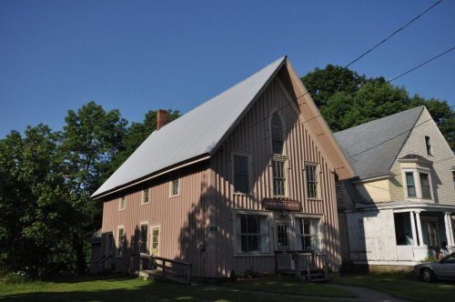


 1907
 c. 1912
 2018


