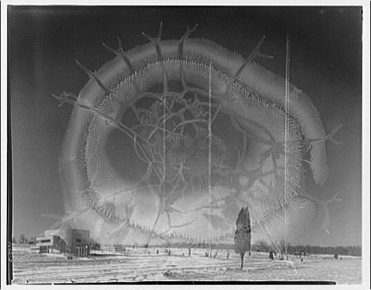
Potomac Electric Power Co. miscellaneous. CBS station, 1920
Wheaton’s story
157 years in pictures
The archive holds 12 old photos and papers going back to 1878 and 6 maps from 1908 on.
- 1869Wheaton is settled
Each edition grades its towns against each other only.

A city of 52,926, settled in 1869.
Wheaton's standout: it is easier to get around on foot or by transit than 98% of U.S. towns. Overall it grades A−, 87th among Maryland's 259 graded towns. Residents are healthier than 75% of U.S. towns on CDC estimates and natural-hazard risk is low. 22% of the land in Wheaton is conserved, above both the Maryland town median (9.5%) and the median of U.S. towns (4.3%). Only 27 of Maryland’s 329 towns score higher on the outdoors. The biggest place to walk is Wheaton Regional Park, 536 acres with 6.8 miles of trail.
Where Wheaton beats most towns.
21.9% of the town is conserved land, across 21 parks and preserves.
Each subject compared with towns across the country (schools within Maryland), ordered by how far Wheaton is from typical.
How TownRatings grades towns →
The archive holds 12 old photos and papers going back to 1878 and 6 maps from 1908 on.
Museums, parks, gardens and other places to visit around Wheaton. Close and well known come first.
 Big draw11 mi National park siteWhite House311K visitors a year
 Big draw11 mi National MemorialWashington Monument204K visitors a year
 Big draw12 mi LandmarkArlington National Cemetery
 Big draw11 mi LandmarkUnited States Triumphal Arch
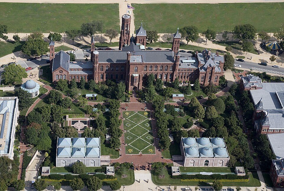 Big draw11 mi MuseumSmithsonian Institution30.0M visitors a year
 Big draw11 mi National MemorialLincoln Memorial7.7M visitors a year
White House: This image or media was taken or created by Matt H. Wade. To see his entire port, CC BY-SA 3.0 · Washington Monument: Oren Rozen, CC BY-SA 4.0 · Arlington National Cemetery: Protoant, Public domain · United States Triumphal Arch: Hstoops, CC0 · Smithsonian Institution: Highsmith, Carol M., 1946-, photographer, Public domain · Lincoln Memorial: Aerial_view_of_Lincoln_Memorial_-_east_side.jpg: Carol M. Highsmith derivative w, Public domain
Wheaton is unincorporated, so Montgomery County and regional agencies provide most services.
EPA SDWIS (Oct 9, 2026) · HIFLD + EIA-861 2025 · Census 2020 ZCTAs · NCES 2024–25 · registration: vote.gov, updated Mar 11, 2026.
Ordered by what stands out in Wheaton.
Wheaton sends many workers across the state line and owes part of its health edge to its incomes.
The trail network density for Wheaton comes to 1.7 miles per square mile, above both Maryland’s towns (0.6) and U.S. towns (0.4). There are 12 miles of trail across 21 parks and preserves.
| Biggest places to walk | Trails | Acres |
|---|---|---|
| 1. Wheaton Regional Park | 6.8 mi | 536 |
| 2. Rock Creek Stream Valley Park | 1.5 mi | 138 |
| 3. Brookside Gardens | 0.7 mi | 27 |
Trails & parks © OpenStreetMap contributors · Conserved land: USGS PAD-US
Of its 16 schools, two are listed below, each with the reason. Public schools: the Montgomery County Public Schools. The 6 public schools in Wheaton teach 3,740 students between them.
| School | Level | Students | Letter |
|---|---|---|---|
| A. Mario Loiederman MiddleLargest public middle schoolGrades 6–8 | Grades 6–8 | 978 | B− |
| Wheaton HighLargest public high schoolGrades 9–12 | Grades 9–12 | 2,794 | A |
NCES · EDFacts · graded within MD on state tests and graduation
The FEMA risk score in Wheaton is 7 of 100. Since 1978, 18 flood insurance claims have been paid out locally. FEMA puts 47% of the town’s expected hazard losses down to inland flooding, and 13% to heat waves. Federal disaster aid has reached households in Wheaton once, in 2003.
FEMA flood insurance claims · FEMA disaster declarations and aid · FEMA National Risk Index · OpenFEMA
Against the 6,940 U.S. towns with household incomes like Wheaton’s, it is healthier than 54%, a smaller edge than it has nationally: part of it comes with its incomes.
For adults in Wheaton, the share who report frequent mental distress is 14%. Of 32 CDC measures, Wheaton beats the Maryland average on 9 and trails it on 10. Two figures for adults in the town: 18% have been diagnosed with depression, 30% have obesity.
| Wheaton | Maryland towns | U.S. towns | |
|---|---|---|---|
| No health insurance, 18–64 (CDC PLACES) | 16% | 8% | 8.1% |
| Yearly checkup (CDC PLACES) | 74% | 79% | 79% |
| Depression (CDC PLACES) | 18% | 20% | 23% |
| Obesity (CDC PLACES) | 30% | 36% | 35% |
| What stands out | Wheaton | MD |
|---|---|---|
| Fewer adults who have had cancer | 5.2% | 7.6% |
| Fewer adults with arthritis | 18.8% | 25.8% |
| More uninsured adults | 16.2% | 8.7% |
CDC PLACES 2025 · modeled estimates for adults · CMS · HRSA
22% of working residents cross a state line to work.
The top destinations are Washington (21%), Rockville (8%) and Bethesda (7%). Commuting out is the norm in Wheaton: 4% of working residents work locally. The share of residents in Wheaton who live below the poverty line: 13%. Half commute less than 9 miles.
| Wheaton | Maryland towns | U.S. towns | |
|---|---|---|---|
| Work from home | 20% | 18% | 11% |
| Below the poverty line | 13% | 7% | 9.6% |
| Average trip to work | 32 minutes | 32 minutes | 25 minutes |
| Median household income | $111,000 | $113,000 | $80,000 |
Census LEHD 2023 · ACS
The range runs from 26° on a January night to 87° on a July afternoon, with about 16 inches of snow a winter.
NOAA U.S. Climate Normals, 1991–2020
Here, 39% of adults 25 and older have a bachelor’s degree, against 44% in Maryland as a whole. By age, Wheaton looks like Maryland: each broad group is within 4 points. 19% never finished high school.
| Wheaton | Maryland towns | U.S. towns | |
|---|---|---|---|
| Aged 65 or older | 13% | 16% | 18% |
| Median age | 37.7 years | 39.4 years | 40.5 years |
| Bachelor’s degree or more, 25+ | 39% | 42% | 29% |
50% women, 50% men
That’s an even split within the survey’s margin of ±3.4 points. Across Maryland, 51.3% of residents are women. Median age: women 37.9, men 37.5.
| Wheaton | MD | U.S. | |
|---|---|---|---|
| Under 10 | 12.8% | 11.9% | 11.6% |
| 10 to 17 | 9.7% | 10.3% | 10.3% |
| 18 to 24 | 8.4% | 8.5% | 9.1% |
| 25 to 34 | 15% | 13.2% | 13.7% |
| 35 to 44 | 14.8% | 13.6% | 13.2% |
| 45 to 54 | 12.8% | 12.6% | 12.2% |
| 55 to 64 | 13.3% | 13.3% | 12.7% |
| 65 to 74 | 7.9% | 9.9% | 10.2% |
| 75 and older | 5.4% | 6.8% | 7% |
| No diploma | 19.3% | 8.9% | 10.4% |
| High school | 20% | 23.4% | 26% |
| Some college | 17.1% | 17.4% | 19.1% |
| Associate’s | 4.9% | 6.8% | 8.8% |
| Bachelor’s | 18.6% | 22.7% | 21.6% |
| Graduate | 20.1% | 20.8% | 14.1% |
U.S. Census Bureau · ACS 2020-2024 5-year estimates
A home in Wheaton typically sold within 35 days of listing. The rent at the middle of the market for Wheaton comes to $2,163 a month. Nearly two thirds of households are owner-occupiers in the town.
| Wheaton | Maryland towns | U.S. towns | |
|---|---|---|---|
| Median rent | $2,163 a month | $1,809 a month | $1,185 a month |
| Households that own their home | 65% | 74% | 73% |
Census ACS, 2020–24 · Zillow Home Value Index · Redfin Data Center
34 within 15 miles of the center of Wheaton
About 6 of every 100 Wheaton residents are enrolled in college, about the same as Maryland.
Where Wheaton’s working residents go each day. Line width shows the share.
Census LEHD 2023
4 notable people were born in Wheaton.
Census-designated place in Maryland, United States
Wheaton is a census-designated place in Montgomery County, Maryland, United States, situated north of Washington, D.C., and northwest of downtown Silver Spring. Wheaton takes its name from Frank Wheaton (1833–1903), a career officer in the United States Army and volunteer from Rhode Island in the Union Army who rose to the rank of major-general while serving before, during, and after the Civil War. Wheaton had a population of 52,150 at the 2020 census. The United States Postal Service has assigned ZIP code 20902 to Wheaton, but the Wheaton Post Office is a part of the larger Silver Spring area. Downtown Wheaton is located around the triangle formed by Veirs Mill Road, University Boulevard, …
From Wikipedia, licensed CC BY-SA 4.0 · facts via Wikidata (CC0)
8 towns share a border with Wheaton.
All 7 graded towns on its borders grade higher than its A−; Aspen Hill (A−) is closest.
| Town | MD rank | Overall | Cost | Safety | Schools | Health |
|---|---|---|---|---|---|---|
| Wheaton | #87 | A− | C | — | B+ | A− |
| Glenmont | #66 | A | C− | — | B+ | A− |
| North Bethesda | #34 | A | D | — | B+ | A+ |
| Kemp Mill | #46 | A | C | — | B+ | A |
| Aspen Hill | #78 | A− | C | — | B+ | A− |
| North Kensington | #10 | A+ | C | — | B+ | A+ |
| Forest Glen | #7 | A+ | C+ | — | B+ | A |
| South Kensington | #47 | A | D | — | B+ | A+ |
Wheaton, Glenmont, North Bethesda, Kemp Mill, Aspen Hill, North Kensington, Forest Glen and South Kensington report no FBI crime data of their own. Compare Wheaton with a neighbor →
Short answers, built from the data on this page.
By most measures, yes. Wheaton grades A− overall, better than 81% of U.S. towns and #87 of 259 in Maryland. It grades A− for health and B+ for schools.
The typical home is worth about $501,000, 18% above the Maryland typical home. Cost of living, which also weighs rents, property taxes and how many households pay 30% or more of their income for housing, grades C.
4 notable people were born here, including Michael Parsons and Diana Barrera.


