Founding year: Wikipedia. First post office: 1868.The full story ↓
History grade
What drives Ridgely’s History grade
On its age, its old homes and the National Register, Ridgely is more historic than 81% of U.S. towns. All 2 inputs are above most U.S. towns; its share of homes from before 1940 ranks highest and its National Register listings lowest.
A−
HistoryA character grade: shown, never part of Ridgely’s overall grade.
Few Maryland towns list much on the Register (a typical Maryland town has 0.9 per 10,000 residents, the U.S. 2.4), so Ridgely’s 11.3 sits above most of its state (70% of Maryland towns have fewer) while its 2 historic buildings outnumber those of 60% of U.S. towns.
How sure. Graded on two of the three inputs, so a change in either one moves the letter more than it would with three. The pre-1940 share is a Census survey estimate (±8.2 points). Two sources give 1867.
Founding year: Wikipedia (other dates in Quick answers). Homes: Census ACS 2020–24. National Register: National Park Service, May 2026 list; each listing counted once (boundary changes and added documentation belong to their listing), and a historic district counts its contributing buildings. How TownRatings grades history →
What stands out about Ridgely’s past
Read from the archive, the National Register and the record. The page puts what stands out first.
The town was established on May 13, 1867, by the Maryland and Baltimore Land Association. The land around present day Ridgely was purchased by the Maryland and Baltimore Land Association from Thomas Bell and the Reverend Greenbury W. Ridgely (2 May 1798-16 Aug 1883) . The town was named after the Rev. Greenbury W. Ridgely.
A railroad boom in the 1860s on the Delmarva Peninsula was fueling land speculation. Civil engineer J.J. Sickler from Philadelphia was commissioned to design the town's layout. The Land Association began construction and built four buildings, including a railroad station, hotel, and two private residences during the first year. James K. Saulsbury constructed a combined store and residence, now known as the Ridgely House.
Passages that mention Ridgely, cut from the printed page as they were published.
History of Caroline County, Maryland, from its beginning1920Read the page →
Read the text
ahoe Bridge to Choptauk Bridge, and that a chapel should be built at Nine Bridges. Two acres of land for a church site were purchased from Edward Barwick for £10 ($50) at or near the present site of Ridgely. This site, however, was not used and the land was subsequently offered for sale.
Text read by machine from the scan; it may contain errors.
History of Caroline County, Maryland, from its beginning1920Read the page →
Read the text
The early conditions of Ridgely, as far as schools and churches were concerned, were poor, the settlers having had to go to Boonsboro for both. The first school of Ridgely was built in 1872 and was called "Sedge Field Academy." This was a one roomed school of which Mr. Swann was the first teacher. It is said tliat this was the first school in the county to liave desks built with reference to the size of the pupils. This one-roomed
Text read by machine from the scan; it may contain errors.
Scans and text from the Internet Archive. Books published in 1930 or earlier, which are in the public domain.
Timeline
Ridgely, 1867 to 1909
Woven from the archive, old maps, post office records, the National Register and the people born here.
US Post Offices dataset (Blevins & Helbock, CC0). Places and cemeteries from the USGS Geographic Names Information System (2021).
Questions about Ridgely’s history
What year was Ridgely founded?
In 1867, according to Wikipedia’s history of the town. Ridgely’s post office opened in 1868, and the census of 1880 counted 81 people here.
How does Ridgely rank for history?
Ridgely is more historic than 81% of U.S. towns. The History grade combines the town’s founding era, the share of homes built before 1940 and its National Register listings. It’s a character grade, so it isn’t part of the overall grade. How it works.
What is on the National Register in Ridgely?
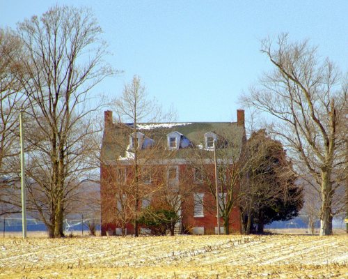
One place: the Oak Lawn (listed 1975).
How old are the homes in Ridgely?
23% of Ridgely’s homes were built before 1940 (Census estimate, ±8.2 points), against a typical 3.3% for a Maryland town; the median home was built in 1981.
Founding dates: Wikidata, Wikipedia, the U.S. post office records of Blevins & Helbock (CC0) and the Census. Homes by year built: Census ACS 2020–24. National Register of Historic Places: National Park Service (list of May 22, 2026). Old photos, postcards and papers: Wikimedia Commons, the Library of Congress and other public archives, credited on each item’s page. Maps: U.S. Geological Survey historical topographic maps (via Esri) and Sanborn fire-insurance maps (Library of Congress). History text and census tables: Wikipedia (CC BY-SA 4.0). Places that used to be: USGS Geographic Names Information System (2021).
From the National Register of Historic Places (1), Wikipedia, Wikidata and Wikipedia for famous people, U.S. Geological Survey historical maps, U.S. Census counts (via Wikipedia), the US Post Offices dataset (Blevins & Helbock), the USGS Geographic Names Information System, Sanborn fire insurance maps (Library of Congress) and old county and town histories (Internet Archive). Archive images are copied here with their credits and licenses, shown on each photo’s page. Refreshed monthly.