Libertytown in pictures
The archive holds 6 old photos and papers going back to 2011.
1 place on the National Register of Historic Places.
Explore the history →Each edition grades its towns against each other only.

A town of 1,346.
The best of Libertytown’s subject grades are an A+ for incomes, an A− for health, and an A for history; the weakest is a D for walkability. 17% of the land in Libertytown is conserved, above both the Maryland town median (9.5%) and the median of U.S. towns (4.3%). Only 29 of Maryland’s 329 towns score higher on history. The biggest place to walk is Libertytown Community Park, 94 acres with 1.7 miles of trail. Libertytown has fewer than 2,500 residents, so it gets subject grades but no overall grade.
Where Libertytown beats most towns.
In a town this size, neighbors are the best guide. Ask them anything.
Each subject compared with towns across the country (schools within Maryland), ordered by how far Libertytown is from typical.
How TownRatings grades towns →
The archive holds 6 old photos and papers going back to 2011.
1 place on the National Register of Historic Places.
Explore the history →Libertytown is unincorporated, so Frederick County and regional agencies provide most services.
EPA SDWIS (Oct 9, 2026) · HIFLD + EIA-861 2025 · Census 2020 ZCTAs · NCES 2024–25 · registration: vote.gov, updated Mar 11, 2026.
Ordered by what stands out in Libertytown.
Libertytown’s FEMA risk score stands at 10 of 100, against 6 of 100 in Maryland’s towns and 44 of 100 across U.S. towns. Of the losses FEMA expects locally, 60% come from inland flooding and 8% from drought. Expected storm and flood damage is lower than in 90% of U.S. communities.
FEMA National Risk Index · OpenFEMA
Its one school is below. The public schools here belong to the Frederick County Public Schools. Enrollment at Libertytown’s public school: 265 students.
| School | Level | Students | Letter |
|---|---|---|---|
| Liberty ElementaryLargest public elementary schoolGrades PK–5 | Grades PK–5 | 265 | B− |
NCES · EDFacts · graded within MD on state tests and graduation
Libertytown does better than the Maryland average on 11 of 32 CDC measures and worse on 3. For adults locally, the share who get no exercise outside work is 19%. Two figures for adults in the town: 11% report frequent physical distress, 14% say their health is fair or poor.
| Libertytown | Maryland towns | U.S. towns | |
|---|---|---|---|
| Get no exercise (CDC PLACES) | 19% | 23% | 25% |
| Frequent physical distress (CDC PLACES) | 11% | 12% | 14% |
| Fair or poor health (CDC PLACES) | 14% | 17% | 19% |
| Food insecurity (CDC PLACES) | 9.2% | 14% | 14% |
| What stands out | Libertytown | MD |
|---|---|---|
| Fewer adults facing food insecurity | 9.2% | 15.4% |
| Fewer adults facing housing insecurity | 8.7% | 13.5% |
| More adults who have had cancer | 9.3% | 7.6% |
CDC PLACES 2025 · modeled estimates for adults · CMS · HRSA
Libertytown’s mean commuting time is 39 minutes. It had 248 jobs in 2023, up 118 from 2013. Also worth knowing: most working residents leave Libertytown for work: only 1% work in town. The top destinations are Frederick (16%), Rockville (5%) and Mount Airy (4%).
| Libertytown | Maryland towns | U.S. towns | |
|---|---|---|---|
| Average trip to work | 39 minutes | 32 minutes | 25 minutes |
| Below the poverty line | 1% | 7% | 9.6% |
| Median household income | $114,000 | $113,000 | $80,000 |
| Working residents who work in town | 0.7% | 3.1% | 8% |
Census LEHD 2023 · ACS
Libertytown’s trail network density comes in at 0.8 miles per square mile. 2.0 miles of trail wind through 2 parks and preserves.
| Biggest places to walk | Trails | Acres |
|---|---|---|
| 1. Libertytown Community Park | 1.7 mi | 94 |
| 2. Unglesbee Park | 0.2 mi | 6 |
Trails & parks © OpenStreetMap contributors · Conserved land: USGS PAD-US
Expect July afternoons of 87° and January nights of 24°, with about 28 inches of snow a winter.
NOAA U.S. Climate Normals, 1991–2020
Zillow Home Value Index · Redfin Data Center
Museums, parks, gardens and other places to visit around Libertytown. Close and well known come first.
Big draw19 mi LandmarkRaven Rock Mountain Complex
Big draw37 mi Stadium & arenaM&T Bank Stadium
37 mi Stadium & arenaOriole Park at Camden Yards
39 mi National MonumentFort McHenry National Monument and Historic Shrine283K visitors a year
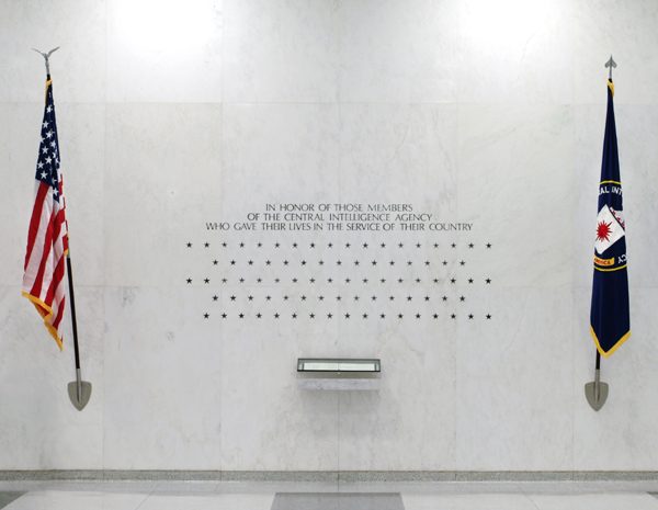
38 mi LandmarkCIA Memorial Wall
30 mi MuseumNational Capital Trolley MuseumRaven Rock Mountain Complex: US Government, Public domain · M&T Bank Stadium: United States Department of Defense Cherie Cullen, Public domain · Oriole Park at Camden Yards: Keith Allison, CC BY-SA 2.0 · Fort McHenry National Monument and Historic Shrine: ScottyBoy900Q at English Wikipedia, CC BY-SA 3.0 · CIA Memorial Wall: Unknown authorUnknown author, Public domain · National Capital Trolley Museum: Frank Hicks, Wheaton Maryland, Public domain
4 within 15 miles of the center of Libertytown
About 1 of every 100 Libertytown residents are enrolled in college, against 7 across Maryland.
Where Libertytown’s working residents go each day. Line width shows the share.
Census LEHD 2023
Census-designated place in Maryland, United States
Libertytown is an unincorporated community and census-designated place (CDP) in Frederick County, in the U.S. state of Maryland. As of the 2010 census it had a population of 950. The Abraham Jones House was listed on the National Register of Historic Places in 1973.
From Wikipedia, licensed CC BY-SA 4.0 · facts via Wikidata (CC0)
Short answers, built from the data on this page.
The typical home is worth about $386,000, 9% below the Maryland typical home. Cost of living, which also weighs rents, property taxes and how many households pay 30% or more of their income for housing, grades B.
Libertytown has 1 place on the National Register of Historic Places. 2 notable people were born here, including Basil Dorsey and Thomas Sappington.