
Joppatowne HS Facade, 2008
Joppatowne’s story
Joppatowne in pictures
Census counts: 11,391 in 2000, 13,425 in 2020. The archive holds 6 old photos and papers going back to 2008 and 6 maps from 1893 on.
Explore the history →Each edition grades its towns against each other only.

A town of 14,237.
Joppatowne's standout: natural-hazard risk is low. Overall it grades A, 59th among Maryland's 259 graded towns. The median household earns $118K and 13% of its land is conserved. Joppatowne’s average commute is 34 minutes, where Maryland’s towns sit at 32 minutes and U.S. towns at 25 minutes. The biggest park or preserve is Mariner Point Park, at 39 acres.
Where Joppatowne beats most towns.
Where Joppatowne’s working residents go each day. Line width shows the share.
Census LEHD 2023
Each subject compared with towns across the country (schools within Maryland), ordered by how far Joppatowne is from typical.
How TownRatings grades towns →
Census counts: 11,391 in 2000, 13,425 in 2020. The archive holds 6 old photos and papers going back to 2008 and 6 maps from 1893 on.
Explore the history →Museums, parks, gardens and other places to visit around Joppatowne. Close and well known come first.
 Big draw17 mi Stadium & arenaM&T Bank Stadium
 17 mi Stadium & arenaOriole Park at Camden Yards
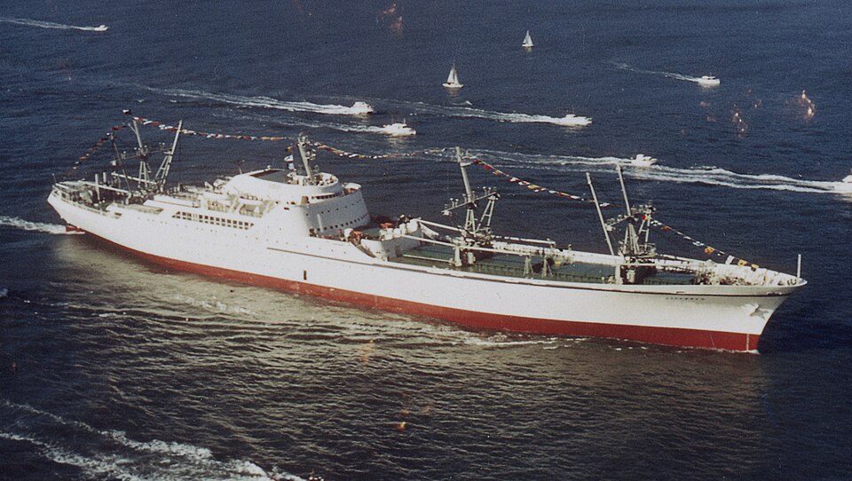 15 mi MuseumNS Savannah
 16 mi National MonumentFort McHenry National Monument and Historic Shrine283K visitors a year
 16 mi MuseumWalters Art Museum
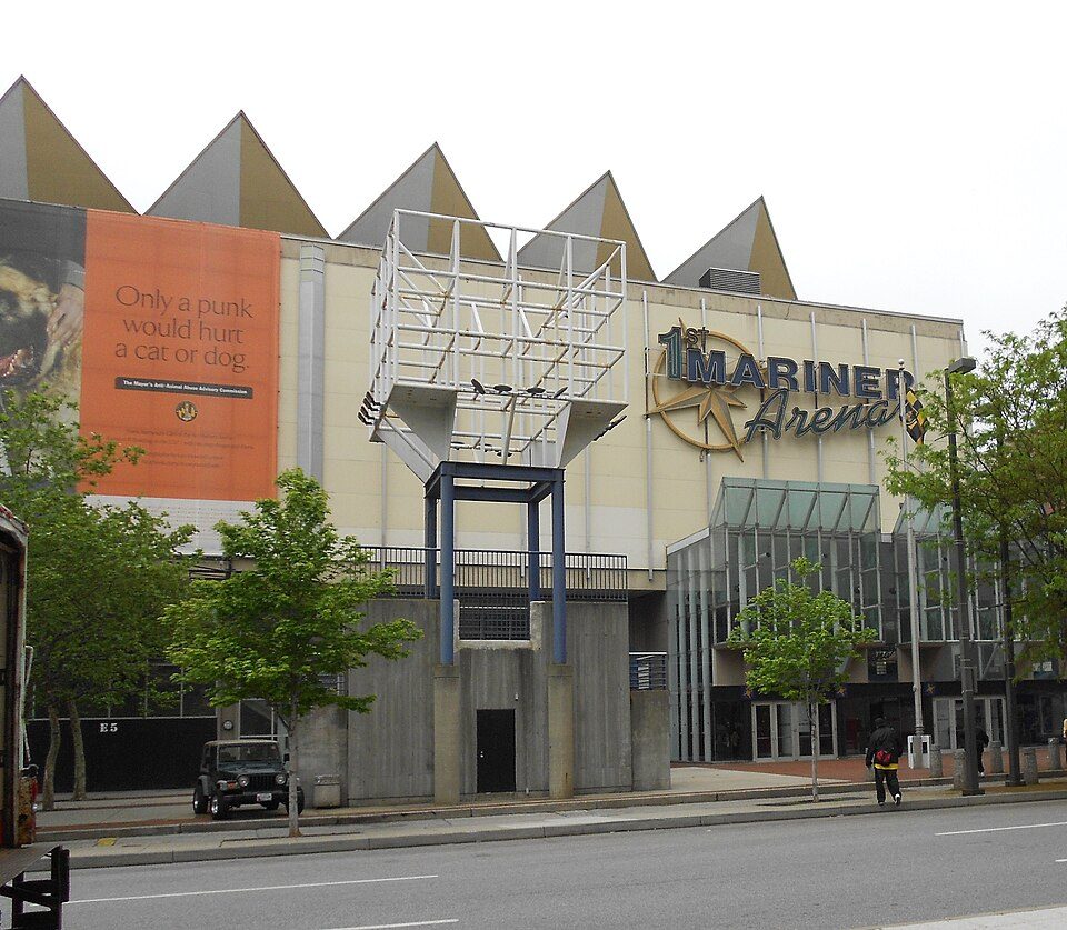 17 mi Stadium & arenaCFG Bank Arena
M&T Bank Stadium: United States Department of Defense Cherie Cullen, Public domain · Oriole Park at Camden Yards: Keith Allison, CC BY-SA 2.0 · NS Savannah: Elton Lord/Atomic Energy Commission, Public domain · Fort McHenry National Monument and Historic Shrine: ScottyBoy900Q at English Wikipedia, CC BY-SA 3.0 · Walters Art Museum: Dylan k, CC BY-SA 3.0 · CFG Bank Arena: Don Woods, CC BY-SA 3.0
Joppatowne is unincorporated, so Harford County and regional agencies provide most services.
EPA SDWIS (Oct 9, 2026) · HIFLD + EIA-861 2025 · Census 2020 ZCTAs · NCES 2024–25 · registration: vote.gov, updated Mar 11, 2026.
Ordered by what stands out in Joppatowne.
Joppatowne sends most of its workers to Baltimore and beyond and is healthy by national standards but mid-pack in Maryland.
Flood insurance has paid out on 21 claims in Joppatowne since 1978. Compared with 92% of U.S. communities, expected storm and flood damage in the town is lower. 52% of the town’s expected losses from natural hazards come from inland flooding, followed by heat waves at 14%. Households locally have drawn federal disaster aid once, in 2003.
FEMA flood insurance claims · FEMA National Risk Index · OpenFEMA
Two of the 6 schools are below, and why each made the list. Its public schools are run by the Harford County Public Schools. The largest public high school is Joppatowne High, with 882 students.
| School | Level | Students | Letter |
|---|---|---|---|
| Magnolia MiddleLargest public middle schoolGrades 6–8 | Grades 6–8 | 689 | C+ |
| Joppatowne HighLargest public high schoolGrades 9–12 | Grades 9–12 | 882 | A− |
NCES · EDFacts · graded within MD on state tests and graduation
Joppatowne has 1,600 jobs for its 5,479 working residents: even if every job went to a resident, most would still commute out.
The top destinations are Baltimore (13%), Bel Air (4%) and Edgewood (4%). Just 2% of Joppatowne’s working residents have a job in town. Jobs based here fell to 1,600 in 2023, 122 fewer than in 2013. Half of commuters travel less than 15 miles.
| Joppatowne | Maryland towns | U.S. towns | |
|---|---|---|---|
| Median household income | $118,000 | $113,000 | $80,000 |
| Work from home | 12% | 18% | 11% |
| Working residents who work in town | 2.5% | 3.2% | 8% |
| Below the poverty line | 6.5% | 7% | 9.6% |
Census LEHD 2023 · ACS
Within Maryland it is less healthy than 55% of the 261 graded towns: Maryland sets a high bar. Against the 6,035 U.S. towns with household incomes like Joppatowne’s, it is less healthy than 63%: its national edge comes with its incomes.
Joppatowne: 12% of adults report frequent physical distress. Two figures for adults in the town: 22% have been diagnosed with depression, 14% binge drink.
| Joppatowne | Maryland towns | U.S. towns | |
|---|---|---|---|
| Sleep under 7 hours (CDC PLACES) | 39% | 38% | 36% |
| Depression (CDC PLACES) | 22% | 20% | 23% |
| Binge drink (CDC PLACES) | 14% | 14% | 16% |
| Get no exercise (CDC PLACES) | 22% | 23% | 25% |
| What stands out | Joppatowne | MD |
|---|---|---|
| Fewer older adults who have lost all their teeth | 7.3% | 9.9% |
| Fewer adults facing food insecurity | 12.4% | 15.4% |
CDC PLACES 2025 · modeled estimates for adults · CMS · HRSA
The town’s typical July afternoon high stands at 88°F.
NOAA U.S. Climate Normals, 1991–2020
Trails run 2.8 miles in 6 parks and preserves. The trail network density in Joppatowne is 0.4 miles per square mile.
| Biggest places to walk | Trails | Acres |
|---|---|---|
| 1. Gunpowder Falls State Park Lost Lake Area | 0.7 mi | 365 |
| 2. Robert Copenhaver Park | 0.3 mi | 20 |
| 3. Mariner Point Park | 0.1 mi | 39 |
Trails & parks © OpenStreetMap contributors · Conserved land: USGS PAD-US
On the market in Joppatowne: a median 12 days to sell. For Joppatowne, the going rate for rent is $1,729 a month. Bidding over the asking price: 44% of homes sold here.
| Joppatowne | Maryland towns | U.S. towns | |
|---|---|---|---|
| Households that own their home | 82% | 74% | 73% |
| Median rent | $1,729 a month | $1,810 a month | $1,185 a month |
Census ACS, 2020–24 · Zillow Home Value Index · Redfin Data Center
6 within 15 miles of the center of Joppatowne
About 5 of every 100 Joppatowne residents are enrolled in college, against 7 across Maryland.
Census-designated place in Maryland, United States
Joppatowne is a census-designated place in southwestern Harford County, Maryland, United States. Serving as a bedroom community for nearby Baltimore, it was established in 1961 as a planned unit development (PUD). The population was 12,616 at the 2010 census, up from 11,391 in 2000. Joppatowne is covered by the "Joppa" ZIP Code of 21085, and "Joppa" is a designated planning region for Harford County. The Joppa ZIP code extends 6 miles (10 km) north of Joppatowne, as far as Benson, just south of Bel Air. The namesake of both Joppatowne and Joppa is the original town of "Joppa" (Jaffa, Israel). It was a major seaport in American colonial times and the county seat of the original Baltimore Cou…
From Wikipedia, licensed CC BY-SA 4.0 · facts via Wikidata (CC0)
One town shares a border with Joppatowne.
| Town | MD rank | Overall | Cost | Safety | Schools | Health |
|---|---|---|---|---|---|---|
| Joppatowne | #59 | A | B− | — | B | B+ |
| Edgewood | #119 | B+ | B | — | B | C+ |
Joppatowne and Edgewood report no FBI crime data of their own. Compare Joppatowne with a neighbor →
Short answers, built from the data on this page.
By most measures, yes. Joppatowne grades A overall, better than 88% of U.S. towns and #59 of 259 in Maryland. It grades B+ for health and B for schools.
The typical home is worth about $342,000, 19% below the Maryland typical home. Cost of living, which also weighs rents, property taxes and how many households pay 30% or more of their income for housing, grades B−.


