Denton dates to 1781, and 28% of its homes were built before 1940
More historic than 94% of U.S. towns · #12 of 261 in Maryland. What drives it
3 places in town are on the National Register, among them a historic district with 207 buildings. Below: 6 old photos and papers, maps from 1901 on, and the census since 1870.
Founding year: Wikipedia. First post office: 1800.The full story ↓
History grade
What drives Denton’s History grade
On its age, its old homes and the National Register, Denton is more historic than 94% of U.S. towns, #12 of 261 in Maryland. All 3 inputs are above most U.S. towns; its National Register listings ranks highest and its age lowest.
A
HistoryA character grade: shown, never part of Denton’s overall grade.
Few Maryland towns list much on the Register (a typical Maryland town has 0.9 per 10,000 residents, the U.S. 2.4), so Denton’s 423 sits above most of its state (89% of Maryland towns have fewer) while its 209 historic buildings outnumber those of 93% of U.S. towns.
How sure. Graded on any two of the three inputs instead, the letter would still be A. The pre-1940 share is a Census survey estimate (±9.2 points). Two sources give 1781.
Founding year: Wikipedia (other dates in Quick answers). Homes: Census ACS 2020–24. National Register: National Park Service, May 2026 list; each listing counted once (boundary changes and added documentation belong to their listing), and a historic district counts its contributing buildings. How TownRatings grades history →
What stands out about Denton’s past
Read from the archive, the National Register and the record. The page puts what stands out first.
National Park Service, National Register of Historic Places. Photos from Wikimedia Commons, credited on each place’s page.
On the map
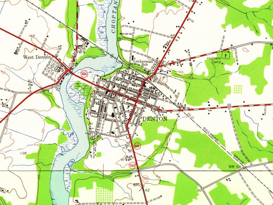
Denton on the map, 1905 to 1973
Every edition of the U.S. Geological Survey’s map of Denton. Tap a year, or press play to watch the town change.
1905Denton sheet · 1:62,500
U.S. Geological Survey historical topographic maps (public domain), via Esri’s collection of the scans. The red ring marks the center of Denton.
Every building
Denton, building by building, 1901–1915
Fire insurance maps drew every building, what it was made of and what it was used for, so insurers could price the risk of fire. Pick a year, then a sheet.
Denton was established in 1781. It was first called Eden Town, for Sir Robert Eden, the last royal governor of Maryland, and over time, Eden Town was shortened to Denton. The town was incorporated in 1802.
The town benefited from trade shipped along the adjacent Choptank River. Shipyards along the river serviced smaller sail and steamships plying their trade on the river, with most traffic flowing down to the larger town of Cambridge. The Choptank was deep enough to pose a formidable barrier to enslaved people fleeing north to freedom. Irish-American abolitionist Hugh Hazlett and a group of escaped slaves were detained near the town in 1858, with a plaque commemorating the event.
Passages that mention Denton, cut from the printed page as they were published.
History of Caroline County, Maryland, from its beginning1920Read the page →
Read the text
seeing liow mncli more convenient it would be to have a bridge here, decided to form a company to erect one, so they were incorporated by the General Assembly under the' name of "The President and Directors of the Denton Bridge Company." This first bridge was a narrow one way drawbridge with a draw twenty-six feet long and a toll bridge to all persons not residents of Caroline County. The Levy
Text read by machine from the scan; it may contain errors.
History of Caroline County, Maryland, from its beginning1920Read the page →
Read the text
to the dissolntion of their society, they generously transferreed to this meeting (Third Haven) their three meeting-houses in Caroline County, namely: Centre (near Preston), Tuckahoe Neck (near Denton) and Northwest Fork (now Pine Grove). About four hundred persons became incorporated with the society, though some afterwards emigrated to Canada and the Western States.
Text read by machine from the scan; it may contain errors.
Scans and text from the Internet Archive. Books published in 1930 or earlier, which are in the public domain.
Timeline
Denton, 1781 to 1982
Woven from the archive, old maps, post office records, the National Register and the people born here.
Nothing in the archives for these yearsWeddings on Main Street, storms, parades, school pictures, the old store. If it’s in your family album, it belongs here.
In 1781, according to Wikipedia’s history of the town. Denton’s post office opened in 1800, and the census of 1870 counted 431 people here.
How does Denton rank for history?
Denton is more historic than 94% of U.S. towns, #12 of 261 in Maryland. The History grade combines the town’s founding era, the share of homes built before 1940 and its National Register listings. It’s a character grade, so it isn’t part of the overall grade. How it works.
What is on the National Register in Denton?
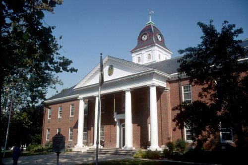
Three places: the Schoolhouse, Denton (listed 1978), the Denton Historic District (1983) and the Denton Armory (1985).
How old are the homes in Denton?
28% of Denton’s homes were built before 1940 (Census estimate, ±9.2 points), against a typical 3.3% for a Maryland town; the median home was built in 1967.
Founding dates: Wikidata, Wikipedia, the U.S. post office records of Blevins & Helbock (CC0) and the Census. Homes by year built: Census ACS 2020–24. National Register of Historic Places: National Park Service (list of May 22, 2026). Old photos, postcards and papers: Wikimedia Commons, the Library of Congress and other public archives, credited on each item’s page. Maps: U.S. Geological Survey historical topographic maps (via Esri) and Sanborn fire-insurance maps (Library of Congress). History text and census tables: Wikipedia (CC BY-SA 4.0). Places that used to be: USGS Geographic Names Information System (2021).
From Wikimedia Commons (6), the National Register of Historic Places (3), Wikipedia, Wikidata and Wikipedia for famous people, U.S. Geological Survey historical maps, U.S. Census counts (via Wikipedia), the US Post Offices dataset (Blevins & Helbock), the USGS Geographic Names Information System, Sanborn fire insurance maps (Library of Congress) and old county and town histories (Internet Archive). Archive images are copied here with their credits and licenses, shown on each photo’s page. Refreshed monthly.








 1907
 1933
 1933
 1933