Cambridge dates to 1793, and 21% of its homes were built before 1940
More historic than 94% of U.S. towns · #13 of 261 in Maryland. What drives it
11 places in town are on the National Register, among them two historic districts with 1,243 buildings between them. Below: 9 old photos and papers, maps from 1885 on, and the census since 1860.
Founding year: Wikidata; Wikipedia’s history section gives the same year. First post office: 1800.The full story ↓
History grade
What drives Cambridge’s History grade
On its age, its old homes and the National Register, Cambridge is more historic than 94% of U.S. towns, #13 of 261 in Maryland. All 3 inputs are above most U.S. towns; its National Register listings ranks highest and its share of homes from before 1940 lowest.
A
HistoryA character grade: shown, never part of Cambridge’s overall grade.
Few Maryland towns list much on the Register (a typical Maryland town has 0.9 per 10,000 residents, the U.S. 2.4), so Cambridge’s 954 sits above most of its state (96% of Maryland towns have fewer) while its 1,255 historic buildings outnumber those of 99% of U.S. towns.
How sure. Graded on any two of the three inputs instead, the letter would range from A− to A+. The pre-1940 share is a Census survey estimate (±3.5 points). Two sources give 1793.
Founding year: Wikidata (other dates in Quick answers). Homes: Census ACS 2020–24. National Register: National Park Service, May 2026 list; each listing counted once (boundary changes and added documentation belong to their listing), and a historic district counts its contributing buildings. How TownRatings grades history →
What stands out about Cambridge’s past
Read from the archive, the National Register and the record. The page puts what stands out first.
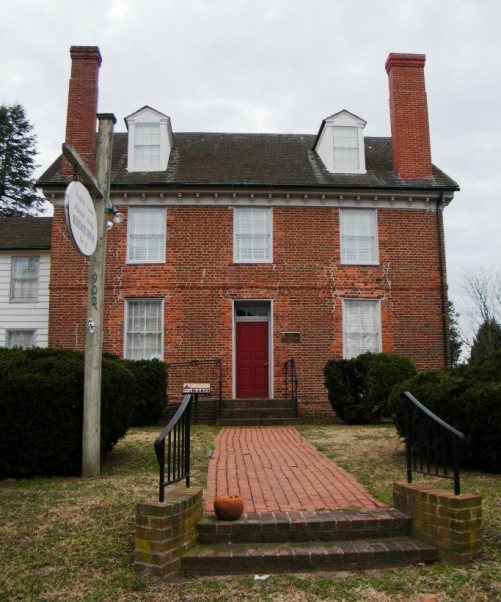
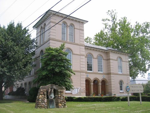
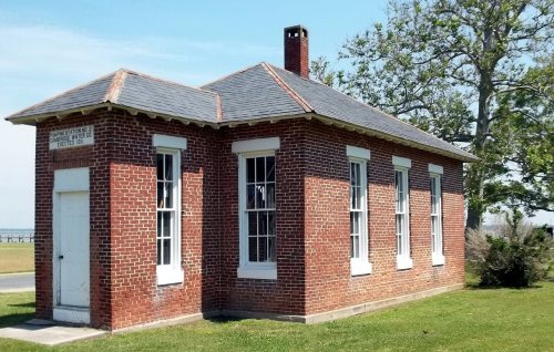
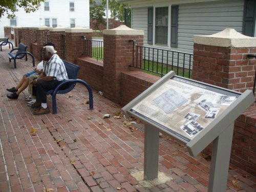
National Park Service, National Register of Historic Places. Photos from Wikimedia Commons, credited on each place’s page.
Every building
Cambridge, building by building, 1885–1930
Fire insurance maps drew every building, what it was made of and what it was used for, so insurers could price the risk of fire. Pick a year, then a sheet.
Settled by English colonists in 1684, Cambridge is one of the oldest colonial cities in Maryland. During the time of English colonization, the Algonquian-speaking Choptank Indians resided along the river bearing their name. Throughout the colonial years, English colonists developed farming on the Eastern Shore, with the largest plantations initially focusing on tobacco, before shifting to mixed farming. Cambridge served as a regional trading center, with its town pier being a major hub. Its history is extensively documented by historical markers scattered throughout the town center.
Passages that mention Cambridge, cut from the printed page as they were published.
History of Dorchester County, Maryland1902 · page 398Read the page →
Read the text
of the organizers and incorporators of the Cambridge Water Co., the Cambridge Mfg. Co., the Cambridge Gas Co., and the Eastern Shore Trust Co., being a Director in all of the above corporations and President of the Cambridge Water Co., also of the Cambridge Mfg. Co.; has done his full share in connection with a number of young men who came to the front with him to make Cambridge the largest and most progressive town on the Maryland and Delaware Peninsula.
Text read by machine from the scan; it may contain errors.
Revised history of Dorchester County, Maryland1925 · page 486Read the page →
Read the text
ment of the city of his birth. | Mr. Wallace was one of the incorporators of the Dorchester — National Bank and is now its Vice-President, also one of the organizers and incorporators of the Cambridge Water Co., the — | Cambridge Mfg. Co., the Cambridge Gas Co., and the Eastern _ Shore Trust Co., being a Director in all of the above corporations and President of the Cambridge Water Co., also of the | Cambridge Mfg. Co.; has done his full share in connection with
Text read by machine from the scan; it may contain errors.
Revised history of Dorchester County, Maryland1925 · page 564Read the page →
The origin of Hurlock, a new and attractive town in the upper section of the county, was the location of a railroad station at that point on the Dorchester and Delaware Railroad (now the Cambridge and Seaford Railroad), in 1867. The first storehouse there was built in 1869 by John M. Hurlock, who also built the first dwelling there in 1872. Then a beautiful forest of oak surrounded the station on all sides and Methodist camp-meetings were annually held in a charm-
Text read by machine from the scan; it may contain errors.
Scans and text from the Internet Archive. Books published in 1930 or earlier, which are in the public domain.
Timeline
Cambridge, 1760 to 1930
Woven from the archive, old maps, post office records, the National Register and the people born here.
Nothing in the archives for these yearsWeddings on Main Street, storms, parades, school pictures, the old store. If it’s in your family album, it belongs here.
Lost post offices, old corners, places now gone and burying grounds
Cambridge’s post office has been open since 1800. Another post office, Thompsons, opened and closed inside today’s town.
Cambridge
1800–today
Thompsons
1899–1902
18001910today
Hamlets and corners on the map
Christs RockJacktownPatamoke VillageThompson
Gone or out of use
Academy Public SchoolschoolCambridge High SchoolschoolCambridge Junior High SchoolschoolDorchester County FairgroundsparkDupont Maternity HospitalhospitalEast Cambridge Public SchoolschoolPeach Blossom Public SchoolschoolStanley Instituteschool
4cemeteries and burying grounds inside Cambridge
BethelCambridgeChristWaugh
US Post Offices dataset (Blevins & Helbock, CC0). Places and cemeteries from the USGS Geographic Names Information System (2021).
Help out
Finish Cambridge’s story
Most archives stop around 1920. The photos from after that are in family albums, not libraries.
Decades since 1900 with photos
00s10s20s30s40s50s60s70s80s90s
2 of 10 decades. The empty ones are waiting for someone’s album.
In 1793, according to Wikidata and Wikipedia’s history of the town. Cambridge’s post office opened in 1800, and the census of 1860 counted 1,862 people here.
How does Cambridge rank for history?
Cambridge is more historic than 94% of U.S. towns, #13 of 261 in Maryland. The History grade combines the town’s founding era, the share of homes built before 1940 and its National Register listings. It’s a character grade, so it isn’t part of the overall grade. How it works.
What is on the National Register in Cambridge?
11 listings: 8 buildings, among them the Stanley Institute (listed 1975, the first), 2 historic districts, the Cambridge Historic District, Wards I and III and the Pine Street Neighborhood Historic District, with 1,243 contributing buildings, and 1 structure. 1,255 historic buildings in all.
How old are the homes in Cambridge?
21% of Cambridge’s homes were built before 1940 (Census estimate, ±3.5 points), against a typical 3.3% for a Maryland town; the median home was built in 1970.
Founding dates: Wikidata, Wikipedia, the U.S. post office records of Blevins & Helbock (CC0) and the Census. Homes by year built: Census ACS 2020–24. National Register of Historic Places: National Park Service (list of May 22, 2026). Old photos, postcards and papers: Wikimedia Commons, the Library of Congress and other public archives, credited on each item’s page. Maps: U.S. Geological Survey historical topographic maps (via Esri) and Sanborn fire-insurance maps (Library of Congress). History text and census tables: Wikipedia (CC BY-SA 4.0). Places that used to be: USGS Geographic Names Information System (2021).
From Wikimedia Commons (9), Wikidata (1), the National Register of Historic Places (11), Wikipedia, Wikidata and Wikipedia for famous people, U.S. Geological Survey historical maps, U.S. Census counts (via Wikipedia), the US Post Offices dataset (Blevins & Helbock), the USGS Geographic Names Information System, Sanborn fire insurance maps (Library of Congress) and old county and town histories (Internet Archive). Archive images are copied here with their credits and licenses, shown on each photo’s page. Refreshed monthly.






 1917
 1919
 c. 1930
 c. 1930
 c. 1930
 c. 1930

