Nantucket dates to 1659, and 21% of its homes were built before 1940
More historic than 98% of U.S. towns · #38 of 283 in Massachusetts. What drives it
4 places in town are on the National Register, among them 2 National Historic Landmarks and a historic district. Below: 6 old photos and papers, maps from 1887 on, and the census since 1790.
Founding year: Wikipedia. First post office: 1792.The full story ↓
History grade
What drives Nantucket’s History grade
On its age, its old homes and the National Register, Nantucket is more historic than 98% of U.S. towns, #38 of 283 in Massachusetts. All 3 inputs are above most U.S. towns; its National Register listings ranks highest and its share of homes from before 1940 lowest.
A+
HistoryA character grade: shown, never part of Nantucket’s overall grade.
Massachusetts towns list more on the Register than most of the country (a typical Massachusetts town has 46.0 per 10,000 residents, the U.S. 2.4), so Nantucket’s 1,764 sits above most of its state (99% of Massachusetts towns have fewer) while its 2,555 historic buildings outnumber those of 100% of U.S. towns.
NoteThe founding year comes from Wikipedia alone; no second source gives 1659.
How sure. Graded on any two of the three inputs instead, the letter would range from A to A+. The pre-1940 share is a Census survey estimate (±3.1 points).
Founding year: Wikipedia (other dates in Quick answers). Homes: Census ACS 2020–24. National Register: National Park Service, May 2026 list; each listing counted once (boundary changes and added documentation belong to their listing), and a historic district counts its contributing buildings. How TownRatings grades history →
What stands out about Nantucket’s past
Read from the archive, the National Register and the record. The page puts what stands out first.
Nantucket probably takes its name from a Wampanoag word, transliterated variously as natocke, nantaticu, nantican, nautica or natockete, which is part of Wampanoag lore about the creation of Martha's Vineyard and Nantucket. The meaning of the term is uncertain, although according to the Encyclopædia Britannica it may have meant "far away island" or "sandy, sterile soil tempting no one". Wampanoag is an Eastern Algonquian language of southern New England. The Nehantucket (known to Europeans as the Niantic) were an Algonquin-speaking people of the area.
Nantucket's nickname, "The Little Grey Lady of the Sea", refers to the island as it appears from the ocean when it is fog-bound.
any, the House of Representatives took does not appear from the Journal of the House. f meeting says: "At a meeting of the Male Inhab¬ itants of the Town of Nantucket quallified by law to vote for Repre¬ sentatives at the Town House in Nantucket May 2. 1812 for the choise of one or more persons for Representatives to represent the Town of Nantucket at the general Court that is, to be convend and held in Bos¬ ton the 27 of May 1812 - The votes being brought in Sorted and
Text read by machine from the scan; it may contain errors.
It does not appear, however, that Nantucket was visited on. this occasion. By an unexpected combination of circumstances the visit to Nantucket, which was one of the principal objects of the raid, was deferred until the expedition was recalled by Lord Howe, with but half its work accomplished. The devestation suffered by the people of Martha’s Vineyard was an indication of what would have been the fate of Nantucket had the original purpose been carried out.*
Text read by machine from the scan; it may contain errors.
The history of Nantucket, being a compendious account of the first settlement of the island by the English, together with the rise and progress of the whale fishery1880 · page 47Read the page →
Read the text
of Nantucket to the government of New York continued until William and Mary came to the throne of England. They directed, that the lines of the "Province of Massachusetts Bay,'' in New England, should be ascertained, and, by the request of the inhabitants and proprietors of the Island of Nantucket, the island was included within these lines, and considered to be a part of Massachusetts.
Text read by machine from the scan; it may contain errors.
Scans and text from the Internet Archive. Books published in 1930 or earlier, which are in the public domain.
By decade
Nantucket, decade by decade
5 decades in the archive, from the 1780s to the 1880s. Scroll each row; tap a photo for its story.
Nothing in the archives for these yearsWeddings on Main Street, storms, parades, school pictures, the old store. If it’s in your family album, it belongs here.
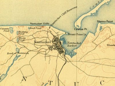
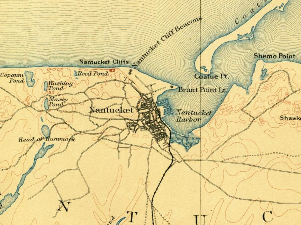
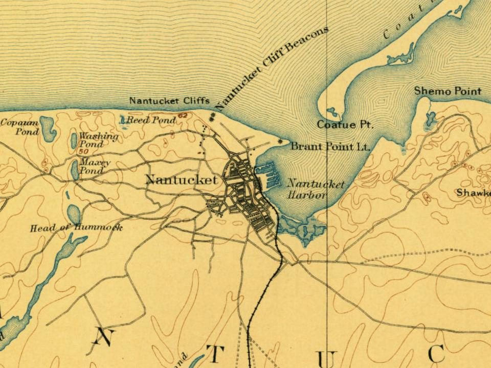
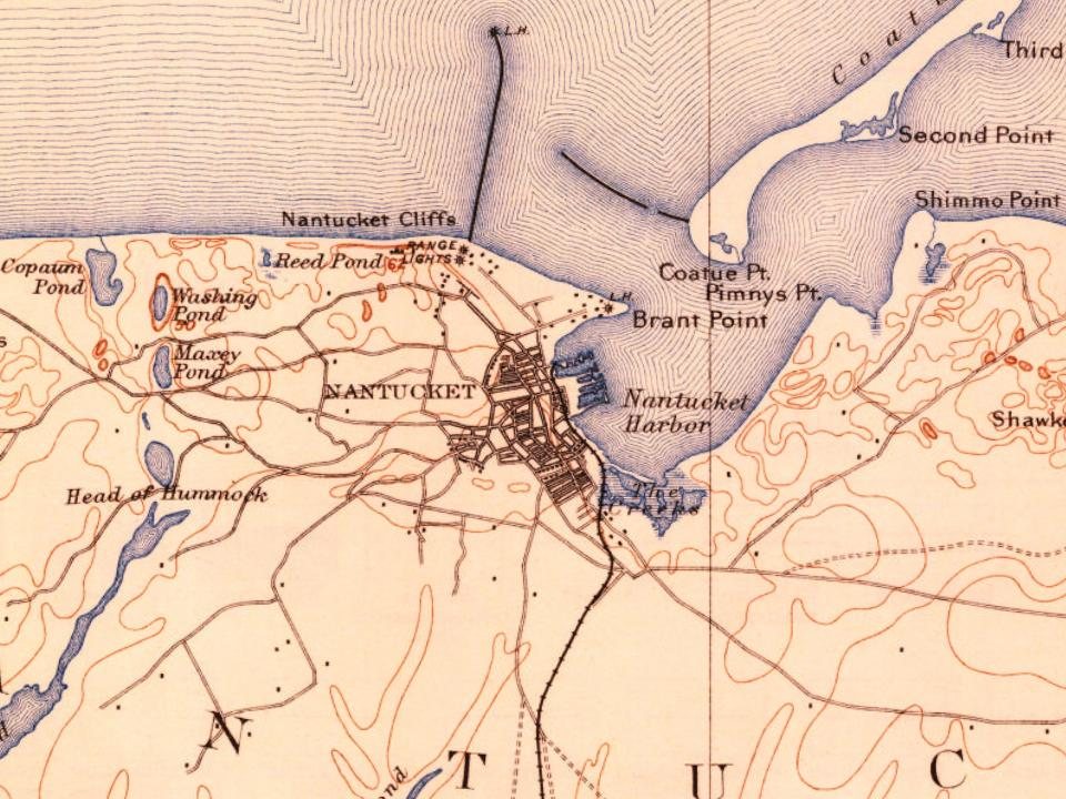
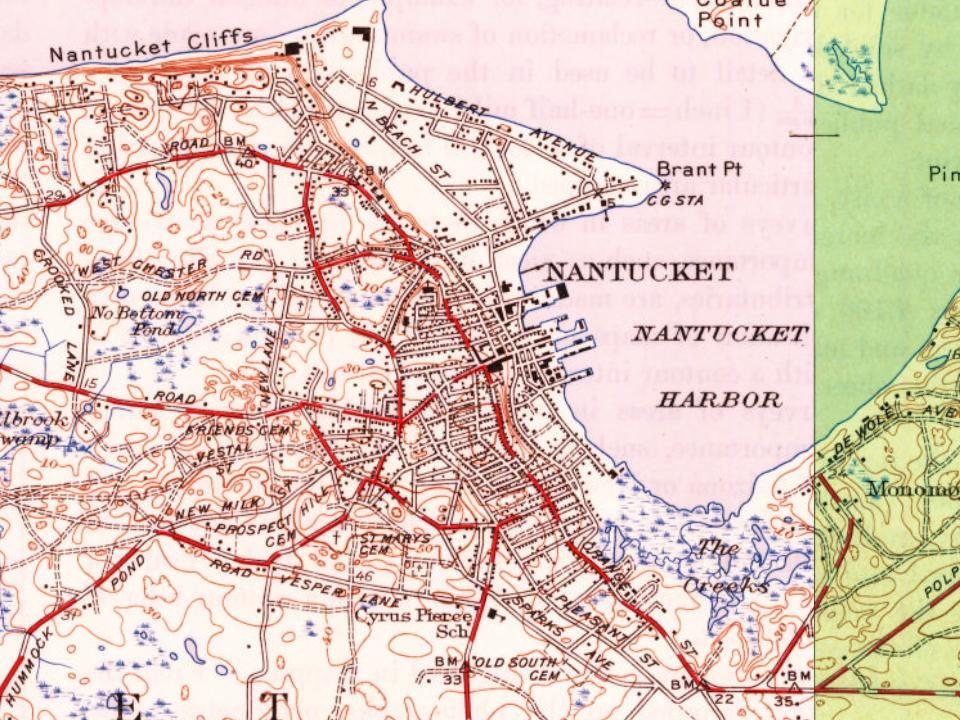
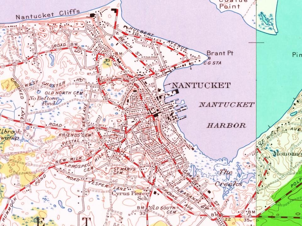
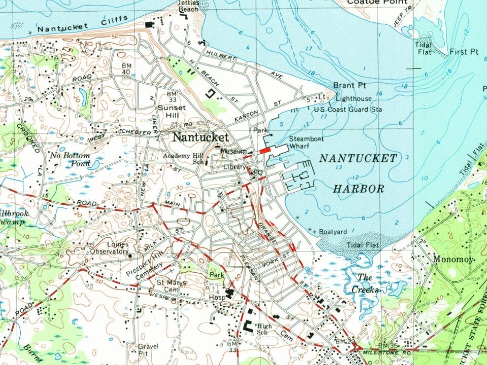
Every edition of the U.S. Geological Survey’s map of Nantucket. Tap a year, or press play to watch the town change.
1889Nantucket sheet · 1:62,500
U.S. Geological Survey historical topographic maps (public domain), via Esri’s collection of the scans. The red ring marks the center of Nantucket.
Every building
Nantucket, building by building, 1887–1909
Fire insurance maps drew every building, what it was made of and what it was used for, so insurers could price the risk of fire. Pick a year, then a sheet.
In 1659, according to Wikipedia’s history of the town. Nantucket’s post office opened in 1792, and the first U.S. census counted 4,555 people here in 1790.
How does Nantucket rank for history?
Nantucket is more historic than 98% of U.S. towns, #38 of 283 in Massachusetts. The History grade combines the town’s founding era, the share of homes built before 1940 and its National Register listings. It’s a character grade, so it isn’t part of the overall grade. How it works.
What is on the National Register in Nantucket?
4 listings, 2 of them National Historic Landmarks: 1 building, 1 historic district, the Nantucket Historic District,, and 2 structures. 2,555 historic buildings in all.
How old are the homes in Nantucket?
21% of Nantucket’s homes were built before 1940 (Census estimate, ±3.1 points), against a typical 21% for a Massachusetts town; the median home was built in 1984.
Founding dates: Wikidata, Wikipedia, the U.S. post office records of Blevins & Helbock (CC0) and the Census. Homes by year built: Census ACS 2020–24. National Register of Historic Places: National Park Service (list of May 22, 2026). Old photos, postcards and papers: Wikimedia Commons, the Library of Congress and other public archives, credited on each item’s page. Maps: U.S. Geological Survey historical topographic maps (via Esri) and Sanborn fire-insurance maps (Library of Congress). History text and census tables: Wikipedia (CC BY-SA 4.0). Places that used to be: USGS Geographic Names Information System (2021).
From Wikimedia Commons (6), the National Register of Historic Places (4), Wikipedia, Wikidata and Wikipedia for famous people, U.S. Geological Survey historical maps, U.S. Census counts (via Wikipedia), the US Post Offices dataset (Blevins & Helbock), the USGS Geographic Names Information System, Sanborn fire insurance maps (Library of Congress) and old county and town histories (Internet Archive). Archive images are copied here with their credits and licenses, shown on each photo’s page. Refreshed monthly.


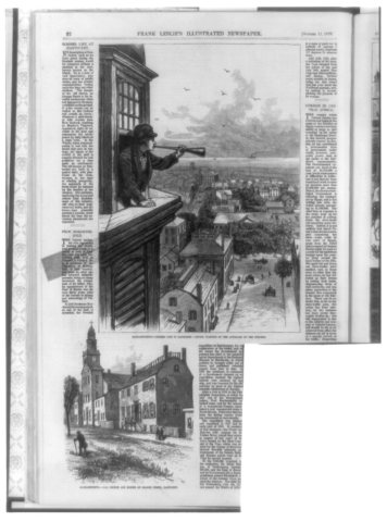




 1879

 ★ Landmark


