
Fruitlands
About the district
Fruitlands, at Prospect Hill, was added to the National Register of Historic Places on Mar 19, 1974: the first place in Harvard to be listed. It was named a National Historic Landmark on May 30, 1974, one of 189 in Massachusetts. Only 238 of Massachusetts’s 4,457 listings are older. The Register lists it for its social history, at the national level. The listing covers 5 acres.
What it isCommune in Massachusetts. From Wikidata (CC0). Read about it on Wikipedia ↗
PDFRead the original nominationThe form that put it on the Register, with its history, photos and a map · 115 MB · National Archives↗1843 to today
- 1843Built
- 1974Added to the National Register of Historic Places
- 1974Named a National Historic Landmark
- 2026On the Register for 52 years
Make it a walk: 2 landmarks in about 10 minutes
Prospect Hill, Harvard · about 0.3 miles on foot, as the crow flies


- 1FruitlandsStart here
- 2
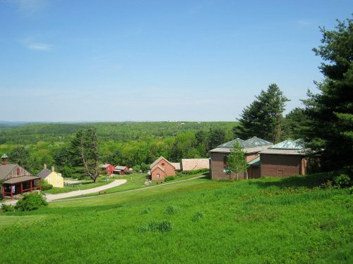 Fruitlands Museums Historic DistrictShingle · 0.3 mi on
3 more Register listings within 2 miles
★ National Historic Landmark · D district · B building · S site. Each opens its own page.
Other National Historic Landmarks nearby
The nearest Landmarks with a photo, within 25 miles, and the year each was named.


Memories of Fruitlands
The record says what it is. Neighbors know what it means.
Your answer becomes a post in Town Square.
Questions about Fruitlands
Is Fruitlands on the National Register of Historic Places?
Yes. It was added on Mar 19, 1974 (Register number 74001761).
Is Fruitlands a National Historic Landmark?
Yes, since May 30, 1974. Massachusetts has 189 National Historic Landmarks.
Can you visit Fruitlands?
Yes: it is open to visitors. Check opening times before you go.
Where can I read the history of Fruitlands?
In its National Register nomination, the form that put it on the Register: a 115 MB PDF at the National Archives, linked on this page.
Sources: National Park Service, National Register of Historic Places (05/22/2026) · National Archives catalog record 63793915 · Wikidata. Map tiles © OpenStreetMap contributors.