Gloucester dates to 1623, and 47% of its homes were built before 1940
Among the most historic 1% of U.S. towns · #13 of 283 in Massachusetts. What drives it
30 places in town are on the National Register, among them 2 National Historic Landmarks and six historic districts with 503 buildings between them. Below: 24 old photos and papers, maps from 1886 on, and the census since 1790.
Founding year: Wikidata. First post office: 1792.The full story ↓
History grade
What drives Gloucester’s History grade
On its age, its old homes and the National Register, Gloucester is among the most historic 1% of U.S. towns, #13 of 283 in Massachusetts. All 3 inputs put Gloucester near the top nationally; its share of homes from before 1940 ranks highest.
A+
HistoryA character grade: shown, never part of Gloucester’s overall grade.
Massachusetts towns list more on the Register than most of the country (a typical Massachusetts town has 46.0 per 10,000 residents, the U.S. 2.4), so Gloucester’s 178 sits above most of its state (73% of Massachusetts towns have fewer) while its 534 historic buildings outnumber those of 97% of U.S. towns.
How sure. Graded on any two of the three inputs instead, the letter would still be A+. The pre-1940 share is a Census survey estimate (±3.3 points). Two sources give 1623.
Founding year: Wikidata (other dates in Quick answers). Homes: Census ACS 2020–24. National Register: National Park Service, May 2026 list; each listing counted once (boundary changes and added documentation belong to their listing), and a historic district counts its contributing buildings. How TownRatings grades history →
What stands out about Gloucester’s past
Read from the archive, the National Register and the record. The page puts what stands out first.
The country’s official list of buildings and places worth saving. 2 are National Historic Landmarks, the highest tier. Boundary changes and added documentation are counted with their listing.
The boundaries of Gloucester originally included the town of Rockport, in an area dubbed "Sandy Bay". The village separated formally from Gloucester on February 27, 1840. In 1873, Gloucester was reincorporated as a city.
Native Americans inhabited what would become northeastern Massachusetts for thousands of years prior to the European colonization of the Americas. At the time of contact, the area was inhabited by Agawam people under sachem Masconomet. Evidence of a village exists on Pole's Hill in the current Riverdale neighborhood.
Passages that mention Gloucester, cut from the printed page as they were published.
The Fisheries of Gloucester from the first catch by the English in 1623, to the centennial year, 18761876 · page 85Read the page →
Read the text
III. The Church connected with the Second Parish, and organized in 1716, withdrew from the Society, when a majority of the latter changed their theological views, in 1830. A reorganization took place, and a new House of Worship was erected in West Gloucester, on the Essex road, in 1834. Rev. Nathaniel Richardson, the present pastor, was settled in 1874.
Text read by machine from the scan; it may contain errors.
The Fisheries of Gloucester from the first catch by the English in 1623, to the centennial year, 18761876 · page 84Read the page →
Read the text
1716, became Universalists, and continued to occupy the Meeting House built about the time of the incorporation of the parish, till 1846, when the edifice was abandoned and demolished. The Society have erected, in 1876, a Chapel at West Gloucester, near the junction of the Essex and Coffin's Beach roads. Their present pastor, settled in 1875, is Rev. Elmer F. Pember.
Text read by machine from the scan; it may contain errors.
Scans and text from the Internet Archive. Books published in 1930 or earlier, which are in the public domain.
By decade
Gloucester, decade by decade
5 decades in the archive, from the 1810s to the 1890s. Scroll each row; tap a photo for its story.
Nothing in the archives for these yearsWeddings on Main Street, storms, parades, school pictures, the old store. If it’s in your family album, it belongs here.
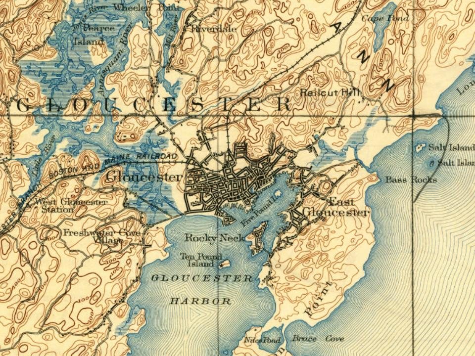
Every edition of the U.S. Geological Survey’s map of Gloucester. Tap a year, or press play to watch the town change.
1886Gloucester sheet · 1:62,500
U.S. Geological Survey historical topographic maps (public domain), via Esri’s collection of the scans. The red ring marks the center of Gloucester.
Every building
Gloucester, building by building, 1888–1917
Fire insurance maps drew every building, what it was made of and what it was used for, so insurers could price the risk of fire. Pick a year, then a sheet.
In 1623, according to Wikidata. Gloucester’s post office opened in 1792, and the first U.S. census counted 5,317 people here in 1790.
How does Gloucester rank for history?
Gloucester is among the most historic 1% of U.S. towns, #13 of 283 in Massachusetts. The History grade combines the town’s founding era, the share of homes built before 1940 and its National Register listings. It’s a character grade, so it isn’t part of the overall grade. How it works.
What is on the National Register in Gloucester?
30 listings, 2 of them National Historic Landmarks: 20 buildings, among them the Fitz Henry (formerly known as Fitz Hugh) Lane House (listed 1970, the first), 6 historic districts with 503 contributing buildings, 1 site, 2 structures, and 1 object. 534 historic buildings in all.
How old are the homes in Gloucester?
47% of Gloucester’s homes were built before 1940 (Census estimate, ±3.3 points), against a typical 21% for a Massachusetts town; the median home was built in 1946.
Founding dates: Wikidata, Wikipedia, the U.S. post office records of Blevins & Helbock (CC0) and the Census. Homes by year built: Census ACS 2020–24. National Register of Historic Places: National Park Service (list of May 22, 2026). Old photos, postcards and papers: Wikimedia Commons, the Library of Congress and other public archives, credited on each item’s page. Maps: U.S. Geological Survey historical topographic maps (via Esri) and Sanborn fire-insurance maps (Library of Congress). History text and census tables: Wikipedia (CC BY-SA 4.0). Places that used to be: USGS Geographic Names Information System (2021).
From Wikimedia Commons (22), the Library of Congress (2), Wikidata (5), the National Register of Historic Places (30), Wikipedia, Wikidata and Wikipedia for famous people, U.S. Geological Survey historical maps, U.S. Census counts (via Wikipedia), the US Post Offices dataset (Blevins & Helbock), the USGS Geographic Names Information System, Sanborn fire insurance maps (Library of Congress) and old county and town histories (Internet Archive). Archive images are copied here with their credits and licenses, shown on each photo’s page. Refreshed monthly.


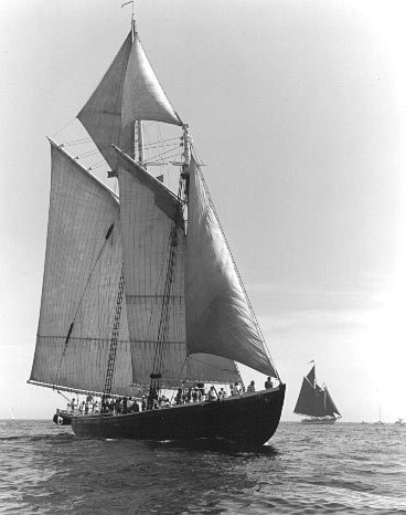 ★ Landmark
 ★ Landmark


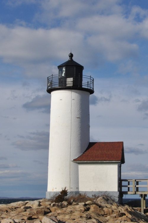


 1874
 1898
 1898
 1898
 1898
 1898
 1898
 1898
 1898
 1898
 1898
 1898
 1898
 1898
 1898
 1898
 1898
 1898
 1898