Los Adaes (Boundary Increase)
Also known as Nuestra Senora del Pilar Presidio (16NA8); San Miguel de Los
About Los Adaes (Boundary Increase)
Los Adaes (Boundary Increase) was added to the National Register of Historic Places and named a National Historic Landmark on the same day, Nov 4, 1993: one of 57 Landmarks in Louisiana. The Register lists it for its exploration/settlement, at the national level. The listing covers 110 acres.
Finding Los Adaes (Boundary Increase)
1/2 mile north of LA 6 north of Robeline, LA


No other Register listing is within a short walk. The nearest are under Around it.
2 more Register listings within 2 miles
★ National Historic Landmark · D district · B building · S site. Each opens its own page.
Other National Historic Landmarks nearby
The nearest Landmarks with a photo, within 25 miles, and the year each was named.
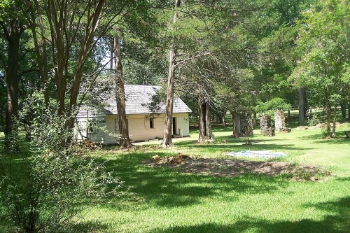


Memories of Los Adaes (Boundary Increase)
The record says what it is. Neighbors know what it means.
Your answer becomes a post in Town Square.
Questions about Los Adaes (Boundary Increase)
Is Los Adaes (Boundary Increase) on the National Register of Historic Places?
Yes. It was added on Nov 4, 1993 (Register number 93001622).
Is Los Adaes (Boundary Increase) a National Historic Landmark?
Yes, since Nov 4, 1993. Louisiana has 57 National Historic Landmarks.
Can you visit Los Adaes (Boundary Increase)?
Our record doesn’t say whether it is open to visitors. Many listed buildings are private, so it may only be seen from the street.
Sources: National Park Service, National Register of Historic Places (05/22/2026). Map tiles © OpenStreetMap contributors.