134 years in pictures
Census counts: 2,352 in 1950, 28,841 in 2020. The archive holds 1 old photo or paper and 7 maps from 1892 on.
2 places on the National Register of Historic Places.
- 1892Laplace is settled

Each edition grades its towns against each other only.

A town of 28,343, settled in 1892.
Laplace grades D overall, 143rd among Louisiana's 161 graded towns, mostly because of health. CDC estimates put its residents' health behind 85% of the country. One bright spot: it is more walkable than 52% of U.S. towns. Laplace’s average trip to work is 33 minutes, above both Louisiana’s towns (24 minutes) and U.S. towns (25 minutes). FEMA rates its natural-hazard risk higher than 95% of U.S. communities, with hurricanes at the top. The biggest park or preserve is Maurepas Swamp Wildlife Management Area, at 956 acres.
Where Laplace’s working residents go each day. Line width shows the share.
Census LEHD 2023
Each subject compared with towns across the country (schools within Louisiana), ordered by how far Laplace is from typical.
How TownRatings grades towns →
Census counts: 2,352 in 1950, 28,841 in 2020. The archive holds 1 old photo or paper and 7 maps from 1892 on.
2 places on the National Register of Historic Places.
Laplace is unincorporated, so St. John the Baptist Parish and regional agencies provide most services.
EPA SDWIS (Oct 9, 2026) · HIFLD + EIA-861 2025 · Census 2020 ZCTAs · NCES 2024–25 · registration: vote.gov, updated Aug 3, 2026.
Ordered by what stands out in Laplace.
Laplace has a longer frost-free season than nearly all U.S. towns, looks healthier within Louisiana than nationally and has home values still below their peak.
The national flood insurance program has paid 5,244 claims in Laplace since 1978. FEMA puts three fifths of the town’s expected hazard losses down to hurricanes, and 22% to inland flooding. Federal aid has come to Laplace households in 6 declared disasters; the latest was in 2024.
FEMA flood insurance claims · FEMA disaster declarations and aid · FEMA National Risk Index · OpenFEMA
Public schools: the St. John the Baptist Parish school district. One of its 5 schools is below, with the reason it’s listed. 4 public schools serve Laplace, with 2,443 students in all.
| School | Level | Students | Letter |
|---|---|---|---|
| Lake Pontchartrain Elementary SchoolLargest public elementary schoolGrades PK–8 | Grades PK–8 | 754 | C− |
NCES · EDFacts · graded within LA on state tests and graduation
Within Louisiana it is healthier than 62% of the 161 graded towns: much of Louisiana scores lower on these measures.
15% of Laplace adults binge drink. CDC measures, 32 in all: Laplace beats Louisiana on 1 and trails on 3. Two figures for adults here: 45% have high blood pressure, 17% have diabetes.
| Laplace | Louisiana towns | U.S. towns | |
|---|---|---|---|
| Sleep under 7 hours (CDC PLACES) | 44% | 42% | 36% |
| High blood pressure (CDC PLACES) | 45% | 44% | 35% |
| Diabetes (CDC PLACES) | 17% | 16% | 12% |
| Food insecurity (CDC PLACES) | 26% | 26% | 14% |
| What stands out | Laplace | LA |
|---|---|---|
| Fewer adults who have had cancer | 6.5% | 7.5% |
| More adults facing housing insecurity | 20.5% | 16.8% |
CDC PLACES 2025 · modeled estimates for adults · CMS · HRSA
In 3 parks and preserves, walkers have 7.0 miles of trail. For Laplace, the trail network density is 0.3 miles per square mile.
| Laplace | Louisiana towns | U.S. towns | |
|---|---|---|---|
| Conserved land | 0.1% | 1.2% | 4.3% |
| Miles of trail per square mile | 0.3 miles per square mile | 0.2 | 0.4 |
| Biggest places to walk | Trails | Acres |
|---|---|---|
| 1. Thomas F. Daley Memorial Park | 1 mi | 27 |
| 2. Larayo Youth Park | 0.3 mi | 9 |
| 3. Maurepas Swamp Wildlife Management Area | — | 956 |
Trails & parks © OpenStreetMap contributors · Conserved land: USGS PAD-US
The average commute for its 11,366 working residents takes 32.9 minutes, against 25.7 across Louisiana.
For most workers, Laplace is a place to come home to: only 12% work in town. 13% of residents live below the poverty line in the town. The median commute is under 22 miles. The top destinations are New Orleans (13%), Metairie (8%) and Kenner (7%).
| Laplace | Louisiana towns | U.S. towns | |
|---|---|---|---|
| Below the poverty line | 13% | 20% | 9.6% |
| Work from home | 7.6% | 5.6% | 11% |
| Median household income | $69,000 | $56,000 | $80,000 |
| Working residents who work in town | 12% | 9.8% | 8% |
Census LEHD 2023 · ACS
The Reserve weather station, 6 miles away, records that the frost-free season runs about 308 days, longer than in 95% of U.S. towns. January nights average 42.8°, milder than in 96% of U.S. towns; July afternoons average 91.8°.
In Laplace, the typical July afternoon high is 92°F. Snow almost never falls.
| Laplace | Louisiana towns | U.S. towns | |
|---|---|---|---|
| January low | 43°F | 42°F | 22°F |
| July high | 92°F | 92°F | 85°F |
NOAA U.S. Climate Normals, 1991–2020
A fifth of adults 25 and older hold at least a bachelor’s degree, against 27% across Louisiana. No broad age group is more than 4 points off the Louisiana average. The share of residents in Laplace who are under 18: 26%.
| Laplace | Louisiana towns | U.S. towns | |
|---|---|---|---|
| Under 18 | 26% | 24% | 22% |
| Aged 65 or older | 15% | 17% | 18% |
| Bachelor’s degree or more, 25+ | 20% | 20% | 29% |
| Median age | 38.1 years | 37.8 years | 40.5 years |
52% women, 48% men
About 94 men for every 100 women (the survey’s margin: ±1.6 points). Across Louisiana, 51.1% of residents are women.
| Laplace | LA | U.S. | |
|---|---|---|---|
| Under 10 | 13.1% | 12.6% | 11.6% |
| 10 to 17 | 12.6% | 10.9% | 10.3% |
| 18 to 24 | 8.2% | 9.1% | 9.1% |
| 25 to 34 | 13% | 13.3% | 13.7% |
| 35 to 44 | 12.1% | 13.3% | 13.2% |
| 45 to 54 | 11.4% | 11.5% | 12.2% |
| 55 to 64 | 14.7% | 12.6% | 12.7% |
| 65 to 74 | 9.7% | 10.2% | 10.2% |
| 75 and older | 5.4% | 6.5% | 7% |
| No diploma | 13.2% | 12.7% | 10.4% |
| High school | 37.5% | 32.5% | 26% |
| Some college | 20.5% | 20.4% | 19.1% |
| Associate’s | 9.2% | 7.3% | 8.8% |
| Bachelor’s | 12% | 17% | 21.6% |
| Graduate | 7.6% | 10.1% | 14.1% |
U.S. Census Bureau · ACS 2020-2024 5-year estimates
The typical value, about $215K, is 15% below its January 2022 peak.
For households in Laplace, the share who are owner-occupiers is 78%. The rent at the middle of the market in the town is $1,351 a month. Homes in Laplace sold for 98.3% of their list price on average.
| Laplace | Louisiana towns | U.S. towns | |
|---|---|---|---|
| Median rent | $1,351 a month | $989 a month | $1,185 a month |
| Households that own their home | 78% | 68% | 73% |
Census ACS, 2020–24 · Zillow Home Value Index · Redfin Data Center
Museums, parks, gardens and other places to visit around Laplace. Close and well known come first.
Big draw25 mi Stadium & arenaCaesars Superdome
Big draw24 mi LakeLake Pontchartrain
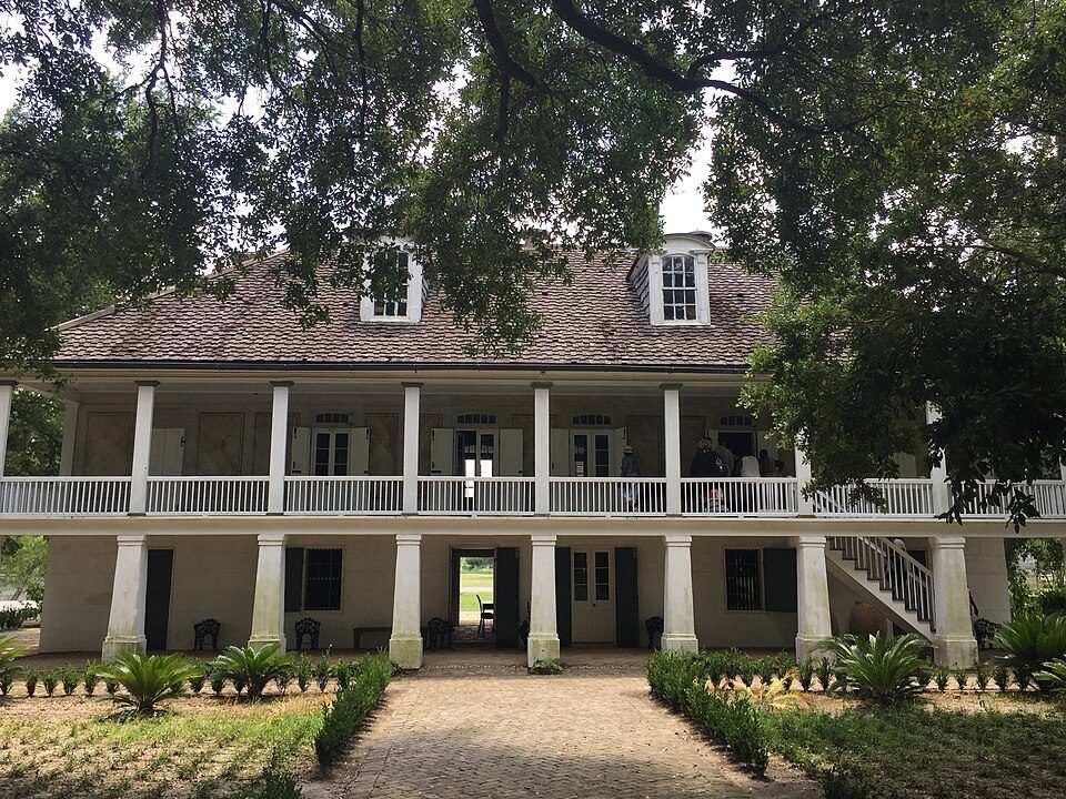
11 mi MuseumWhitney Plantation Historic District
26 mi MuseumNational World War II Museum707K visitors a year
24 mi City parkCity Park
26 mi Stadium & arenaLakefront ArenaCaesars Superdome: Infrogmation of New Orleans, CC BY-SA 3.0 · Lake Pontchartrain: Mersh13, CC BY-SA 3.0 · Whitney Plantation Historic District: Bill Leiser, CC BY-SA 4.0 · National World War II Museum: Nolabob, CC BY-SA 3.0 · City Park: Infrogmation of New Orleans, CC BY 2.5 · Lakefront Arena: Spatms, CC BY-SA 4.0
None within 15 miles of Laplace; the nearest are
About 5 of every 100 Laplace residents are enrolled in college, about the same as Louisiana.
2 places in Laplace on the National Register of Historic Places.
7 notable people were born in Laplace.
Census-designated place in Louisiana, United States
LaPlace ( lə-PLAHSS) is a census-designated place (CDP) in St. John the Baptist Parish, Louisiana, United States, situated along the east bank of the Mississippi River, in the New Orleans metropolitan area. In 2020, it had a population of 28,841. LaPlace is the southern terminus of Interstate 55, where it joins with Interstate 10, and of US 51, where it terminates at the junction with US 61. LaPlace is located 25 miles (40 km) west of New Orleans.
From Wikipedia, licensed CC BY-SA 4.0 · facts via Wikidata (CC0)
3 towns share a border with Laplace.
| Town | LA rank | Overall | Cost | Safety | Schools | Health |
|---|---|---|---|---|---|---|
| Laplace | #143 | D | C+ | — | C+ | D |
| Reserve | #148 | D− | B | — | C+ | D− |
| Edgard | — | — | A | — | C+ | C+ |
| Montz | — | — | C− | — | A | B− |
Edgard and Montz have fewer than 2,500 residents, so they get subject grades but no overall grade. Laplace, Reserve, Edgard and Montz report no FBI crime data of their own. Compare Laplace with a neighbor →
Short answers, built from the data on this page.
Laplace grades D overall, better than 7% of U.S. towns and #143 of 161 in Louisiana. It grades D for health and C+ for schools. Hazard risk is its weak spot, with a D−.
That is 3.4 years of the area's median household income ($62,655 across the New Orleans-Metairie, LA metro area). Cost of living, which also weighs rents, property taxes and how many households pay 30% or more of their income for housing, grades C+.
7 notable people were born here, including Kid Ory and Kerry Watkins.