
DERELICT BOAT, 1972
Lafitte’s story
Lafitte in pictures
Census counts: 1,223 in 1970, a peak of 1,576 in 2000, 1,014 in 2020. The archive holds 12 old photos and papers going back to 1972 and 5 maps from 1892 on.
Explore the history →Each edition grades its towns against each other only.

A town of 488.
The biggest park or preserve is Jean Lafitte Nature Study Park, at 90 acres. Lafitte has fewer than 1,000 residents, too few for fair grades; the figures below are still real.
Coastal flooding makes up 37% of the storm damage FEMA expects here.
FEMA National Risk Index · OpenFEMA · OpenStreetMap
Census counts: 1,223 in 1970, a peak of 1,576 in 2000, 1,014 in 2020. The archive holds 12 old photos and papers going back to 1972 and 5 maps from 1892 on.
Explore the history →Museums, parks, gardens and other places to visit around Lafitte. Close and well known come first.
 Big draw17 mi Stadium & arenaCaesars Superdome
 Big draw33 mi LakeLake Pontchartrain
 16 mi MuseumNational World War II Museum707K visitors a year
 in town National Historical ParkJean Lafitte National Historical Park and Preserve227K visitors a year
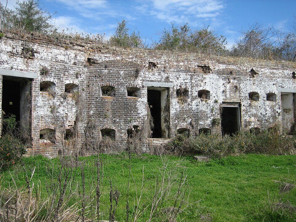 30 mi LandmarkFort Macomb
 17 mi MuseumThe Cabildo
Caesars Superdome: Infrogmation of New Orleans, CC BY-SA 3.0 · Lake Pontchartrain: Mersh13, CC BY-SA 3.0 · National World War II Museum: Nolabob, CC BY-SA 3.0 · Jean Lafitte National Historical Park and Preserve: No machine-readable author provided. Jan Kronsell assumed (based on copyright cl, CC BY-SA 3.0 · Fort Macomb: Infrogmation, CC BY 2.5 · The Cabildo: Infrogmation of New Orleans, CC BY-SA 3.0
Lafitte is unincorporated, so Jefferson Parish and regional agencies provide most services.
EPA SDWIS (Oct 9, 2026) · HIFLD + EIA-861 2025 · Census 2020 ZCTAs · NCES 2024–25 · registration: vote.gov, updated Aug 3, 2026.
Ordered by what stands out in Lafitte.
Just over two fifths of Lafitte’s expected losses from natural hazards come from hurricanes, followed by coastal flooding at 37%. Federal aid has come to Lafitte households in 9 declared disasters; the latest was in 2024. Expected storm and flood damage is higher than in 100% of U.S. communities.
FEMA disaster declarations and aid · FEMA National Risk Index · OpenFEMA
The share of working residents in Lafitte who work locally is 2.6%, below both Louisiana’s towns (9.8%) and U.S. towns (8%). Jobs here fell by 74 from 2013 to 2023, to 132. Half commute less than 17 miles. The top destinations are New Orleans (12%), Marrero (9%) and Harvey (8%).
| Lafitte | Louisiana towns | U.S. towns | |
|---|---|---|---|
| Below the poverty line | 4.3% | 20% | 9.6% |
| Working residents who work in town | 2.6% | 9.8% | 8% |
Census LEHD 2023 · ACS
NOAA U.S. Climate Normals, 1991–2020
Among adults in Lafitte, 26% say their health is fair or poor. On the CDC’s 32 measures, Lafitte is ahead of Louisiana on 6 and behind on 7. 18% of adults in the town have diabetes; 17% report frequent physical distress.
| Lafitte | Louisiana towns | U.S. towns | |
|---|---|---|---|
| High blood pressure (CDC PLACES) | 47% | 44% | 35% |
| Diabetes (CDC PLACES) | 18% | 16% | 12% |
| Frequent physical distress (CDC PLACES) | 17% | 16% | 14% |
| Smoke cigarettes (CDC PLACES) | 20% | 19% | 14% |
| What stands out | Lafitte | LA |
|---|---|---|
| Fewer adults facing a utility shut-off | 9.2% | 12.4% |
| Fewer adults facing housing insecurity | 12.6% | 16.8% |
| More adults who have had cancer | 10.3% | 7.5% |
CDC PLACES 2025 · modeled estimates for adults · CMS · HRSA
For households in Lafitte, the share who are owner-occupiers is 81%.
Census ACS, 2020–24 · Zillow Home Value Index · Redfin Data Center
Trails total 0.5 miles in 1 park or preserve. Lafitte’s trail density comes in at 0.1 miles per square mile.
| Biggest places to walk | Trails | Acres |
|---|---|---|
| 1. Jean Lafitte Nature Study Park | — | 90 |
Trails & parks © OpenStreetMap contributors · Conserved land: USGS PAD-US
None within 15 miles of Lafitte; the nearest are
About 0 of every 100 Lafitte residents are enrolled in college, against 6 across Louisiana.
In a town this size, neighbors are the best guide. Ask them anything.
Census-designated place in Louisiana, United States
Lafitte is an unincorporated community and census-designated place (CDP) in Jefferson Parish, Louisiana, United States. The population was 972 at the 2010 census, and 816 in 2019. In 2020, its population increased to 1,014 people. It is part of the New Orleans–Metairie–Kenner metropolitan statistical area. Lafitte is located at the southern end of Louisiana Highway 45 along Bayou Barataria, and fishing is a major part of the local economy and culture.
From Wikipedia, licensed CC BY-SA 4.0 · facts via Wikidata (CC0)
Short answers, built from the data on this page.
Lafitte has fewer than 1,000 residents, too few for fair grades; the figures below are still real.


