Paris dates to 1775, and 20% of its homes were built before 1940
More historic than 97% of U.S. towns · #4 of 142 in Kentucky. What drives it
13 places in town are on the National Register, among them four historic districts with 304 buildings between them. Below: 9 old photos and papers, maps from 1886 on, and the census since 1800.
Founding year: Wikidata. First post office: 1795.The full story ↓
History grade
What drives Paris’ History grade
On its age, its old homes and the National Register, Paris is more historic than 97% of U.S. towns, #4 of 142 in Kentucky. All 3 inputs are above most U.S. towns; its age ranks highest and its share of homes from before 1940 lowest.
A+
HistoryA character grade: shown, never part of Paris’ overall grade.
Kentucky towns list more on the Register than most of the country (a typical Kentucky town has 29.9 per 10,000 residents, the U.S. 2.4), so Paris’ 308 sits above most of its state (88% of Kentucky towns have fewer) while its 313 historic buildings outnumber those of 95% of U.S. towns.
NoteThe founding year comes from Wikidata alone; no second source gives 1775.
How sure. Graded on any two of the three inputs instead, the letter would range from A to A+. The pre-1940 share is a Census survey estimate (±4.3 points).
Founding year: Wikidata (other dates in Quick answers). Homes: Census ACS 2020–24. National Register: National Park Service, May 2026 list; each listing counted once (boundary changes and added documentation belong to their listing), and a historic district counts its contributing buildings. How TownRatings grades history →
What stands out about Paris’ past
Read from the archive, the National Register and the record. The page puts what stands out first.
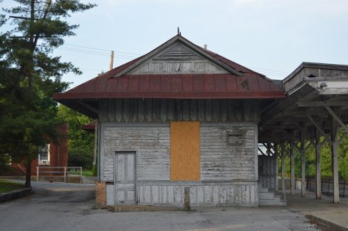
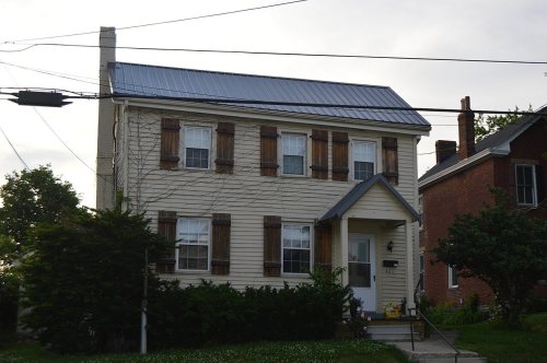
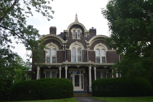
National Park Service, National Register of Historic Places. Photos from Wikimedia Commons, credited on each place’s page.
Every building
Paris, building by building, 1886–1912
Fire insurance maps drew every building, what it was made of and what it was used for, so insurers could price the risk of fire. Pick a year, then a sheet.
Joseph Houston settled a station in the area in 1776, but was forced to relocate due to prior land grants. In 1786, Lawrence Protzman purchased the area of present-day Paris from its owners, platted 250 acres (100 ha) for a town, and offered land for public buildings in exchange for the Virginia legislature making the settlement the seat of the newly formed Bourbon County. In 1789, the town was formally established as Hopewell after Hopewell, New Jersey, his hometown. The next year, it was renamed Paris after the French capital to match its county and honor the French assistance during the American Revolution.
Passages that mention Paris, cut from the printed page as they were published.
Sketches of Paris, Bourbon county, Kentucky / by G.R. Keller and J.M. McCann1876Read the page →
Read the text
This completed all the houses on Main street. Crossing over the bridge and going into what is now known as East Paris, we find the following buildings: The Paris Mills, then owned, as we have stated, by Thomas Jones, Sr., and operated for him by William Shields.
Text read by machine from the scan; it may contain errors.
Sketches of Paris, Bourbon county, Kentucky / by G.R. Keller and J.M. McCann1876Read the page →
Read the text
The Presbyterians were the pioneers of religion in Paris, having established the first church in 1787, and continued ever since to sustain an organization, and to-day are sustaining two preachers, having two working congregations and owning two church buildings.
Text read by machine from the scan; it may contain errors.
Scans and text from the Internet Archive. Books published in 1930 or earlier, which are in the public domain.
Timeline
Paris, 1775 to 1954
Woven from the archive, old maps, post office records, the National Register and the people born here.
Nothing in the archives for these yearsWeddings on Main Street, storms, parades, school pictures, the old store. If it’s in your family album, it belongs here.
In 1775, according to Wikidata. Paris’ post office opened in 1795, and the census of 1800 counted 377 people here.
How does Paris rank for history?
Paris is more historic than 97% of U.S. towns, #4 of 142 in Kentucky. The History grade combines the town’s founding era, the share of homes built before 1940 and its National Register listings. It’s a character grade, so it isn’t part of the overall grade. How it works.
What is on the National Register in Paris?
13 listings: 8 buildings, among them the Duncan Tavern (listed 1973, the first), 4 historic districts with 304 contributing buildings, and 1 object. 313 historic buildings in all.
How old are the homes in Paris?
20% of Paris’ homes were built before 1940 (Census estimate, ±4.3 points), against a typical 5.9% for a Kentucky town; the median home was built in 1979.
Founding dates: Wikidata, Wikipedia, the U.S. post office records of Blevins & Helbock (CC0) and the Census. Homes by year built: Census ACS 2020–24. National Register of Historic Places: National Park Service (list of May 22, 2026). Old photos, postcards and papers: Wikimedia Commons, the Library of Congress and other public archives, credited on each item’s page. Maps: U.S. Geological Survey historical topographic maps (via Esri) and Sanborn fire-insurance maps (Library of Congress). History text and census tables: Wikipedia (CC BY-SA 4.0). Places that used to be: USGS Geographic Names Information System (2021).
From Wikimedia Commons (14), the Library of Congress (3), Wikidata (1), the National Register of Historic Places (13), Wikipedia, U.S. Geological Survey historical maps, U.S. Census counts (via Wikipedia), the US Post Offices dataset (Blevins & Helbock), the USGS Geographic Names Information System, Sanborn fire insurance maps (Library of Congress) and old county and town histories (Internet Archive). Archive images are copied here with their credits and licenses, shown on each photo’s page. Refreshed monthly.






 1877
 1880
 1940
 1940
 2014
 2014
 2010
 2007
 2007
 2007
 2006
 2004


