The Burnside post office opened in 1880, the earliest record of the town by name. Another post office, Point Isabel (1877), opened inside today’s city and later closed.
First census: 1,117 in 19102020 census: 694146 years
Founding year: the first Burnside post office (Blevins & Helbock, CC0).The full story ↓
What stands out about Burnside’s past
Read from the archive, the National Register and the record. The page puts what stands out first.
Fire insurance maps drew every building, what it was made of and what it was used for, so insurers could price the risk of fire. Pick a year, then a sheet.
The community was originally settled at the juncture of the Cumberland River and its South Fork. It was called Point Isabel, allegedly for a woman who jumped off a nearby cliff after breaking off a relationship. In 1890, the town was renamed for Civil War General Ambrose Burnside, who established a camp there during the war.
Burnside was a center for shipping by rail and steamboat packet. Its lumber mills sent products around the world. The town boasted retail stores, saloons, a post office, restaurants, churches, a bank, hotels, and even Burnside Academy – the first Wesleyan preparatory school in the state.
The Burnside post office opened in 1880, the earliest record of the town by name (U.S. post office records).
What is on the National Register in Burnside?
4 listings: 3 buildings, among them the Boland House (listed 1984, the first), and 1 historic district, the Burnside Historic District, with 4 contributing buildings. 8 historic buildings in all.
Founding dates: Wikidata, Wikipedia, the U.S. post office records of Blevins & Helbock (CC0) and the Census. Homes by year built: Census ACS 2020–24. National Register of Historic Places: National Park Service (list of May 22, 2026). Old photos, postcards and papers: Wikimedia Commons, the Library of Congress and other public archives, credited on each item’s page. Maps: U.S. Geological Survey historical topographic maps (via Esri) and Sanborn fire-insurance maps (Library of Congress). History text and census tables: Wikipedia (CC BY-SA 4.0). Places that used to be: USGS Geographic Names Information System (2021). How TownRatings grades history →
From Wikimedia Commons (7), Wikidata (2), the National Register of Historic Places (4), Wikipedia, Wikidata and Wikipedia for famous people, U.S. Geological Survey historical maps, U.S. Census counts (via Wikipedia), the US Post Offices dataset (Blevins & Helbock), the USGS Geographic Names Information System and Sanborn fire insurance maps (Library of Congress). Archive images are copied here with their credits and licenses, shown on each photo’s page. Refreshed monthly.


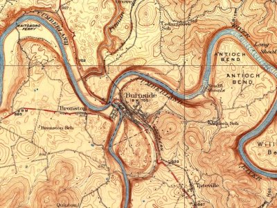
 2018
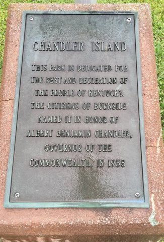 2018
 2014
 2014
 2014
 2014
 2004


