How Cherryvale began, and where its name came from
When was Cherryvale founded?
1871
The Cherryvale post office opened in 1871, the earliest record of the town by name. Another post office, Cherryville (1870), opened inside today’s city and later closed.
First census: 690 in 18802020 census: 2,192155 years
How did Cherryvale get its name?
Cherryvale was named Cherryvale from its position in the valley of Cherry Creek.
How historic is Cherryvale?
B+
More historic than 65% of U.S. towns, on its age, its old homes and the National Register.
On its age, its old homes and the National Register, Cherryvale is more historic than 65% of U.S. towns. Its share of homes from before 1940 holds the grade up; its age pulls it down.
B+
HistoryA character grade: shown, never part of Cherryvale’s overall grade.
Kansas towns list more on the Register than most of the country (a typical Kansas town has 5.1 per 10,000 residents, the U.S. 2.4), so Cherryvale’s 4.8 sits near the middle of its state (46% of Kansas towns have fewer) while its 1 listings outnumber those of 51% of U.S. towns.
How sure. Graded on any two of the three inputs instead, the letter would range from C to A−. The pre-1940 share is a Census survey estimate (±8.1 points). The founding year is the first post office, not a stated founding date.
Founding year: the first post office (other dates in Quick answers). Homes: Census ACS 2020–24. National Register: National Park Service, May 2026 list; each listing counted once (boundary changes and added documentation belong to their listing), and a historic district counts its contributing buildings. How TownRatings grades history →
What stands out about Cherryvale’s past
Read from the archive, the National Register and the record. The page puts what stands out first.
Every edition of the U.S. Geological Survey’s map of Cherryvale. Tap a year, or press play to watch the town change.
1886Independence sheet · 1:125,000
U.S. Geological Survey historical topographic maps (public domain), via Esri’s collection of the scans. The red ring marks the center of Cherryvale.
Every building
Cherryvale, building by building, 1885–1917
Fire insurance maps drew every building, what it was made of and what it was used for, so insurers could price the risk of fire. Pick a year, then a sheet.
Cherryvale was founded on the land of the Osage Indians who were pushed out by veterans of the American Civil War looking for land. The first white man to purchase property and settle here was Mr. Abe Eaton, who later sold it to the Kansas City, Lawrence & Southern Kansas Railroad which then became the Leavenworth, Lawrence & Galveston Railway, and eventually came under the control of the Atchison, Topeka and Santa Fe Railway, which operated the line for much of the 20th century. The town site was platted by the railroad in 1871. It was named Cherryvale from its position in the valley of Cherry Creek.
Passages that mention Cherryvale, cut from the printed page as they were published.
History of Montgomery county, Kansas1903 · page 143Read the page →
Read the text
After much solicitation by some of the citizens they succeeded in getting a proposition from General Xettleton and Col. Valiet, of Cincinnati. Ohio, and the owners of the stub railroad from Cherryvale to Independence by which they pledged themselves individually, together with the earnings of the above railroad, to extend that road to Elk City making a terminus there, in consideration of which they asked Louisburg township to subscribe to the capital stock of the company in the sum of twenty-two thousand dollars. This was during the. year 1876. Here was the
Text read by machine from the scan; it may contain errors.
History of Montgomery county, Kansas1903 · page 385Read the page →
Read the text
species of domestic commerce and closed the business with an accumulation of some capital and a roving and wandering habit. His army life, also, contributed to his spirit of unrest, and he came west in response to this peculiar mental bent. He came to Cherryvale, by rail, and staged it across to the new town of Independence, in Montgomery county, Kansas. His first home in the county was the Caldwell House, then kept by Larimer & Allen, and named in honor of U. S. Senator Caldwell, of Kansas. At Humboldt, enroute, he met Lyman U. Humphrey, who in-
Text read by machine from the scan; it may contain errors.
Scans and text from the Internet Archive. Books published in 1930 or earlier, which are in the public domain.
Timeline
Cherryvale, 1870 to 1931
Woven from the archive, old maps, post office records, the National Register and the people born here.
Nothing in the archives for these yearsWeddings on Main Street, storms, parades, school pictures, the old store. If it’s in your family album, it belongs here.
Cherryvale’s post office has been open since 1871. Another post office, Cherryville, opened and closed inside today’s town.
Cherryville
1870–1871
Cherryvale
1871–today
18701950today
US Post Offices dataset (Blevins & Helbock, CC0). Places and cemeteries from the USGS Geographic Names Information System (2021).
Questions about Cherryvale’s history
What year was Cherryvale founded?
The Cherryvale post office opened in 1871, the earliest record of the town by name (U.S. post office records).
How does Cherryvale rank for history?
Cherryvale is more historic than 65% of U.S. towns. The History grade combines the town’s founding era, the share of homes built before 1940 and its National Register listings. It’s a character grade, so it isn’t part of the overall grade. How it works.
What is on the National Register in Cherryvale?
One place: the Cherryvale Carnegie Free Library (listed 1987).
How old are the homes in Cherryvale?
36% of Cherryvale’s homes were built before 1940 (Census estimate, ±8.1 points), against a typical 10% for a Kansas town; the median home was built in 1952.
Founding dates: Wikidata, Wikipedia, the U.S. post office records of Blevins & Helbock (CC0) and the Census. Homes by year built: Census ACS 2020–24. National Register of Historic Places: National Park Service (list of May 22, 2026). Old photos, postcards and papers: Wikimedia Commons, the Library of Congress and other public archives, credited on each item’s page. Maps: U.S. Geological Survey historical topographic maps (via Esri) and Sanborn fire-insurance maps (Library of Congress). History text and census tables: Wikipedia (CC BY-SA 4.0). Places that used to be: USGS Geographic Names Information System (2021).
From Wikimedia Commons (10), the Library of Congress (1), the National Register of Historic Places (1), Wikipedia, Wikidata and Wikipedia for famous people, U.S. Geological Survey historical maps, U.S. Census counts (via Wikipedia), the US Post Offices dataset (Blevins & Helbock), the USGS Geographic Names Information System, Sanborn fire insurance maps (Library of Congress) and old county and town histories (Internet Archive). Archive images are copied here with their credits and licenses, shown on each photo’s page. Refreshed monthly.


 1909
 2009
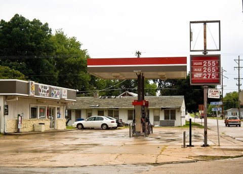 2009
 2009
 2009
 2009
 2005
 2005
 2004
