Peaked at 1,175 in 1920; 254 people lived here in 2020.
14 censuses, 1890–2020.
U.S. Census Bureau decennial counts, from the census table on Arcadia’s Wikipedia page.
From the old history books
What they wrote about Arcadia in 1905
Passages that mention Arcadia, cut from the printed page as they were published.
A Twentieth century history and biographical record of Crawford County, Kansas1905 · page 20Read the page →
Read the text
The town of Arcadia in Lincoln township was laid out on or near Coxe's creek, in the year 1S60, on the military road which extended from Fort Scott to Fort Gibson in the Indian Territory, and was the second town laid out in the county. The town was then called Hathaway. As early as 1862 Hathaway boasted of a house, which consisted of two rooms, built of logs. Before and during the war this house was the theatre of many stirring scenes. It was a typical frontier town. Here was a stopping place for the weary traveler, and here many tarried a night to
Text read by machine from the scan; it may contain errors.
A Twentieth century history and biographical record of Crawford County, Kansas1905 · page 291Read the page →
Read the text
.Mr. Gunn moved to Girard in [892, and for the following year read law in the office of James T. Bridgens, being admitted to the bar in 1893. He purchased the Arcadia Neti's in January, 1894. I le moved to Mississippi in 1896 and in February founded the Quitman Herald, and in November, [896, founded the Wayne County (Mississippi) Nezt's. In 18177 he returned to Crawford county, and in March assumed control of the Arcadia 'Finn's, and has managed that publication ever since.
Text read by machine from the scan; it may contain errors.
Scans and text from the Internet Archive. Books published in 1930 or earlier, which are in the public domain.
Timeline
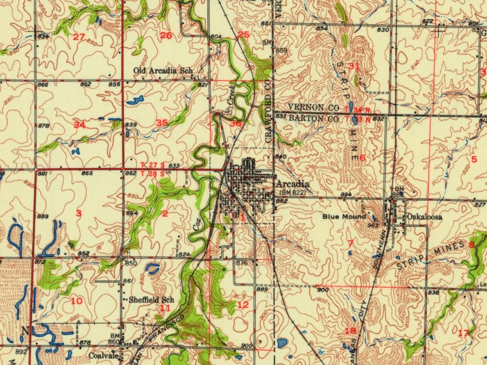
Arcadia, 1862 to 1948
Woven from the archive, old maps, post office records, the National Register and the people born here.
Founding dates: Wikidata, Wikipedia, the U.S. post office records of Blevins & Helbock (CC0) and the Census. Homes by year built: Census ACS 2020–24. National Register of Historic Places: National Park Service (list of May 22, 2026). Old photos, postcards and papers: Wikimedia Commons, the Library of Congress and other public archives, credited on each item’s page. Maps: U.S. Geological Survey historical topographic maps (via Esri) and Sanborn fire-insurance maps (Library of Congress). History text and census tables: Wikipedia (CC BY-SA 4.0). Places that used to be: USGS Geographic Names Information System (2021). How TownRatings grades history →
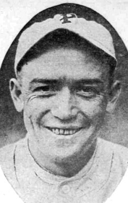
From Wikimedia Commons (2), Wikipedia, Wikidata and Wikipedia for famous people, U.S. Geological Survey historical maps, U.S. Census counts (via Wikipedia), the US Post Offices dataset (Blevins & Helbock), the USGS Geographic Names Information System and old county and town histories (Internet Archive). Archive images are copied here with their credits and licenses, shown on each photo’s page. Refreshed monthly.

![.Mr. Gunn moved to Girard in [892, and for the following year read law in the office of James T. Bridgens, being admitted to the bar in 1893. He purchased the Arcadia Neti's in January, 1894. I le moved to Mississippi in 1896 and in February founded the Quitman Herald, and in November, [896, founde…](https://images.townratings.com/story/6248/bk-f8854e0c62b64055-l.jpg)
 2005
 2004