
Wheatfield, Indiana (1915), 1915
Wheatfield’s story
144 years in pictures
The archive holds 6 old photos and papers going back to 1915.
- 1882Wheatfield is settled
Each edition grades its towns against each other only.

A town of 931, settled in 1882.
Wheatfield has fewer than 1,000 residents, too few for fair grades; the figures below are still real.
In a town this size, neighbors are the best guide. Ask them anything.
The archive holds 6 old photos and papers going back to 1915.
Who provides power, water and the rest in Wheatfield, and how to reach them.
EPA SDWIS (Oct 9, 2026) · HIFLD + EIA-861 2025 · Census 2020 ZCTAs · NCES 2024–25 · registration: vote.gov, updated Nov 18, 2024.
Ordered by what stands out in Wheatfield.
Half of commuters travel less than 29 miles. Wheatfield’s mean commuting time is 28 minutes, against 24 minutes in Indiana’s towns and 25 minutes across U.S. towns. Also worth knowing: the share of residents in Wheatfield who live below the poverty line: 14%. The top destinations are DeMotte (6%), Valparaiso (6%) and Rensselaer (5%).
| Wheatfield | Indiana towns | U.S. towns | |
|---|---|---|---|
| Working residents who work in town | 0.5% | 11% | 8% |
| Average trip to work | 28 minutes | 24 minutes | 25 minutes |
| Below the poverty line | 14% | 10% | 9.6% |
Census LEHD 2023 · ACS
In July, afternoons reach 84°; in January, nights fall to 17°, and about 25 inches of snow falls in a winter.
NOAA U.S. Climate Normals, 1991–2020
Wheatfield’s FEMA hazard score is 33 of 100, where Indiana’s towns sit at 38 of 100 and U.S. towns at 44 of 100. Of the losses FEMA expects in the town, 55% come from inland flooding and 18% from cold waves. Federal aid has come to Wheatfield households in 5 declared disasters; the latest was in 2018.
FEMA disaster declarations and aid · FEMA National Risk Index · OpenFEMA
For adults in Wheatfield, the share who smoke cigarettes is 18%. Only 10 of the 590 Indiana towns we compare have a lower share of adults who had a checkup this year than Wheatfield. The town does better than the Indiana average on 4 of 32 CDC measures and worse on 2.
| Wheatfield | Indiana towns | U.S. towns | |
|---|---|---|---|
| Sleep under 7 hours (CDC PLACES) | 42% | 37% | 36% |
| Yearly checkup (CDC PLACES) | 75% | 80% | 79% |
| Frequent mental distress (CDC PLACES) | 20% | 18% | 17% |
| Binge drink (CDC PLACES) | 19% | 16% | 16% |
| What stands out | Wheatfield | IN |
|---|---|---|
| Fewer adults with diabetes | 10.7% | 13% |
| Fewer adults who have had a stroke | 3% | 3.5% |
| Fewer adults getting a yearly checkup | 75.4% | 79.7% |
CDC PLACES 2025 · modeled estimates for adults · CMS · HRSA
In Wheatfield, 81% of households own their home.
Census ACS, 2020–24 · Zillow Home Value Index · Redfin Data Center
Across 1 park or preserve: 0.2 miles of trail. For Wheatfield, the density of trails is 0.3 miles per square mile.
| Biggest places to walk | Trails | Acres |
|---|---|---|
| 1. Centennial Park | — | 1 |
Trails & parks © OpenStreetMap contributors · Conserved land: USGS PAD-US
Museums, parks, gardens and other places to visit around Wheatfield. Close and well known come first.
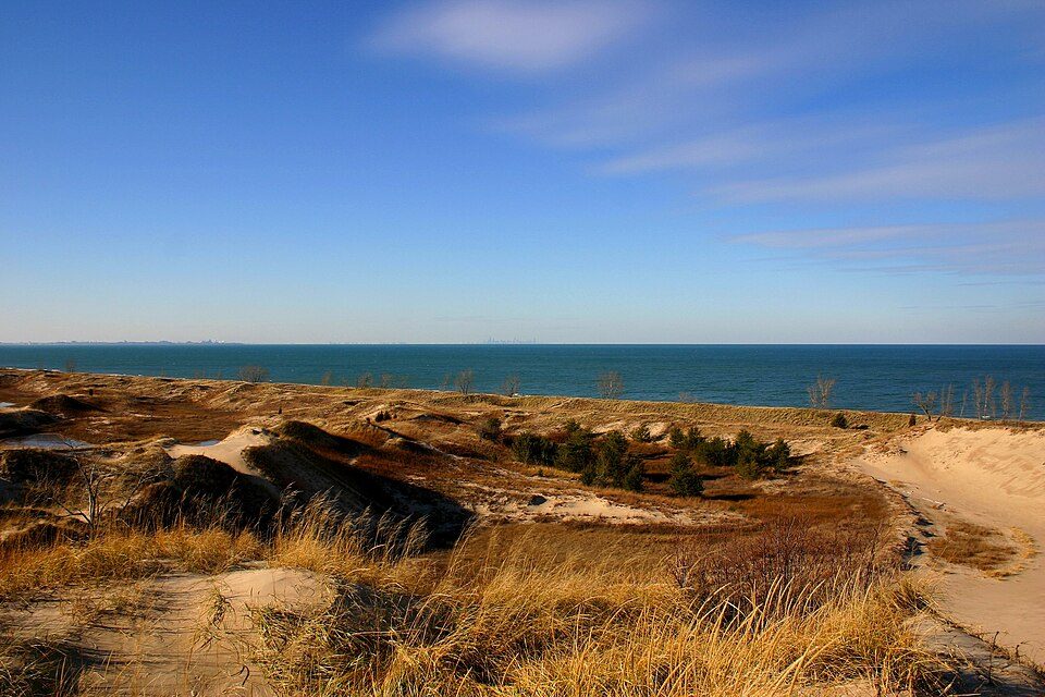 26 mi National ParkIndiana Dunes National Park2.6M visitors a year31 mi Theme parkIndiana Beach
 15 mi MuseumHoosier Valley Railroad Museum
 19 mi MuseumBrauer Museum of Art
 28 mi GardenIndiana Botanic Gardens31 mi Theme parkEnchanted Forest
Indiana Dunes National Park: J. Crocker, Attribution · Hoosier Valley Railroad Museum: Chris Light (talk), CC BY-SA 3.0 · Brauer Museum of Art: Thomas Alexander Harrison, Public domain · Indiana Botanic Gardens: Kurt Stüber [1], CC BY-SA 3.0
None within 15 miles of Wheatfield; the nearest are
About 2 of every 100 Wheatfield residents are enrolled in college, against 6 across Indiana.
Where Wheatfield’s working residents go each day. Line width shows the share.
Census LEHD 2023
Town in Indiana, United States
Wheatfield is a town in Wheatfield Township, Jasper County, Indiana, United States. The population was 904 at the 2020 census.
From Wikipedia, licensed CC BY-SA 4.0 · facts via Wikidata (CC0)
Short answers, built from the data on this page.
Wheatfield has fewer than 1,000 residents, too few for fair grades; the figures below are still real.


