Laurel was platted in 1836 by James Conwell, a native of Maryland. Conwell had first intended to name his settlement New Baltimore, but instead decided to call it Laurel, after the city of Laurel, Maryland. The last wild passenger pigeon, once the most common bird in North America, was shot near Laurel in 1902.
The first county fair under the auspices of this society was held at Laurel in 1852. Three acres of grf>und. just south of the village of Laurel, were fenced in with a sevenfoot board fence; a speaker's stand, floral hall, mechanic's hall, a hall for grain and dairy products, an office and ticket building, with pens for cattle, hogs and sheep, were among the improvements of the place. The main buildings were thirty by one hundred and fifty feet in size.
Text read by machine from the scan; it may contain errors.
Laurel was platted, originally, Xovember 30, 1836, by pioneer James Conwell, who had been selling goods from his house before that date. At first he intended naming his new town site Xew Baltimore, but later changed his notion and called his town Laurel after a town in his old home state, Maryland. It is situated on the old canal and is described on the maps as being situated on parts of sections 9 and 10 in township 12, range 12 east. It is on the Big Four system of railroad. During the first few years of its history it grew very rapidly, especially during the years in which the canal was
Text read by machine from the scan; it may contain errors.
Scans and text from the Internet Archive. Books published in 1930 or earlier, which are in the public domain.
Timeline
Laurel, 1820 to 1960
Woven from the archive, old maps, post office records, the National Register and the people born here.
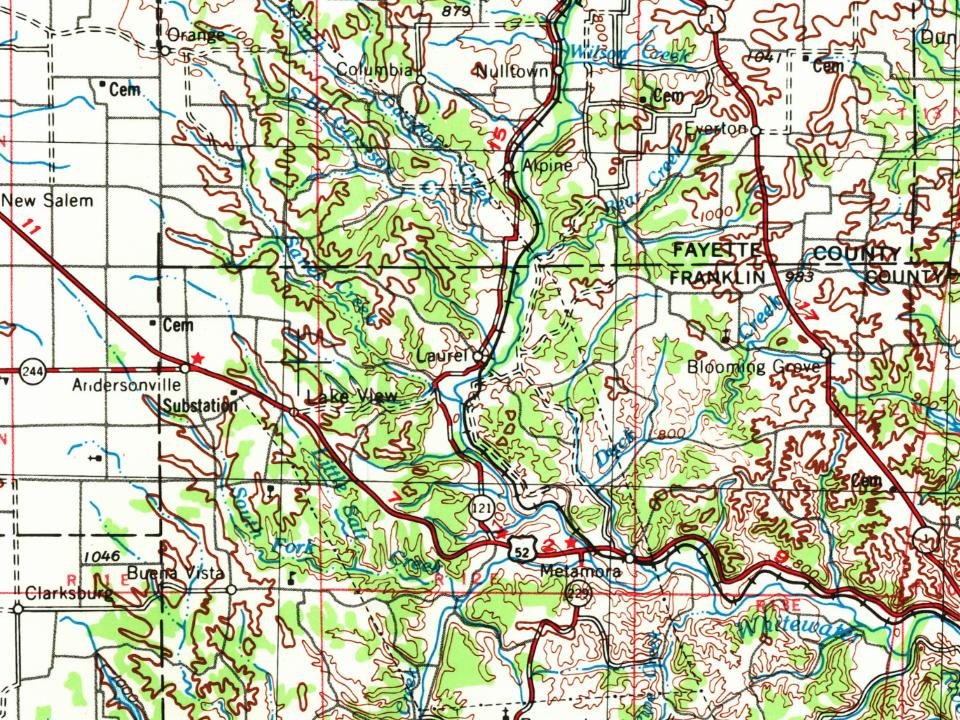
U.S. Geological Survey historical topographic maps (public domain), via Esri’s collection of the scans. The red ring marks the center of Laurel.
Every building
Laurel, building by building, 1896–1916
Fire insurance maps drew every building, what it was made of and what it was used for, so insurers could price the risk of fire. Pick a year, then a sheet.
1896Sheet 1 of 1
Edition
Sheets
BrickWoodStone
Sanborn Map Company, via the Library of Congress. Editions published in 1930 or earlier, which are in the public domain.
Famous people
2 famous people were born in Laurel
Writers, athletes, leaders and more, ranked by how widely they’re known.
Founding dates: Wikidata, Wikipedia, the U.S. post office records of Blevins & Helbock (CC0) and the Census. Homes by year built: Census ACS 2020–24. National Register of Historic Places: National Park Service (list of May 22, 2026). Old photos, postcards and papers: Wikimedia Commons, the Library of Congress and other public archives, credited on each item’s page. Maps: U.S. Geological Survey historical topographic maps (via Esri) and Sanborn fire-insurance maps (Library of Congress). History text and census tables: Wikipedia (CC BY-SA 4.0). Places that used to be: USGS Geographic Names Information System (2021). How TownRatings grades history →
From Wikimedia Commons (1), Wikipedia, Wikidata and Wikipedia for famous people, U.S. Geological Survey historical maps, U.S. Census counts (via Wikipedia), the US Post Offices dataset (Blevins & Helbock), the USGS Geographic Names Information System, Sanborn fire insurance maps (Library of Congress) and old county and town histories (Internet Archive). Archive images are copied here with their credits and licenses, shown on each photo’s page. Refreshed monthly.


 2016