On its age, its old homes and the National Register, Lancaster Township is more historic than 61% of U.S. towns. Its share of homes from before 1940 holds the grade up; its National Register listings pull it down.
B
HistoryA character grade: shown, never part of Lancaster Township’s overall grade.
Indiana towns list more on the Register than most of the country (a typical Indiana town has 7.9 per 10,000 residents, the U.S. 2.4), so Lancaster Township’s 0.0 sits below most of its state (22% of Indiana towns have fewer) while its 0 listings outnumber those of 23% of U.S. towns.
How sure. Graded on two of the three inputs, so a change in either one moves the letter more than it would with three. The pre-1940 share is a Census survey estimate (±11.7 points).
Founding year: our sources. Homes: Census ACS 2020–24. National Register: National Park Service, May 2026 list; each listing counted once (boundary changes and added documentation belong to their listing), and a historic district counts its contributing buildings. How TownRatings grades history →
What stands out about Lancaster Township’s past
Read from the archive, the National Register and the record. The page puts what stands out first.
Lost post offices, old corners and burying grounds
Three other post offices opened and closed inside today’s town.
Majenica
1858–1909
River
1875–1905
Harlansburg
1879–1903
18501940today
Hamlets and corners on the map
HarlansburgLancasterMajenicaRiver
3cemeteries and burying grounds inside Lancaster Township
German SettlementLoon CreekRees
US Post Offices dataset (Blevins & Helbock, CC0). Places and cemeteries from the USGS Geographic Names Information System (2021).
The story so far
Lancaster Township, in brief
Wikipedia doesn’t have a history of Lancaster Township yet. The photos, dates and memories neighbors add here are how it gets written.
Lancaster Township is one of twelve townships in Huntington County, Indiana, United States. As of the 2020 census, its population was 1,130 (down from 1,150 at 2010) and it contained 477 housing units.
Its population held steady between the last two censuses: 1,150 in 2010, 1,130 in 2020.
Intro from Wikipedia. Population: U.S. Census Bureau.
From the old history books
What they wrote about Lancaster Township, 1887–1914
Passages that mention Lancaster Township, cut from the printed page as they were published.
History of Huntington County, Indiana1887 · page 730Read the page →
Read the text
later and moved to Wabash County. The purchaser of this place was Henry Fulhart, who moved to his new home in the fall of 1838. He subsequently disposed of his interests in Polk and became a resident of Lancaster Township. Oliver Jones joined the settlement in 1837, and made the first improvements on the Hiram Satterthwaite farm in the western part of the township.
Text read by machine from the scan; it may contain errors.
History of Huntington County, Indiana1900 · page 718Read the page →
Read the text
later and moved to Wabash County. The purchaser of this place was Henry Fulhart, who moved to his new home in the fall of 1838. He subsequently disposed of his interests in Polk and became a resident of Lancaster Township. Oliver Jones joined the settlement in 1837, and made th« first improvements on the Hiram Satterthwaite farm in the western part of the township.
Text read by machine from the scan; it may contain errors.
History of Huntington County, Indiana1914 · page 110Read the page →
Read the text
was on the farm of Willis Jeffrey. The first marriage occurred in November, 1837, Charles Morgan and Elizabeth Fisher being the con¬ tracting parties. This marriage occurred while Polk was still a part of Lancaster Township. The first school was taught by Hugh Anderson in 1838, in a log cabin located in the northeast corner of Section 25. The first public highway through the township was the one “surveyed and located along the Salamonie River, from Lagro, Wabash County, to Warren, Huntington County.” In the spring of 1837 John D.
Text read by machine from the scan; it may contain errors.
History of Huntington County, Indiana1887 · page 722Read the page →
Read the text
he attended at intervals until nearly his twentieth year, frequently walking a distance of six miles to and from the old log building known as the Ream School House in Lancaster Township. In 1871-73 he attended the Howard College, Kokemo, Indiana, and in 1873 began the study of medicine with Dr. A. H. Shaffer, of Huntington. He entered the medical department of the Michigan University at Ann Arbor in 1873. Attended one term, and later became a student of the College of Physicians and Surgeons at
Text read by machine from the scan; it may contain errors.
Scans and text from the Internet Archive. Books published in 1930 or earlier, which are in the public domain.
Timeline
Lancaster Township, 1858 to 1950
Woven from the archive, old maps, post office records, the National Register and the people born here.
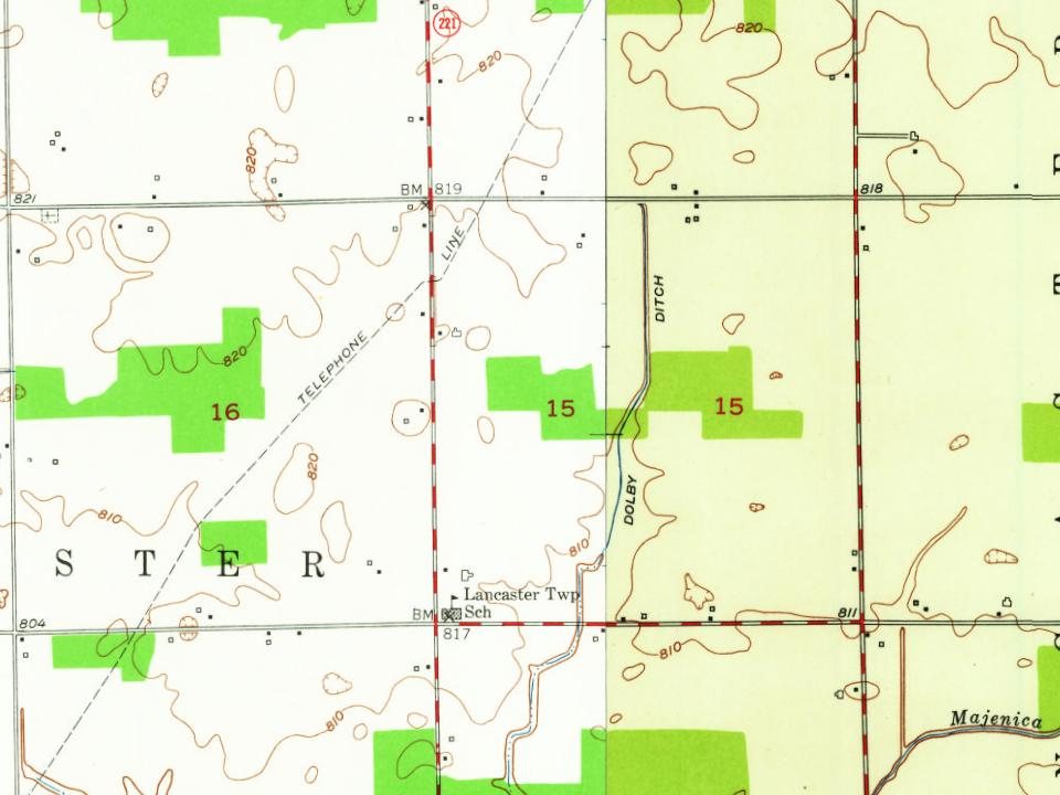
Every edition of the U.S. Geological Survey’s map of Lancaster Township. Tap a year, or press play to watch the town change.
1950Andrews sheet · 1:24,000
U.S. Geological Survey historical topographic maps (public domain), via Esri’s collection of the scans. The red ring marks the center of Lancaster Township.
Famous people
Famous people close to Lancaster Township
Nobody well known was born in Lancaster Township itself, so here are the best known from just nearby.
Lancaster Township is more historic than 61% of U.S. towns. The History grade combines the town’s founding era, the share of homes built before 1940 and its National Register listings. It’s a character grade, so it isn’t part of the overall grade. How it works.
How old are the homes in Lancaster Township?
35% of Lancaster Township’s homes were built before 1940 (Census estimate, ±11.7 points), against a typical 14% for an Indiana town; the median home was built in 1969.
Founding dates: Wikidata, Wikipedia, the U.S. post office records of Blevins & Helbock (CC0) and the Census. Homes by year built: Census ACS 2020–24. National Register of Historic Places: National Park Service (list of May 22, 2026). Old photos, postcards and papers: Wikimedia Commons, the Library of Congress and other public archives, credited on each item’s page. Maps: U.S. Geological Survey historical topographic maps (via Esri) and Sanborn fire-insurance maps (Library of Congress). History text and census tables: Wikipedia (CC BY-SA 4.0). Places that used to be: USGS Geographic Names Information System (2021).
From U.S. Geological Survey historical maps, the US Post Offices dataset (Blevins & Helbock), the USGS Geographic Names Information System and old county and town histories (Internet Archive). Archive images are copied here with their credits and licenses, shown on each photo’s page. Refreshed monthly.