Edinburgh dates to 1822, and 24% of its homes were built before 1940
More historic than 93% of U.S. towns · #107 of 593 in Indiana. What drives it
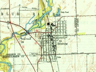
3 places in town are on the National Register, among them three historic districts with 155 buildings between them. Below: maps from 1948 on and the census since 1860.
Founding year: Wikipedia. First post office: 1823.The full story ↓
History grade
What drives Edinburgh’s History grade
On its age, its old homes and the National Register, Edinburgh is more historic than 93% of U.S. towns, #107 of 593 in Indiana. All 3 inputs are above most U.S. towns; its National Register listings ranks highest and its age lowest.
A
HistoryA character grade: shown, never part of Edinburgh’s overall grade.
Indiana towns list more on the Register than most of the country (a typical Indiana town has 7.9 per 10,000 residents, the U.S. 2.4), so Edinburgh’s 354 sits above most of its state (93% of Indiana towns have fewer) while its 155 historic buildings outnumber those of 92% of U.S. towns.
NoteThe founding year comes from Wikipedia alone; no second source gives 1822.
How sure. Graded on any two of the three inputs instead, the letter would range from A− to A. The pre-1940 share is a Census survey estimate (±6.0 points).
Founding year: Wikipedia (other dates in Quick answers). Homes: Census ACS 2020–24. National Register: National Park Service, May 2026 list; each listing counted once (boundary changes and added documentation belong to their listing), and a historic district counts its contributing buildings. How TownRatings grades history →
What stands out about Edinburgh’s past
Read from the archive, the National Register and the record. The page puts what stands out first.
Edinburgh was laid out in about 1822. A founder of the town being a native of Scotland may have caused the name Edinburgh to be selected. The Edinburgh post office has been in operation since 1823. Edinburgh was incorporated as a town in 1853. Early in its history it was sometimes referred to as the town of Edinburg.
Edinburgh Commercial Historic District, South Walnut Street Historic District, and Toner Historic District are listed on the National Register of Historic Places.
Passages that mention Edinburgh, cut from the printed page as they were published.
Edinburgh and its neighbourhood, geological and historical1870 · page 24Read the page →
Read the text
Banffshire, where a sea-bottom richly charged with shells may be found at a level considerably higher over the present sea-line than the higher parts of the New Town of Edinburgh, and which at one point lies from five to six miles inland. When the tide covered that ancient sea-bottom, the geography of Scotland must have been widely different from what it is now. The great Caledonian Valley must have been an ocean sound, open
Text read by machine from the scan; it may contain errors.
Edinburgh and its neighbourhood, geological and historical1870 · page 234Read the page →
Read the text
the Arthur Seat group of hills, with their pleasant springs and runnels, but also drainage of a very different kind, — that of by very much the larger part of the Old Town of Edinburgh, — it has been inundated, from the copious introduction of water into the city, and the substitution of effective drains for the old practice which Samuel Johnson, during his visit, Closed in the dark,’ by a river of liquid manure, which, by being spread out, on the
Text read by machine from the scan; it may contain errors.
In 1428 John \'ernoar gave a land (/.£'., a tenement) near the town of Edinburgh, on tlie suudi side thereof, in the street called Cowgate, to Richard Lundy, a monk of jNIelrose, for twenty shillings yearly. He or his heirs were to have the refusal of it if it were sold. (" Monastic Ann.,'' Teviotdale.)
Text read by machine from the scan; it may contain errors.
Scans and text from the Internet Archive. Books published in 1930 or earlier, which are in the public domain.
In 1822, according to Wikipedia’s history of the town. Edinburgh’s post office opened in 1823, and the census of 1860 counted 1,100 people here.
How does Edinburgh rank for history?
Edinburgh is more historic than 93% of U.S. towns, #107 of 593 in Indiana. The History grade combines the town’s founding era, the share of homes built before 1940 and its National Register listings. It’s a character grade, so it isn’t part of the overall grade. How it works.
What is on the National Register in Edinburgh?
Three places: the Edinburgh Commercial Historic District (listed 1991), the South Walnut Street Historic District (2011) and the Toner Historic District (2011).
How old are the homes in Edinburgh?
24% of Edinburgh’s homes were built before 1940 (Census estimate, ±6.0 points), against a typical 14% for an Indiana town; the median home was built in 1967.
Founding dates: Wikidata, Wikipedia, the U.S. post office records of Blevins & Helbock (CC0) and the Census. Homes by year built: Census ACS 2020–24. National Register of Historic Places: National Park Service (list of May 22, 2026). Old photos, postcards and papers: Wikimedia Commons, the Library of Congress and other public archives, credited on each item’s page. Maps: U.S. Geological Survey historical topographic maps (via Esri) and Sanborn fire-insurance maps (Library of Congress). History text and census tables: Wikipedia (CC BY-SA 4.0). Places that used to be: USGS Geographic Names Information System (2021).
From Wikimedia Commons (6), Wikidata (1), the National Register of Historic Places (3), Wikipedia, Wikidata and Wikipedia for famous people, U.S. Geological Survey historical maps, U.S. Census counts (via Wikipedia), the US Post Offices dataset (Blevins & Helbock), the USGS Geographic Names Information System and old county and town histories (Internet Archive). Archive images are copied here with their credits and licenses, shown on each photo’s page. Refreshed monthly.




 2022
 2022
 2016
 2016
 2011
 2007


