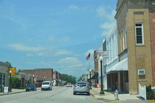
3 places in town are on the National Register, among them a historic district with 24 buildings. Below: 3 old photos and papers, maps from 1898 on, and the census since 1880.
The Converse post office opened in 1892, the earliest record of the town by name. Another post office, Xenia (1854), opened inside today’s town and later closed.
First census: 732 in 18802020 census: 1,161134 years
How historic is Converse?
A−
More historic than 76% of U.S. towns, on its age, its old homes and the National Register.
Founding year: the first Converse post office (Blevins & Helbock, CC0).The full story ↓
History grade
What drives Converse’s History grade
On its age, its old homes and the National Register, Converse is more historic than 76% of U.S. towns. Its National Register listings hold the grade up; its age pulls it down.
A−
HistoryA character grade: shown, never part of Converse’s overall grade.
Indiana towns list more on the Register than most of the country (a typical Indiana town has 7.9 per 10,000 residents, the U.S. 2.4), so Converse’s 320 sits above most of its state (92% of Indiana towns have fewer) while its 26 historic buildings outnumber those of 81% of U.S. towns.
How sure. Graded on any two of the three inputs instead, the letter would range from B− to A. The pre-1940 share is a Census survey estimate (±9.9 points). The founding year is the first post office, not a stated founding date.
Founding year: the first post office (other dates in Quick answers). Homes: Census ACS 2020–24. National Register: National Park Service, May 2026 list; each listing counted once (boundary changes and added documentation belong to their listing), and a historic district counts its contributing buildings. How TownRatings grades history →
What stands out about Converse’s past
Read from the archive, the National Register and the record. The page puts what stands out first.
National Park Service, National Register of Historic Places. Photos from Wikimedia Commons, credited on each place’s page.
Every building
Converse, building by building, 1898–1920
Fire insurance maps drew every building, what it was made of and what it was used for, so insurers could price the risk of fire. Pick a year, then a sheet.
Passages that mention Converse, cut from the printed page as they were published.
History of Miami County, Indiana1914 · page 180Read the page →
Read the text
Lamb and Abi.jah Ridgeway laid out the tonii of Amboy on section 23, four miles west of Converse, as a station on the new railroad. About the time the town was laid out, Elisha Clark established a large steam sawmill there and a little later the firm of Lowder & Smith put up a second savraiill. Both these mills did a good business while the timber lasted, and large quantities of lumber were sliipped from Amboy during the early years of its existence. About the mills a village soon grew up and other lines of business were introduced. The first merchant was Ben-
Text read by machine from the scan; it may contain errors.
History of Miami County, Indiana1914 · page 280Read the page →
Read the text
was demonstrated, however, that gas existed in that part of the county and a second well was drilled, which yielded enough gas to supply the town for domestic purposes. The company drilled eight wells altogether, five of which were within the corporate limits of the town of Converse. Before the close of the year a few farmers living west of Converse formed a company and drilled a well to supply their homes with fuel. The Xenia (Converse) Real Estate Company drilled a well in 1889, which furnished enough gas to supply the electric light plant, the hoop works
Text read by machine from the scan; it may contain errors.
Scans and text from the Internet Archive. Books published in 1930 or earlier, which are in the public domain.
Timeline
Converse, 1854 to 1962
Woven from the archive, old maps, post office records, the National Register and the people born here.
Nothing in the archives for these yearsWeddings on Main Street, storms, parades, school pictures, the old store. If it’s in your family album, it belongs here.
Between 732 and 1,415 people in every census since 1880.
15 censuses, 1880–2020.
U.S. Census Bureau decennial counts, from the census table on Converse’s Wikipedia page.
Places that used to be
Lost post offices and burying grounds
Converse’s post office has been open since 1892. Another post office, Xenia, opened and closed inside today’s town.
Xenia
1854–1892
Converse
1892–today
18501940today
1cemetery inside Converse
Independent Order of Odd Fellows
US Post Offices dataset (Blevins & Helbock, CC0). Places and cemeteries from the USGS Geographic Names Information System (2021).
Questions about Converse’s history
What year was Converse founded?
The Converse post office opened in 1892, the earliest record of the town by name (U.S. post office records).
How does Converse rank for history?
Converse is more historic than 76% of U.S. towns. The History grade combines the town’s founding era, the share of homes built before 1940 and its National Register listings. It’s a character grade, so it isn’t part of the overall grade. How it works.
What is on the National Register in Converse?
Three places: the Converse Depot (listed 1995), the Converse-Jackson Township Public Library (1999) and the Converse Commercial Historic District (2016).
How old are the homes in Converse?
21% of Converse’s homes were built before 1940 (Census estimate, ±9.9 points), against a typical 14% for an Indiana town; the median home was built in 1976.
Founding dates: Wikidata, Wikipedia, the U.S. post office records of Blevins & Helbock (CC0) and the Census. Homes by year built: Census ACS 2020–24. National Register of Historic Places: National Park Service (list of May 22, 2026). Old photos, postcards and papers: Wikimedia Commons, the Library of Congress and other public archives, credited on each item’s page. Maps: U.S. Geological Survey historical topographic maps (via Esri) and Sanborn fire-insurance maps (Library of Congress). History text and census tables: Wikipedia (CC BY-SA 4.0). Places that used to be: USGS Geographic Names Information System (2021).
From Wikimedia Commons (4), the Library of Congress (1), Wikidata (1), the National Register of Historic Places (3), Wikipedia, U.S. Geological Survey historical maps, U.S. Census counts (via Wikipedia), the US Post Offices dataset (Blevins & Helbock), the USGS Geographic Names Information System, Sanborn fire insurance maps (Library of Congress) and old county and town histories (Internet Archive). Archive images are copied here with their credits and licenses, shown on each photo’s page. Refreshed monthly.




 1909
 Date?
 2018
 2010


