Fire insurance maps drew every building, what it was made of and what it was used for, so insurers could price the risk of fire. Pick a year, then a sheet.
1895Sheet 1 of 1
Edition
Sheets
BrickWoodStone
Sanborn Map Company, via the Library of Congress. Editions published in 1930 or earlier, which are in the public domain.
Colfax was laid out in 1849 by Montgomery Stroud. It was originally named Midway for its position between Chicago and Louisville along the IC&L railroad. In 1853 the town gained a post office named Colfax, and in December 1857 the name of the town itself became Colfax, by petition of the residents. By 1861 the town had two churches, two general stores, a hotel, a saw mill and approximately 200 residents.
An incorporation election held December 25, 1869, resulted in 24 yeas and 1 no. The town had 187 residents in 1870, but with the construction of the Vandalia railroad through town in 1870-71 it grew quickly and by 1880 had a population of 638.
Passages that mention Colfax, cut from the printed page as they were published.
History of Clinton County, Indiana1913 · page 345Read the page →
Read the text
Colfax was laid out in 1849, by Montgomery Stroud, and was given the name of Midway, as a half way point between Indianapolis and Lafayette, on the old Lafavette railroad — now the Big Four. In 1853 it was made a postoffice under the name of Colfax. The double name became a source of inconvenience, as people would direct mail to Midway, and there was a Midway postoffice in Spencer county, Indiana, and half a dozen in other states. In December, 1857, residents of the place petitioned to change the name of the place to Colfax, which was done. In 1861 its population was estimated at
Text read by machine from the scan; it may contain errors.
History of Clinton County, Indiana. Together with sketches of its cities, villages and towns, educational, religious, civil, military, and political history, portraits of prominent persons, and biographies of representative citizens. Also a condensed hist1886 · page 444Read the page →
Read the text
John M. Clark, M. D., a retired physician and surgeon, living at Colfax, Indiana, has been a resident of Clinton County since October, 1836, when he settled on a tract of land in Perry Township, where in 1835 and 1836 he entered 600 acres of land, a part of which is now the site of Colfax. He lived on this land four years and then went to Jefferson, where he lived, engaged in the practice of his profession, until 1873, when he returned to Colfax, where he has since made his home, building his residence that
Text read by machine from the scan; it may contain errors.
History of Clinton County, Indiana. Together with sketches of its cities, villages and towns, educational, religious, civil, military, and political history, portraits of prominent persons, and biographies of representative citizens. Also a condensed hist1886 · page 791Read the page →
Read the text
The village of Colfax, formerly called Medway, is located on section 8, in the southwestern part of the township,at the junction of the Terre Haute & Logansport and Cincinnati, Indianapolis, St. Louis & Chicago railroads, which afford excellent facilities for transportation in all directions. It was laid out in 1849, by Montgomery Stroud, and was at that time called Medway. A few years later, however, Dr. J. M. Clark made an addition, and then it took its present name. Considerable enterprise is apparent from the
Text read by machine from the scan; it may contain errors.
Scans and text from the Internet Archive. Books published in 1930 or earlier, which are in the public domain.
Timeline
Colfax, 1849 to 1962
Woven from the archive, old maps, post office records, the National Register and the people born here.
National Park Service, National Register of Historic Places. Photos from Wikimedia Commons, credited on each place’s page.
People over time
Colfax, census by census
Between 187 and 823 people in every census since 1870.
16 censuses, 1870–2020.
U.S. Census Bureau decennial counts, from the census table on Colfax’s Wikipedia page.
Questions about Colfax’s history
What year was Colfax founded?
In 1849, according to Wikidata and Wikipedia’s history of the town. Colfax’s post office opened in 1853, and the census of 1870 counted 187 people here.
What is on the National Register in Colfax?
Two places: the Rosenberger Building (listed 1984) and the Colfax Carnegie Library (1994).
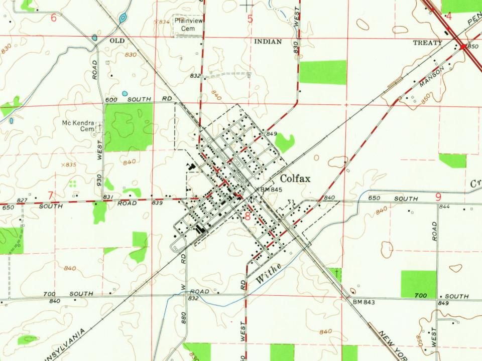
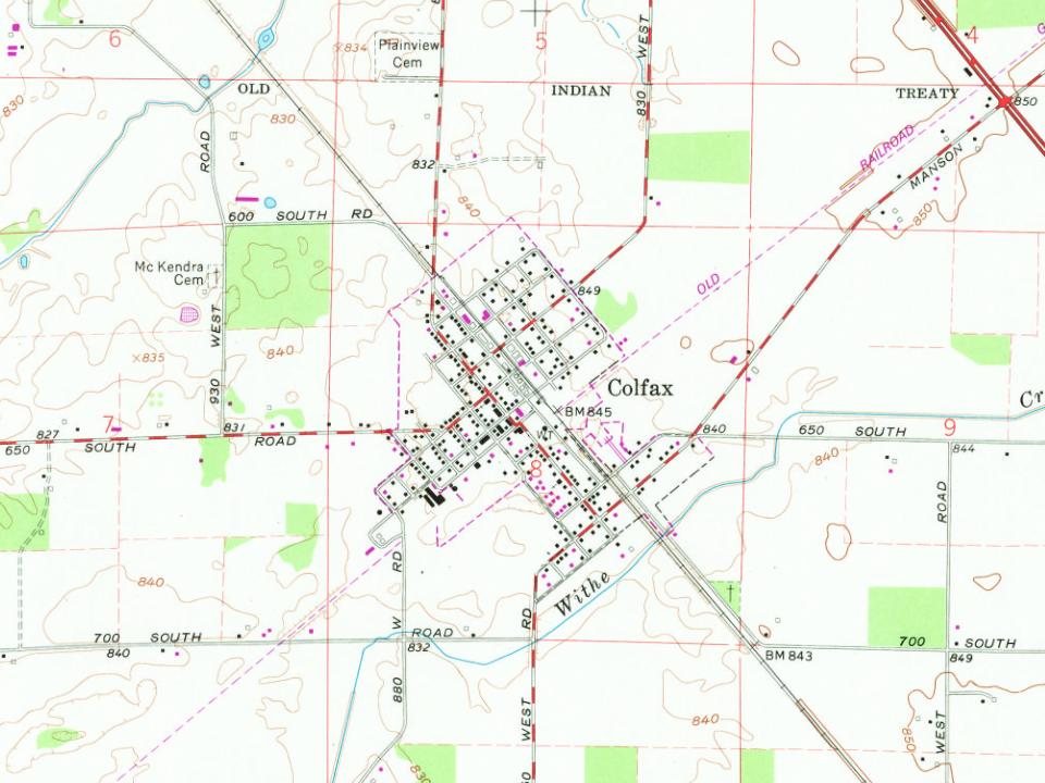
Founding dates: Wikidata, Wikipedia, the U.S. post office records of Blevins & Helbock (CC0) and the Census. Homes by year built: Census ACS 2020–24. National Register of Historic Places: National Park Service (list of May 22, 2026). Old photos, postcards and papers: Wikimedia Commons, the Library of Congress and other public archives, credited on each item’s page. Maps: U.S. Geological Survey historical topographic maps (via Esri) and Sanborn fire-insurance maps (Library of Congress). History text and census tables: Wikipedia (CC BY-SA 4.0). Places that used to be: USGS Geographic Names Information System (2021). How TownRatings grades history →
From Wikimedia Commons (4), the National Register of Historic Places (2), Wikipedia, Wikidata and Wikipedia for famous people, U.S. Geological Survey historical maps, U.S. Census counts (via Wikipedia), the US Post Offices dataset (Blevins & Helbock), the USGS Geographic Names Information System, Sanborn fire insurance maps (Library of Congress) and old county and town histories (Internet Archive). Archive images are copied here with their credits and licenses, shown on each photo’s page. Refreshed monthly.


 2016
 2013
 2013
 2012