More historic than 24% of U.S. towns · #517 of 593 in Indiana. What drives it
Most of Brooklyn was built recently: 7% of its homes predate 1940 and the median home dates from 1990. Below: maps from 1908 on and the census since 1880.
Founding year: Wikipedia. First post office: 1856.The full story ↓
History grade
What drives Brooklyn’s History grade
On its age, its old homes and the National Register, Brooklyn is more historic than 24% of U.S. towns, #517 of 593 in Indiana. Its share of homes from before 1940 holds the grade up; its National Register listings pull it down.
C−
HistoryA character grade: shown, never part of Brooklyn’s overall grade.
Indiana towns list more on the Register than most of the country (a typical Indiana town has 7.9 per 10,000 residents, the U.S. 2.4), so Brooklyn’s 0.0 sits below most of its state (22% of Indiana towns have fewer) while its 0 listings outnumber those of 23% of U.S. towns.
How sure. Graded on any two of the three inputs instead, the letter would range from D to C. The pre-1940 share is a Census survey estimate (±4.5 points). Two sources give 1854.
Founding year: Wikipedia (other dates in Quick answers). Homes: Census ACS 2020–24. National Register: National Park Service, May 2026 list; each listing counted once (boundary changes and added documentation belong to their listing), and a historic district counts its contributing buildings. How TownRatings grades history →
What stands out about Brooklyn’s past
Read from the archive, the National Register and the record. The page puts what stands out first.
Brooklyn was laid out in 1854, at about the time the railroad was extended to that point. The town probably took its name after Brooklyn, New York. A post office has been in operation at Brooklyn since 1856.
This town also has rich history as part the Underground Railroad in Indiana mainly spanning from Bloomington to Indianapolis.
The Franklin Landers-Black and Adams Farm was listed on the National Register of Historic Places in 2000.
Passages that mention Brooklyn, cut from the printed page as they were published.
A history of the city of Brooklyn1867 · page 381Read the page →
Read the text
pia," a tract of land which, he says, " was surveyed and laid out in streets as long ago as the year 1787, and then intended as a city ; its progress has been arranged according to the plan, and begins to 1 The town of Brooklyn at this period — and, indeed, until the incorporation of the village of Brooklyn — was divided, for ecclesiastical, school, and other purposes, into seven districts, retaining the same names which had descended from the " neighborhoods" or hamlets of the earlier settlements, viz. : " The Ferry" {het Veer) ; the " Red Hook" {de Roede Hock); "Brooklyn" {Breuckelen) ; "Bedford" (Betfort); "Gowanus" {Gaujanes
Text read by machine from the scan; it may contain errors.
The civil, political, professional and ecclesiastical history, and commercial and industrial record of the county of Kings and the city of Brooklyn, N. Y., from 1683 to 18841884 · page 557Read the page →
Read the text
The Board of Police of the City of Brooklyn. — An act to establish a police department in and for the city of Brooklyn, and to define its powers and duties, was passed April 5th, 1870, which declared that the city of Brooklyn should thereafter constitute a separate police district; and a police department was thereby created therein, the management and control of which was vested in a board of commissioners, to be
Text read by machine from the scan; it may contain errors.
The civil, political, professional and ecclesiastical history, and commercial and industrial record of the county of Kings and the city of Brooklyn, N. Y., from 1683 to 18841884 · page 619Read the page →
Read the text
Esq., member of Assembly from Kings County, presented to the Legislature a petition for a charter for the Long Island Lank, to be located in the village of Brooklyn. On the 5th of February following, the standing committee on Banks and Insurance Companies, reported on the petition that, “having duly examined the merits of the application, and having learned from different sources that the incorporated
Text read by machine from the scan; it may contain errors.
A history of the city of Brooklyn1867 · page 386Read the page →
Read the text
On the 2d of April, 1801, the village of Brooklyn was incorporated as a fire district, by an act entitled " An Act to vest certain powers in the Freeholders and Inhabitants of part of the Town of Brooklyn, in Kings County," etc., the 6th section of which is of much importance, inasmuch as it authenticated the copies of Old Road Records, then recently transferred from the County Clerk's office to the office of the Clerk of the Town.
Text read by machine from the scan; it may contain errors.
Scans and text from the Internet Archive. Books published in 1930 or earlier, which are in the public domain.
Timeline
Brooklyn, 1854 to 1955
Woven from the archive, old maps, post office records, the National Register and the people born here.
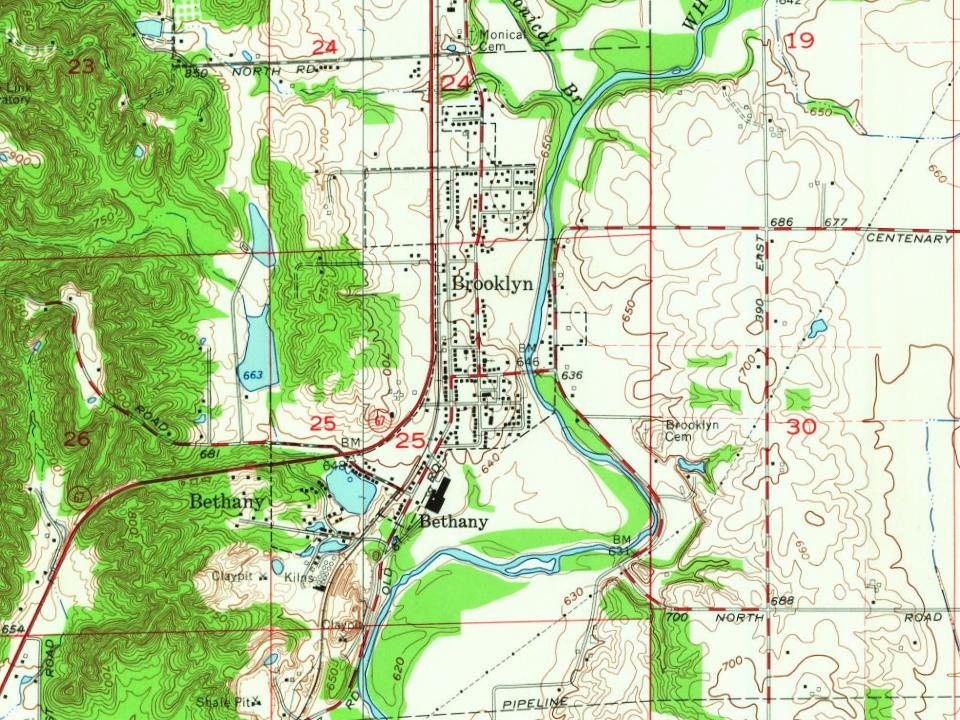
Every edition of the U.S. Geological Survey’s map of Brooklyn. Tap a year, or press play to watch the town change.
1955Mooresville East sheet · 1:24,000
U.S. Geological Survey historical topographic maps (public domain), via Esri’s collection of the scans. The red ring marks the center of Brooklyn.
Every building
Brooklyn, building by building, 1908–1920
Fire insurance maps drew every building, what it was made of and what it was used for, so insurers could price the risk of fire. Pick a year, then a sheet.
In 1854, according to Wikipedia’s history of the town. Brooklyn’s post office opened in 1856, and the census of 1880 counted 244 people here.
How does Brooklyn rank for history?
Brooklyn is more historic than 24% of U.S. towns, #517 of 593 in Indiana. The History grade combines the town’s founding era, the share of homes built before 1940 and its National Register listings. It’s a character grade, so it isn’t part of the overall grade. How it works.
How old are the homes in Brooklyn?
7% of Brooklyn’s homes were built before 1940 (Census estimate, ±4.5 points), against a typical 14% for an Indiana town; the median home was built in 1990.
Founding dates: Wikidata, Wikipedia, the U.S. post office records of Blevins & Helbock (CC0) and the Census. Homes by year built: Census ACS 2020–24. National Register of Historic Places: National Park Service (list of May 22, 2026). Old photos, postcards and papers: Wikimedia Commons, the Library of Congress and other public archives, credited on each item’s page. Maps: U.S. Geological Survey historical topographic maps (via Esri) and Sanborn fire-insurance maps (Library of Congress). History text and census tables: Wikipedia (CC BY-SA 4.0). Places that used to be: USGS Geographic Names Information System (2021).
From Wikimedia Commons (3), Wikipedia, U.S. Geological Survey historical maps, U.S. Census counts (via Wikipedia), the US Post Offices dataset (Blevins & Helbock), the USGS Geographic Names Information System, Sanborn fire insurance maps (Library of Congress) and old county and town histories (Internet Archive). Archive images are copied here with their credits and licenses, shown on each photo’s page. Refreshed monthly.


 2016
 2011
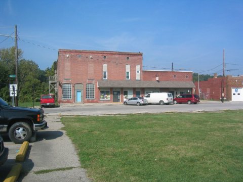 2006