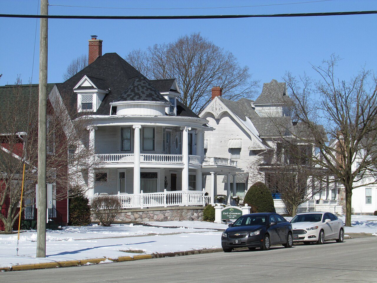
2 places in town are on the National Register, among them two historic districts with 70 buildings between them. Below: maps from 1892 on and the census since 1880.
Founding year: the first Argos post office (Blevins & Helbock, CC0). Wikidata: 1869.The full story ↓
History grade
What drives Argos’ History grade
On its age, its old homes and the National Register, Argos is more historic than 84% of U.S. towns. Its National Register listings hold the grade up; its age pulls it down.
A−
HistoryA character grade: shown, never part of Argos’ overall grade.
Indiana towns list more on the Register than most of the country (a typical Indiana town has 7.9 per 10,000 residents, the U.S. 2.4), so Argos’ 388 sits above most of its state (94% of Indiana towns have fewer) while its 70 historic buildings outnumber those of 87% of U.S. towns.
How sure. Graded on any two of the three inputs instead, the letter would range from B+ to A+. The pre-1940 share is a Census survey estimate (±7.1 points). The founding year is the first post office, not a stated founding date; Wikidata’s 1869 falls in the same era, so the grade doesn’t depend on which one is used.
Founding year: the first post office (other dates in Quick answers). Homes: Census ACS 2020–24. National Register: National Park Service, May 2026 list; each listing counted once (boundary changes and added documentation belong to their listing), and a historic district counts its contributing buildings. How TownRatings grades history →
What stands out about Argos’ past
Read from the archive, the National Register and the record. The page puts what stands out first.
National Park Service, National Register of Historic Places. Photos from Wikimedia Commons, credited on each place’s page.
Every building
Argos, building by building, 1892–1913
Fire insurance maps drew every building, what it was made of and what it was used for, so insurers could price the risk of fire. Pick a year, then a sheet.
1892Sheet 1 of 1
Edition
Sheets
BrickWoodStone
Sanborn Map Company, via the Library of Congress. Editions published in 1930 or earlier, which are in the public domain.
In 1833, Sidney Williams arrived in the area which is now Marshall County and purchased 600 acres (2.4 km2) of land on the present day site of Argos. Mr. Williams built a tavern, an inn, and helped build a section of Michigan Road. Mr. Williams sold his land to Clark Bliven, the man who built the courthouse on the Williams's land. This local place of rest was not considered a town until some time later. On January 8, 1851, John Pleak and Marquis L. Smith, laid out the town of Sidney, which is the predecessor to Argos. The town of Sidney was named in honor of Sidney Williams.
Argos is situated on the Michigan road eight miles south from Plymouth. The Lake Erie & Western railroad runs through the eastern part of the town, and the Nickel Plate railroad forms a junction with the Erie road in the south part of the place and runs through the southwestern part m a westerly direction.
Text read by machine from the scan; it may contain errors.
A twentieth century history of Marshall County, Indiana1908 · page 129Read the page →
Read the text
The village of Walnut is situated in Walnut township, about four miles south of Argos on the Lake Erie & Western railroad. It was laid out and platted by Frederick Stair April 16, 1866, and contained eighty-three lots. It was named Fredericksburg, in honor of the proprietor, and that is still the legal name of the village. When the railroad was completed through that place in 1868, two years after it had been organized, the railroad changed the name of the village to Walnut, after Walnut township, and by that name it has been known ever since. In the early years of its
Text read by machine from the scan; it may contain errors.
born in Rush county, Ind., the daughter of Edward and Famar Bliven. Soon after his marriage Mr. Smith settled on his present homestead, where he has since lived. He has been engaged in farming, and for many years kept the only hotel in Argos, his hotel being the first of the place, and the origin of the town of Argos. He is extensively known, because of being the landlord that had given headquarters to so many weary travelers. For over thirty years he has been an active and zealous member of
Text read by machine from the scan; it may contain errors.
A twentieth century history of Marshall County, Indiana1908 · page 120Read the page →
Read the text
John C. Fremont, who was on that day voted for as the Republican candidate for president. As he was beaten in his race for president, it was an easy matter to get the board of commissioners to change the name to Argos. The town of Argos was incorporated under the state law in December, 1869. The first election was held December 4, 1869, and resulted in the election of the following officers : Trustees, Joseph F. Norton, Jonathan Pickerel and J. S. Leland ; marshal, James Pickerel ; clerk, George W.
Text read by machine from the scan; it may contain errors.
Scans and text from the Internet Archive. Books published in 1930 or earlier, which are in the public domain.
Timeline
Argos, 1857 to 1984
Woven from the archive, old maps, post office records, the National Register and the people born here.
The Argos post office opened in 1857, the earliest record of the town by name (U.S. post office records). Wikidata gives 1869.
How does Argos rank for history?
Argos is more historic than 84% of U.S. towns. The History grade combines the town’s founding era, the share of homes built before 1940 and its National Register listings. It’s a character grade, so it isn’t part of the overall grade. How it works.
What is on the National Register in Argos?
Two places: the Argos Downtown Historic District (listed 2001) and the Argos Northside Historic District, (2017).
How old are the homes in Argos?
33% of Argos’ homes were built before 1940 (Census estimate, ±7.1 points), against a typical 14% for an Indiana town; the median home was built in 1958.
Founding dates: Wikidata, Wikipedia, the U.S. post office records of Blevins & Helbock (CC0) and the Census. Homes by year built: Census ACS 2020–24. National Register of Historic Places: National Park Service (list of May 22, 2026). Old photos, postcards and papers: Wikimedia Commons, the Library of Congress and other public archives, credited on each item’s page. Maps: U.S. Geological Survey historical topographic maps (via Esri) and Sanborn fire-insurance maps (Library of Congress). History text and census tables: Wikipedia (CC BY-SA 4.0). Places that used to be: USGS Geographic Names Information System (2021).
From Wikimedia Commons (21), Wikidata (1), the National Register of Historic Places (2), Wikipedia, Wikidata and Wikipedia for famous people, U.S. Geological Survey historical maps, U.S. Census counts (via Wikipedia), the US Post Offices dataset (Blevins & Helbock), Sanborn fire insurance maps (Library of Congress) and old county and town histories (Internet Archive). Archive images are copied here with their credits and licenses, shown on each photo’s page. Refreshed monthly.




 2021
 2021
 2021
 2021
 2021
 2021
 2020
 2020
 2020
 2013
 2013
 2013
 2013
 2013
 2013
 2013
 2013
 2012
 2011
 2011
 2005
