Peaked at 1,485 in 1870; 437 people lived here in 2020.
17 censuses, 1860–2020.
U.S. Census Bureau decennial counts, from the census table on Sonora Township’s Wikipedia page.
Places that used to be
Lost post offices, old corners, places now gone and burying grounds
Two other post offices opened and closed inside today’s town.
Sonora
1860–1903
Powellton
1882–1918
18601940today
Hamlets and corners on the map
PowelltonSonora
Gone or out of use
Center SchoolschoolChristy SchoolschoolElliott SchoolschoolGibralter SchoolschoolGolden Point SchoolschoolLarry SchoolschoolPleasant Hill SchoolschoolSanobia Churchchurch
6cemeteries and burying grounds inside Sonora Township
NauvooOak GroveOld Nauvoo Burial GroundsSaints Peter and PaulStearnsThornber
US Post Offices dataset (Blevins & Helbock, CC0). Places and cemeteries from the USGS Geographic Names Information System (2021).
The story so far
Sonora Township, in brief
Wikipedia doesn’t have a history of Sonora Township yet. The photos, dates and memories neighbors add here are how it gets written.
Sonora Township is one of twenty-four townships in Hancock County, Illinois, USA. As of the 2020 census, its population was 437 and it contained 246 housing units.
Sonora Township was established in 1849. Between the 2010 and 2020 censuses its population fell from 494 to 437 (-12%).
Intro from Wikipedia. Population: U.S. Census Bureau.
Timeline
Sonora Township, 1849 to 1964
Woven from the archive, old maps, post office records, the National Register and the people born here.
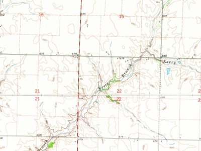
The U.S. Geological Survey’s map of Sonora Township.
1964Niota sheet · 1:24,000
U.S. Geological Survey historical topographic maps (public domain), via Esri’s collection of the scans. The red ring marks the center of Sonora Township.
Stories next door
History across the town line
Each neighbor’s History grade, on the same three inputs.
Founding dates: Wikidata, Wikipedia, the U.S. post office records of Blevins & Helbock (CC0) and the Census. Homes by year built: Census ACS 2020–24. National Register of Historic Places: National Park Service (list of May 22, 2026). Old photos, postcards and papers: Wikimedia Commons, the Library of Congress and other public archives, credited on each item’s page. Maps: U.S. Geological Survey historical topographic maps (via Esri) and Sanborn fire-insurance maps (Library of Congress). History text and census tables: Wikipedia (CC BY-SA 4.0). Places that used to be: USGS Geographic Names Information System (2021). How TownRatings grades history →
From Wikimedia Commons (1), Wikidata and Wikipedia for famous people, U.S. Geological Survey historical maps, U.S. Census counts (via Wikipedia), the US Post Offices dataset (Blevins & Helbock) and the USGS Geographic Names Information System. Archive images are copied here with their credits and licenses, shown on each photo’s page. Refreshed monthly.

 2026
