More historic than 46% of U.S. towns · #425 of 768 in Illinois. What drives it
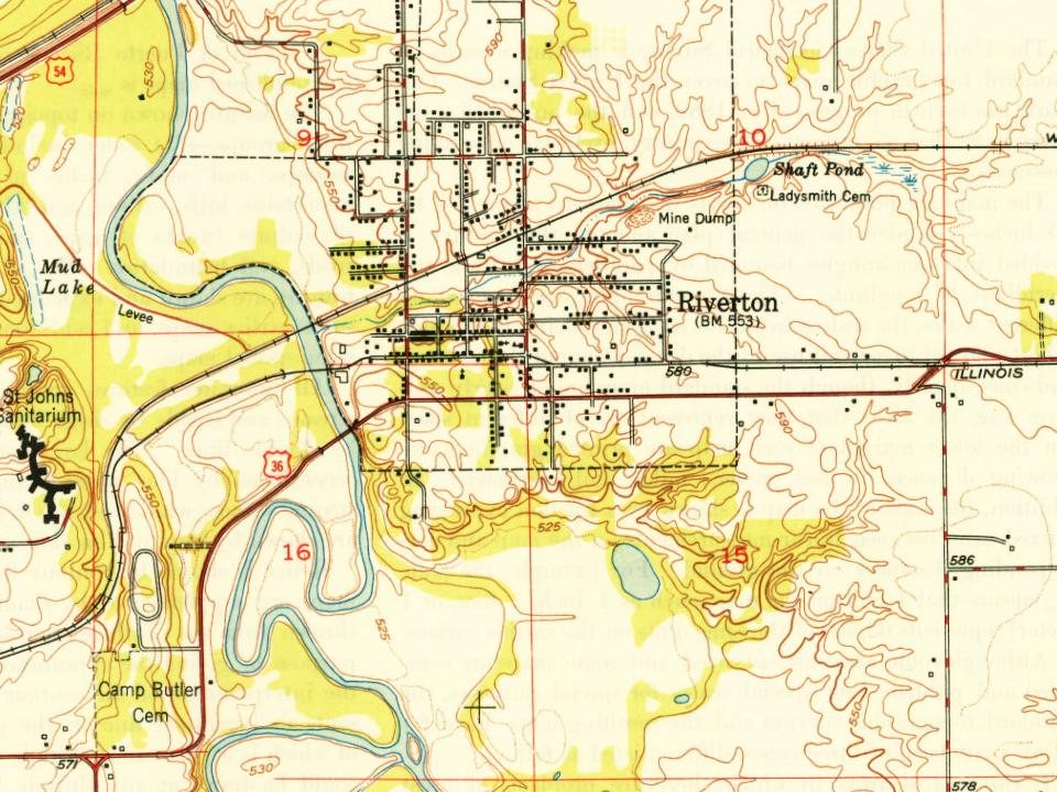
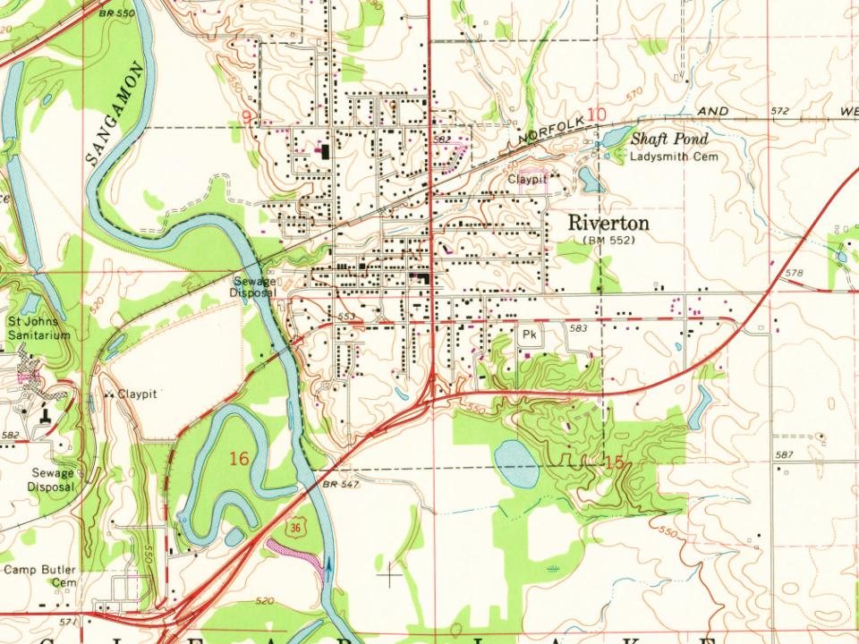
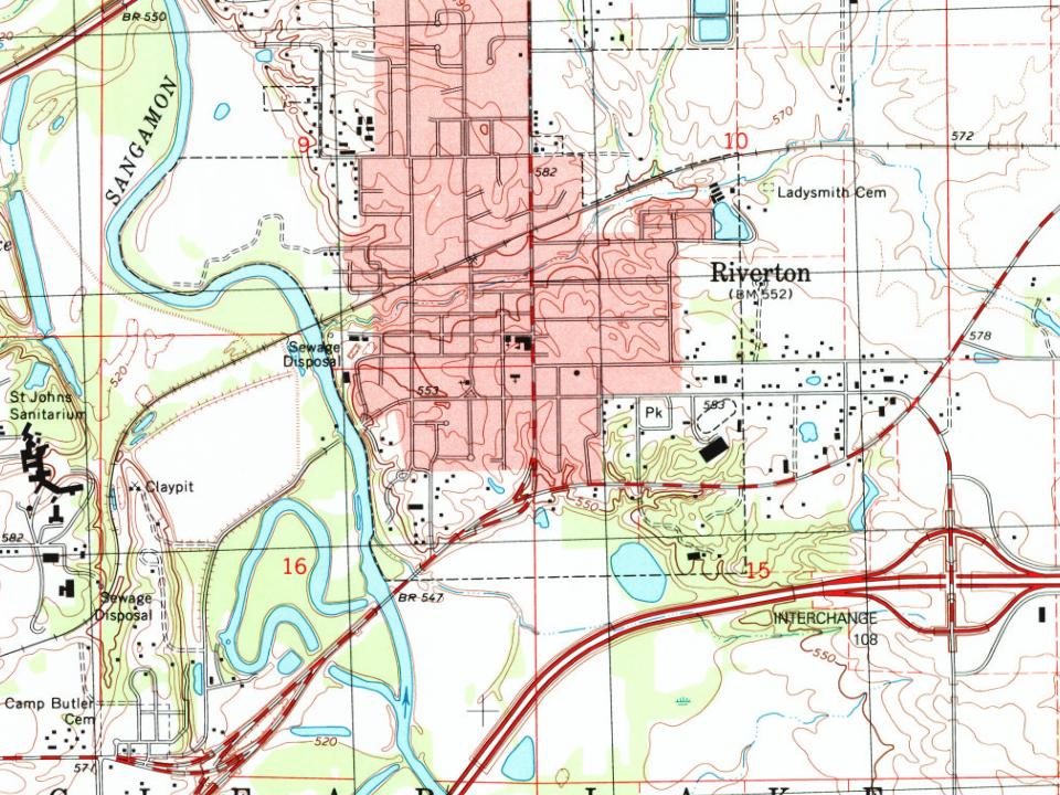
Most of Riverton was built recently: 8% of its homes predate 1940 and the median home dates from 1974. Below: 1 old photo or paper, maps from 1907 on, and the census since 1880.
Founding year: Wikidata; Wikipedia’s history section gives the same year. First post office: 1841.The full story ↓
History grade
What drives Riverton’s History grade
On its age, its old homes and the National Register, Riverton is more historic than 46% of U.S. towns, #425 of 768 in Illinois. Its age holds the grade up; its National Register listings pull it down.
B−
HistoryA character grade: shown, never part of Riverton’s overall grade.
Few Illinois towns list much on the Register (a typical Illinois town has 0.5 per 10,000 residents, the U.S. 2.4), so Riverton’s 0.0 sits below most of its state (28% of Illinois towns have fewer) while its 0 listings outnumber those of 23% of U.S. towns.
How sure. Graded on any two of the three inputs instead, the letter would range from C to B. The pre-1940 share is a Census survey estimate (±6.7 points). Two sources give 1837.
Founding year: Wikidata (other dates in Quick answers). Homes: Census ACS 2020–24. National Register: National Park Service, May 2026 list; each listing counted once (boundary changes and added documentation belong to their listing), and a historic district counts its contributing buildings. How TownRatings grades history →
What stands out about Riverton’s past
Read from the archive, the National Register and the record. The page puts what stands out first.
Riverton was founded by John Taylor in 1837. Originally named Judy's Ferry for the ferry crossing the Sangamon River there, then Jamestown, after politician James Shields, the village was successful for about a decade, producing lumber for a planned railroad. When it was discovered that the railroad was badly constructed and unreliable, Jamestown fell into economic distress and the land on which it sat was sold.
The town was sold to Joseph Loose of Maryland, then again to John D. Keedy, a Springfield distiller. Land south of Jamestown was purchased and a distillery was put up. Yet again, the properties were lost, first mortgaged to Jacob Bunn, then given as a claim settlement to Parley L. Howlett, another distiller.
Passages that mention Riverton, cut from the printed page as they were published.
History of Sangamon County, Illinois1881 · page 854Read the page →
Read the text
The village of Riverton was laid out and platted by John Taylor, December 1, 183'7, its location being described as "the south half of the northeavSt quarter of section nine, township sixteen, range four, west." The plat was recorded under the name of Jamestown, so named in honor of James F. Reed, whose adventures are given on a preceding page, in connection
Text read by machine from the scan; it may contain errors.
Historical Encyclopedia of Illinois and history of Sangamon County1912 · page 1255Read the page →
Read the text
hundred days, and mustered out at Camp Butler. After the war was over he resumed farming, lived at Round Prairie for several years, then moved to Riverton, where for fifteen years he was in the employ of the Clear Lake Ice Company. Since 1892 he has been living retired in Riverton. He is a member of Riverton Post, G. A. R. His religious affiliations are
Text read by machine from the scan; it may contain errors.
History of Sangamon County, Illinois1881 · page 851Read the page →
Read the text
roads, the Wabash and the Springfield & Northwestern. The former enters from Springfield on section nineteen, runs in a northeasterly direction through the village of Riverton to section ten, when it runs due east into the township of Mechanicsburg. The latter from Springfield enters on section eighteen, and runs northeast, enters Williams township from section two.
Text read by machine from the scan; it may contain errors.
Historical Encyclopedia of Illinois and history of Sangamon County1912 · page 1711Read the page →
Read the text
manner until 1884, when he sailed for America, landing in New York. From that city he came direct to Dawson, Ill., and for a year worked , in the mines there, then moved to Riverton. After a year spent in this-town, he went to Canada, and spent eighteen months in the Dominion, but did not like it there and returned to Riverton, where he bought a small farm of
Text read by machine from the scan; it may contain errors.
Scans and text from the Internet Archive. Books published in 1930 or earlier, which are in the public domain.
Timeline
Riverton, 1837 to 1966
Woven from the archive, old maps, post office records, the National Register and the people born here.
Nothing in the archives for these yearsWeddings on Main Street, storms, parades, school pictures, the old store. If it’s in your family album, it belongs here.
In 1837, according to Wikidata and Wikipedia’s history of the town. Riverton’s post office opened in 1841, and the census of 1880 counted 703 people here.
How does Riverton rank for history?
Riverton is more historic than 46% of U.S. towns, #425 of 768 in Illinois. The History grade combines the town’s founding era, the share of homes built before 1940 and its National Register listings. It’s a character grade, so it isn’t part of the overall grade. How it works.
How old are the homes in Riverton?
8% of Riverton’s homes were built before 1940 (Census estimate, ±6.7 points), against a typical 11% for an Illinois town; the median home was built in 1974.
Founding dates: Wikidata, Wikipedia, the U.S. post office records of Blevins & Helbock (CC0) and the Census. Homes by year built: Census ACS 2020–24. National Register of Historic Places: National Park Service (list of May 22, 2026). Old photos, postcards and papers: Wikimedia Commons, the Library of Congress and other public archives, credited on each item’s page. Maps: U.S. Geological Survey historical topographic maps (via Esri) and Sanborn fire-insurance maps (Library of Congress). History text and census tables: Wikipedia (CC BY-SA 4.0). Places that used to be: USGS Geographic Names Information System (2021).
From Wikimedia Commons (1), Wikipedia, Wikidata and Wikipedia for famous people, U.S. Geological Survey historical maps, U.S. Census counts (via Wikipedia), the US Post Offices dataset (Blevins & Helbock), the USGS Geographic Names Information System, Sanborn fire insurance maps (Library of Congress) and old county and town histories (Internet Archive). Archive images are copied here with their credits and licenses, shown on each photo’s page. Refreshed monthly.