Marengo dates to 1835, and 22% of its homes were built before 1940
More historic than 83% of U.S. towns · #155 of 768 in Illinois. What drives it
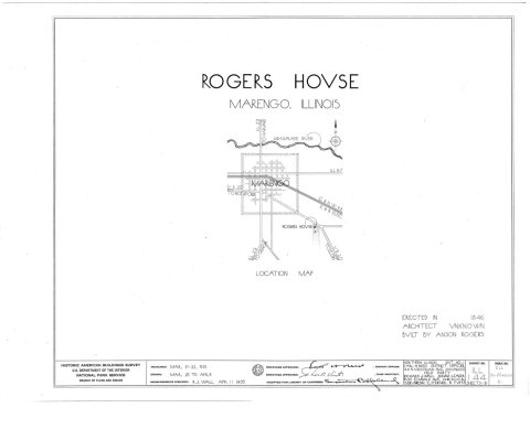
Its Register listings are the Charles H. Hibbard House and the Orson Rogers House. Its Register listings are the Charles H. Hibbard House and the Orson Rogers House. Below: 6 old photos and papers, maps from 1885 on, and the census since 1860.
Founding year: Wikidata. First post office: 1844.The full story ↓
History grade
What drives Marengo’s History grade
On its age, its old homes and the National Register, Marengo is more historic than 83% of U.S. towns, #155 of 768 in Illinois. All 3 inputs are above most U.S. towns; its age ranks highest and its National Register listings lowest.
A−
HistoryA character grade: shown, never part of Marengo’s overall grade.
Few Illinois towns list much on the Register (a typical Illinois town has 0.5 per 10,000 residents, the U.S. 2.4), so Marengo’s 2.8 sits above most of its state (70% of Illinois towns have fewer) while its 2 listings outnumber those of 60% of U.S. towns.
How sure. Graded on any two of the three inputs instead, the letter would still be A−. The pre-1940 share is a Census survey estimate (±8.4 points). Two sources give 1835.
Founding year: Wikidata (other dates in Quick answers). Homes: Census ACS 2020–24. National Register: National Park Service, May 2026 list; each listing counted once (boundary changes and added documentation belong to their listing), and a historic district counts its contributing buildings. How TownRatings grades history →
What stands out about Marengo’s past
Read from the archive, the National Register and the record. The page puts what stands out first.
Fire insurance maps drew every building, what it was made of and what it was used for, so insurers could price the risk of fire. Pick a year, then a sheet.
The Marengo Ridge conservation area, located north of the town, was formed by the retreating of the Wisconsin glacier roughly 24,000 years ago. Native Americans lived around the area prior to European settlers. When early settlers came to the area it proved difficult to farm. As a result, numerous blocks of timber were spared and still remain on the landscape.
The first European settler of Marengo was Calvin Spencer. He is the namesake of Calvin Spencer park. He arrived in the spring of 1835 with his wife and sister. In the autumn of that same year, Moses Spencer, the father of Calvin, also moved to Marengo with his wife who died shortly thereafter, becoming the first death in the town.
Passages that mention Marengo, cut from the printed page as they were published.
History of McHenry County, Illinois1885 · page 735Read the page →
Read the text
benefit. From it was taken the stone to build the school-houses at Marengo and Union. Near the southern line the railroad traverses the township from east to west, and the location of the depot at the village of Marengo makes an advantageous point for ship ping the products of adjoining townships.
Text read by machine from the scan; it may contain errors.
History of McHenry County, Illinois1885 · page 166Read the page →
Read the text
Two principal settlements were founded in 1835— the "Virginia settlement," so called because the majority of the early settlers in that neighborhood were Virginians; and the "Pleasant Grove'' settlement, now known as Marengo and vicinity. The Virginia settlement was principally in the eastern part of the present town of Dorr, where the following persons settled in 1835: James Dufield, Christopher Walkup, John Walkup, Josiah Walkup, Win. Hartman, John Gibson, John McClure and Samuel Gillilan.
Text read by machine from the scan; it may contain errors.
In Marengo Township the first school was taught by Caroline Cobb in 1839, but prior to this ( ). 1'. Rogers taught in a small log schoolhouse, marly opposite the Calvin Spencer residence in the village of Marengo.
Text read by machine from the scan; it may contain errors.
History of McHenry County, Illinois1922 · page 137Read the page →
Read the text
liar in 1 > 4 A . lie continued with Judge Skinner for two years, and then. May 7, 1S47, arrived at Marengo, being the second lawyer to locate there. In the autumn of 1848 lie was elected magistrate in a political contest between the northern and southern part of Marengo Township. About the same time he was appointed postmaster of Marengo, and held that position until 1861. In 1853, in company with Cornelius Lansing, he opened a banking house at Marengo, and carried it on until 1863, when he was appointed paymaster in the Army of the
Text read by machine from the scan; it may contain errors.
Scans and text from the Internet Archive. Books published in 1930 or earlier, which are in the public domain.
By decade
Marengo, decade by decade
4 decades in the archive, from the 1890s to the 1930s. Scroll each row; tap a photo for its story.
Nothing in the archives for these yearsWeddings on Main Street, storms, parades, school pictures, the old store. If it’s in your family album, it belongs here.
In 1835, according to Wikidata. Marengo’s post office opened in 1844, and the census of 1860 counted 1,119 people here.
How does Marengo rank for history?
Marengo is more historic than 83% of U.S. towns, #155 of 768 in Illinois. The History grade combines the town’s founding era, the share of homes built before 1940 and its National Register listings. It’s a character grade, so it isn’t part of the overall grade. How it works.
What is on the National Register in Marengo?
Two places: the Charles H. Hibbard House (listed 1979) and the Orson Rogers House (1979).
How old are the homes in Marengo?
22% of Marengo’s homes were built before 1940 (Census estimate, ±8.4 points), against a typical 11% for an Illinois town; the median home was built in 1974.
Founding dates: Wikidata, Wikipedia, the U.S. post office records of Blevins & Helbock (CC0) and the Census. Homes by year built: Census ACS 2020–24. National Register of Historic Places: National Park Service (list of May 22, 2026). Old photos, postcards and papers: Wikimedia Commons, the Library of Congress and other public archives, credited on each item’s page. Maps: U.S. Geological Survey historical topographic maps (via Esri) and Sanborn fire-insurance maps (Library of Congress). History text and census tables: Wikipedia (CC BY-SA 4.0). Places that used to be: USGS Geographic Names Information System (2021).
From Wikimedia Commons (6), the National Register of Historic Places (2), Wikipedia, Wikidata and Wikipedia for famous people, U.S. Geological Survey historical maps, U.S. Census counts (via Wikipedia), the US Post Offices dataset (Blevins & Helbock), the USGS Geographic Names Information System, Sanborn fire insurance maps (Library of Congress) and old county and town histories (Internet Archive). Archive images are copied here with their credits and licenses, shown on each photo’s page. Refreshed monthly.




 c. 1896
 1933


