Guest, Sign inJoin

Post to Keithsburg

We’ll email a one-tap link to publish your post. No password, and nothing is public until you click it.
Already a member? Sign in
–Not graded
History · Keithsburg

Keithsburg’s post office opened in 1848, and 26% of its homes were built before 1940

2 places in town are on the National Register, among them a historic district with 14 buildings. Below: 1 old photo or paper, maps from 1894 on, and the census since 1850.

1848first post office
2on the National Register
26%homes built before 1940
1old photo or paper
3famous people
Quick answers

How Keithsburg began, and where its name came from

When was Keithsburg founded?

1848

The Keithsburg post office opened in 1848, the earliest record of the town by name.

First census: 252 in 18502020 census: 550178 years

How did Keithsburg get its name?

Keithsburg was named for Robert Keith, a pioneer settler.

Founding year: the first Keithsburg post office (Blevins & Helbock, CC0). Name: Wikipedia, licensed CC BY-SA 4.0.

What stands out about Keithsburg’s past

Read from the archive, the National Register and the record. The page puts what stands out first.

★ What stands out · Help out

Start Keithsburg’s collection

The first neighbors to add old photos shape how Keithsburg’s history is told.

Decades since 1900 with photos
00s10s20s30s40s50s60s70s80s90s
1 of 10 decades. The empty ones are waiting for someone’s album.
People over time

Keithsburg, census by census

02004006008001,0001,2001,4001,6001850190019502000Peak: 1,566

Peaked at 1,566 in 1900; 550 people lived here in 2020.

18 censuses, 1850–2020.

U.S. Census Bureau decennial counts, from the census table on Keithsburg’s Wikipedia page.

Every building

Keithsburg, building by building, 1894–1913

Fire insurance maps drew every building, what it was made of and what it was used for, so insurers could price the risk of fire. Pick a year, then a sheet.

Keithsburg fire insurance map, 1894, sheet 11894Sheet 1 of 3
Edition
BrickWoodStone

Sanborn Map Company, via the Library of Congress. Editions published in 1930 or earlier, which are in the public domain.

The story so far

Keithsburg, in brief

Wikipedia doesn’t have a history of Keithsburg yet. The photos, dates and memories neighbors add here are how it gets written.

Keithsburg is a city in Mercer County, Illinois, United States, on the Mississippi River. The population was 550 at the 2020 census, down from 609 in 2010. It was named for Robert Keith, a pioneer settler. Due to a flood in 1993, there isn't much to do in Keithsburg. Some of the things that are still in use today include, a bar/restaurant named “The Eagles Nest”, and one or two playgrounds.

Its first post office opened in 1848. Between the 2010 and 2020 censuses its population fell from 609 to 550 (-10%).

Intro from Wikipedia. Population: U.S. Census Bureau.

From the old history books

What they wrote about Keithsburg in 1882

Passages that mention Keithsburg, cut from the printed page as they were published.

The Keithsburg 6z Eastern Railroad Company was organized under the law of the state providing for a general system of railroad incorporations, September 22, 1873, by the following incorporators : "W. D.
History of Mercer County1882 · page 170Read the page →
Read the text

The Keithsburg 6z Eastern Railroad Company was organized under the law of the state providing for a general system of railroad incorporations, September 22, 1873, by the following incorporators : "W. D.

Text read by machine from the scan; it may contain errors.
The first roads in this townsliip were opened by order of the county commissioners June 3, 1839. one havina; been surveyed from the bridsre on the Edwards river, on the New Boston and Knoxville state road, through Keithsburg to Gavitt's cabin (alias Cohimbia City) on to the county line, and the oth…
History of Mercer County1882 · page 166Read the page →
Read the text

The first roads in this townsliip were opened by order of the county commissioners June 3, 1839. one havina; been surveyed from the bridsre on the Edwards river, on the New Boston and Knoxville state road, through Keithsburg to Gavitt's cabin (alias Cohimbia City) on to the county line, and the other from Keithsburg to Isaiah Willits', and from thence intersecting with the county road leading to the Ohio settlement on Pope' River. This is substantially the description given in the petitions which Robert Keith presented at the regular term, March 9,

Text read by machine from the scan; it may contain errors.

Scans and text from the Internet Archive. Books published in 1930 or earlier, which are in the public domain.

Timeline

Keithsburg, 1848 to 1941

Woven from the archive, old maps, post office records, the National Register and the people born here.

  1. 19th century
  2. 1848Post officeThe Keithsburg post office opens
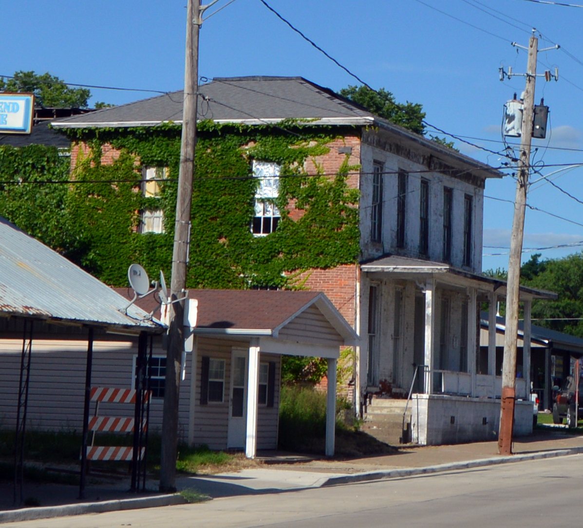
  3. 1849BuiltCommercial House is built
  4. 1867Born hereParke Wilson is born here
  5. 1872Born hereBen W. Olcott is born here
  6. 20th century
  7. 1900CensusPopulation peaks at 1,566
  8. 1901Born hereDan C. Ogle is born here
  9. 1935On the mapFirst mapped by the U.S. Geological Survey
  10. 1941In the archiveIllinois-Iowa, Keithsburg quadrangle
By decade

Keithsburg, decade by decade

One decade in the archive so far: the 1940s. Scroll each row; tap a photo for its story.

1950s–1990snothing yet
Nothing in the archives for these yearsWeddings on Main Street, storms, parades, school pictures, the old store. If it’s in your family album, it belongs here.
Add from your album
On the map

Keithsburg on the map, 1935 to 1982

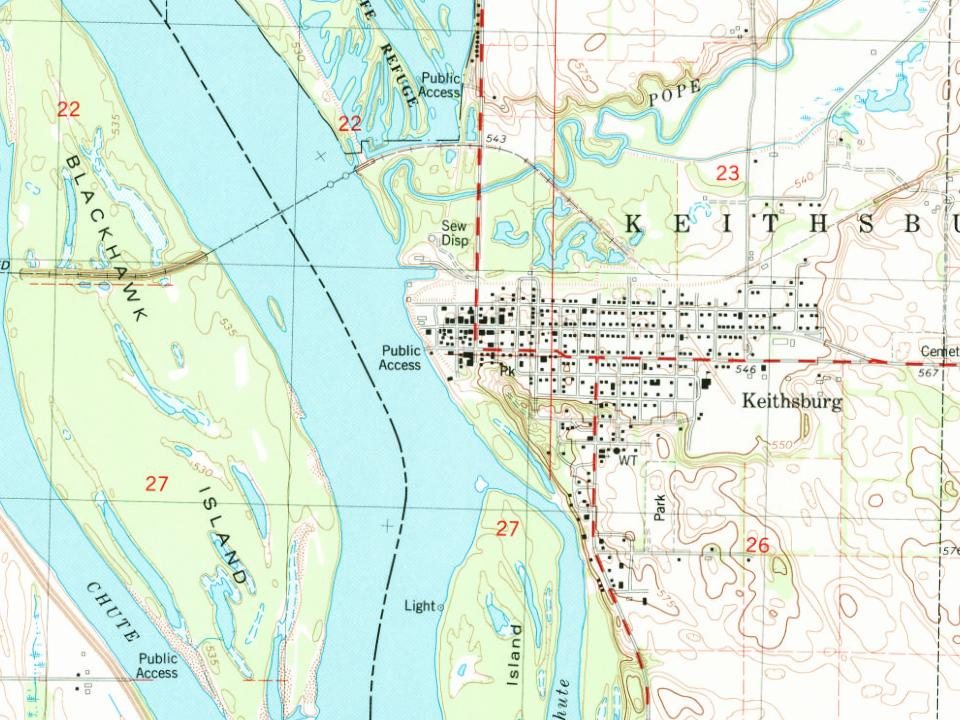
Every edition of the U.S. Geological Survey’s map of Keithsburg. Tap a year, or press play to watch the town change.

Keithsburg on the 1935 USGS mapKeithsburg on the 1941 USGS mapKeithsburg on the 1982 USGS map1935Keithsburg sheet · 1:62,500

U.S. Geological Survey historical topographic maps (public domain), via Esri’s collection of the scans. The red ring marks the center of Keithsburg.

Then & now

Stand where they stood

No then-and-now pairs yet. Take a photo from the same spot as an old one and they appear here side by side.

Illinois-Iowa, Keithsburg quadrangle
Retake this viewIllinois-Iowa, Keithsburg quadrangle, 1941

Find the spot, match the angle, and add your photo. It becomes the first then-and-now pair on Keithsburg’s page.

Retake this view · +15
On the National Register

2 listings protect 15 historic buildings

The country’s official list of buildings and places worth saving.

places listed
2
National Historic Landmarks
0
none yet
historic buildings protected
15
each building in a district counts
first listed
1983
Commercial House
BuildingsDistricts

Architectural styles listings

Italianate1

National Park Service, National Register of Historic Places. Photos from Wikimedia Commons, credited on each place’s page.

Famous people

3 famous people were born in Keithsburg

Writers, athletes, leaders and more, ranked by how widely they’re known.

See all →
Stories next door

History across the town line

Each neighbor’s History grade, on the same three inputs.

Questions about Keithsburg’s history

What year was Keithsburg founded?

The Keithsburg post office opened in 1848, the earliest record of the town by name (U.S. post office records).

What is on the National Register in Keithsburg?

Two places: the Commercial House (listed 1983) and the Keithsburg Historic District (1986).

Memory lane

What the archives can’t tell you, neighbors can.

Town Square →
Start a conversation
Sources

Where this page comes from

Founding dates: Wikidata, Wikipedia, the U.S. post office records of Blevins & Helbock (CC0) and the Census. Homes by year built: Census ACS 2020–24. National Register of Historic Places: National Park Service (list of May 22, 2026). Old photos, postcards and papers: Wikimedia Commons, the Library of Congress and other public archives, credited on each item’s page. Maps: U.S. Geological Survey historical topographic maps (via Esri) and Sanborn fire-insurance maps (Library of Congress). History text and census tables: Wikipedia (CC BY-SA 4.0). Places that used to be: USGS Geographic Names Information System (2021). How TownRatings grades history →

From Wikimedia Commons (5), Wikidata (2), the National Register of Historic Places (2), Wikidata and Wikipedia for famous people, U.S. Geological Survey historical maps, U.S. Census counts (via Wikipedia), the US Post Offices dataset (Blevins & Helbock), the USGS Geographic Names Information System, Sanborn fire insurance maps (Library of Congress) and old county and town histories (Internet Archive). Archive images are copied here with their credits and licenses, shown on each photo’s page. Refreshed monthly.