Hardin was first known as Terry's Landing, after its first settler, Dr. William Terry, according to John Lammy's American Centennial celebration speech in Hardin on July 4, 1876. Benjamin F. Childs bought the landing in 1835 and renamed it Childs' Landing. The village name was changed to Hardin when it became the county seat of Calhoun County in 1847. The new name honored John J. Hardin, a former congressman and a colonel in the First Regiment of Illinois Volunteers, who was killed earlier that year in the Mexican–American War. Hardin became the seat of Calhoun County after the county courthouse had burned down in Gilead. The seat was temporarily moved to Hamburg. Still, after Benjamin Childs donated five acres of land and fifty thousand bricks for the new courthouse, as well as a free barbecue, it was decided in a vote that the county seat would be moved in 1847.
Passages that mention Hardin, cut from the printed page as they were published.
The Biographical review of Johnson, Massac, Pope and Hardin counties, Illinois1893 · page 248Read the page →
Read the text
The father of our subject passed his boyhood in Hardin County, and in early manhood began to deal in horses .and mules, buying his stock in Illinois, and taking it down the river to some of the lower Mississippi River towns, Natchez being his principal market. In 1837 he came to Golconda and opened one of the first stores here and became one of the pioneer merchants of the place. He
Text read by machine from the scan; it may contain errors.
Scans and text from the Internet Archive. Books published in 1930 or earlier, which are in the public domain.
Founding dates: Wikidata, Wikipedia, the U.S. post office records of Blevins & Helbock (CC0) and the Census. Homes by year built: Census ACS 2020–24. National Register of Historic Places: National Park Service (list of May 22, 2026). Old photos, postcards and papers: Wikimedia Commons, the Library of Congress and other public archives, credited on each item’s page. Maps: U.S. Geological Survey historical topographic maps (via Esri) and Sanborn fire-insurance maps (Library of Congress). History text and census tables: Wikipedia (CC BY-SA 4.0). Places that used to be: USGS Geographic Names Information System (2021). How TownRatings grades history →
From Wikimedia Commons (4), Wikipedia, the US Post Offices dataset (Blevins & Helbock), the USGS Geographic Names Information System and old county and town histories (Internet Archive). Archive images are copied here with their credits and licenses, shown on each photo’s page. Refreshed monthly.


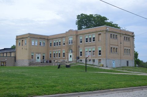 2014
 2014
 2014
 2014


