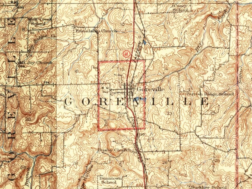
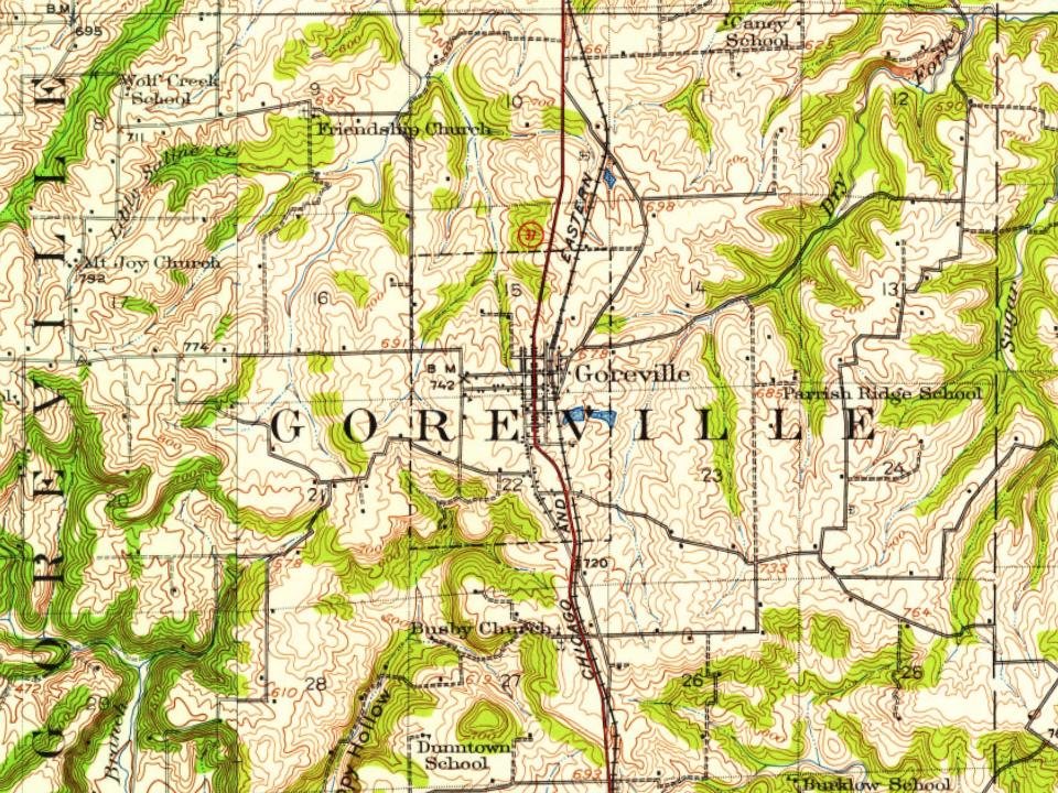
Most of Goreville was built recently: 6% of its homes predate 1940 and the median home dates from 1979. Below: maps from 1925 on and the census since 1900.
Founding year: the first Goreville post office (Blevins & Helbock, CC0).The full story ↓
History grade
What drives Goreville’s History grade
On its age, its old homes and the National Register, Goreville is more historic than 23% of U.S. towns. Its age holds the grade up; its National Register listings pull it down.
C−
HistoryA character grade: shown, never part of Goreville’s overall grade.
Few Illinois towns list much on the Register (a typical Illinois town has 0.5 per 10,000 residents, the U.S. 2.4), so Goreville’s 0.0 sits below most of its state (28% of Illinois towns have fewer) while its 0 listings outnumber those of 23% of U.S. towns.
How sure. Graded on any two of the three inputs instead, the letter would range from C− to C. The pre-1940 share is a Census survey estimate (±3.5 points). The founding year is the first post office, not a stated founding date.
Founding year: the first post office (other dates in Quick answers). Homes: Census ACS 2020–24. National Register: National Park Service, May 2026 list; each listing counted once (boundary changes and added documentation belong to their listing), and a historic district counts its contributing buildings. How TownRatings grades history →
What stands out about Goreville’s past
Read from the archive, the National Register and the record. The page puts what stands out first.
The village is named after John Gore, who bought 40 acres of land in the area from the United States Government in 1854. Gore operated a general store on the property. In 1866 a post office was built on the land and it was named Goreville in honor of him.
In 1898 the Chicago and Eastern Illinois Railroad built a train line about a mile northeast of town. Some of the town's businesses moved closer to the tracks and others formed by the tracks as the town grew. The Village of Goreville officially incorporated on April 18, 1900, with a population of 406.
Passages that mention Goreville, cut from the printed page as they were published.
A history of Johnson County, Illinois1925 · page 114Read the page →
Read the text
Goreville Presbyterian Church is also an old one, but there could be little definite data of the first organization found. Its home was the lower story of what is known as the Hall which stands between the old and new towns of Goreville. Some of the first members were Mrs. Mary J.
Text read by machine from the scan; it may contain errors.
A history of Johnson County, Illinois1925 · page 31Read the page →
Read the text
Goreville, a prosperous village in the northern part of our county, has a cannery. It is owned and operated by John Terry and while it does not boast of its capacity, it is said to store up in tin the very best quality of tomatoes and beans that can be found. The Charles Stone Quarry is situated in the southwest part of the county on the farm orginally owned by Pleasant Axley at the village of White Hill. This community is made up of the employees of the
Text read by machine from the scan; it may contain errors.
Scans and text from the Internet Archive. Books published in 1930 or earlier, which are in the public domain.
By decade
No old photos in the archives yet
Weddings on Main Street, storms, parades, school pictures, the old store. If it’s in your family album, it belongs here.
Be the first to add onePhotograph a print flat, in daylight, no flash.
The Goreville post office opened in 1866, the earliest record of the town by name (U.S. post office records).
How does Goreville rank for history?
Goreville is more historic than 23% of U.S. towns. The History grade combines the town’s founding era, the share of homes built before 1940 and its National Register listings. It’s a character grade, so it isn’t part of the overall grade. How it works.
How old are the homes in Goreville?
6% of Goreville’s homes were built before 1940 (Census estimate, ±3.5 points), against a typical 11% for an Illinois town; the median home was built in 1979.
Founding dates: Wikidata, Wikipedia, the U.S. post office records of Blevins & Helbock (CC0) and the Census. Homes by year built: Census ACS 2020–24. National Register of Historic Places: National Park Service (list of May 22, 2026). Old photos, postcards and papers: Wikimedia Commons, the Library of Congress and other public archives, credited on each item’s page. Maps: U.S. Geological Survey historical topographic maps (via Esri) and Sanborn fire-insurance maps (Library of Congress). History text and census tables: Wikipedia (CC BY-SA 4.0). Places that used to be: USGS Geographic Names Information System (2021).
From Wikipedia, U.S. Geological Survey historical maps, U.S. Census counts (via Wikipedia), the US Post Offices dataset (Blevins & Helbock), the USGS Geographic Names Information System and old county and town histories (Internet Archive). Archive images are copied here with their credits and licenses, shown on each photo’s page. Refreshed monthly.