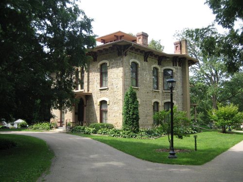
Freeport dates to 1827, and 34% of its homes were built before 1940
More historic than 89% of U.S. towns · #88 of 768 in Illinois. What drives it
Its Register listings are the Oscar Taylor House, the Soldiers' Monument and the Stephenson County Courthouse. Below: 15 old photos and papers, maps from 1890 on, and the census since 1840.
Founding year: Wikidata. First post office: 1837.The full story ↓
History grade
What drives Freeport’s History grade
On its age, its old homes and the National Register, Freeport is more historic than 89% of U.S. towns, #88 of 768 in Illinois. All 3 inputs are above most U.S. towns; its share of homes from before 1940 ranks highest and its National Register listings lowest.
A
HistoryA character grade: shown, never part of Freeport’s overall grade.
Few Illinois towns list much on the Register (a typical Illinois town has 0.5 per 10,000 residents, the U.S. 2.4), so Freeport’s 1.3 sits near the middle of its state (64% of Illinois towns have fewer) while its 3 listings outnumber those of 65% of U.S. towns.
How sure. Graded on any two of the three inputs instead, the letter would range from A− to A. The pre-1940 share is a Census survey estimate (±3.1 points). Two sources give 1827.
Founding year: Wikidata (other dates in Quick answers). Homes: Census ACS 2020–24. National Register: National Park Service, May 2026 list; each listing counted once (boundary changes and added documentation belong to their listing), and a historic district counts its contributing buildings. How TownRatings grades history →
What stands out about Freeport’s past
Read from the archive, the National Register and the record. The page puts what stands out first.
Fire insurance maps drew every building, what it was made of and what it was used for, so insurers could price the risk of fire. Pick a year, then a sheet.
Nothing in the archives for these yearsWeddings on Main Street, storms, parades, school pictures, the old store. If it’s in your family album, it belongs here.
The community was originally called Winneshiek. When it was incorporated, the new municipality took its name from the generosity of Tutty Baker, who was credited with running a "free port" on the Pecatonica River. The name "Winneshiek" was later adopted, and is preserved to this day, by the Freeport Community Theatre Group. In 1837, Stephenson County was formed, and Freeport became its seat of government in 1838. Linked by a stagecoach with Chicago, the community grew rapidly. In 1840, a frame courthouse was erected and the first school was founded. Within two years, Freeport had two newspapers, and in 1853, the two were joined by a third, which was published in German. By then, the community had a population of 2,000.
Passages that mention Freeport, cut from the printed page as they were published.
The History of Stephenson County, Illinois1880 · page 389Read the page →
Read the text
Previous to 1850, the village of Freeport was under a Board of County Supervisors. In the summer of 1850, the village was incorporated as a town, under the general law of the State. The corporate existence of the town of Freeport continued until the adoption of an act incorporating the city of Freeport, which took effect February 14, 1855.
Text read by machine from the scan; it may contain errors.
built by William Waddams, at Waddams Grove, in 1833. Lyman Brewster settled at Winslow in 1834; James Timms at Kellogg's Grove in 1835 . The first home in Freeport was built byWilliam Baker, in December, 1835. Stephenson County was organized in 1837 and in June that year Freeport was selected to be the County seat A stage line from
Text read by machine from the scan; it may contain errors.
The History of Stephenson County, Illinois1880 · page 562Read the page →
Read the text
The village of Florence is located on the Chicago, Milwaukee & St. Paul road, eight miles southwest of Freeport. It was established when the station was located there, and, though it has been in existence for upward of twenty years, its proximity to Freeport has prevented its becoming more than a village of very moderate pretensions. The most important building to be seen there is the German Evangelical Church, erected during the summer of 1877, under the direction of Presiding Elder Byers. It is a frame, 30x40, with a steeple seventy-five feet high, and cost, ready for occupation, $2,000. The Rev. John
Text read by machine from the scan; it may contain errors.
History of Stephenson County, Illinois1910 · page 182Read the page →
Read the text
In 1857, the booklet "Present Advantages and Future Prospects of the City of Freeport" gave the following description of the city schools: "If there is any one thing of which the City of Freeport may justly boast as her chief ornament, it is her schools. In 1856, the first system of graded instruction was put in practice. The whole city and its environs is a single school district. The schools are free to all and supported by general taxation. Three school commissioners are elected who have supervision of the whole, hire all the teachers, and direct the standard of promotion to higher classes. The commissioners are
Text read by machine from the scan; it may contain errors.
Scans and text from the Internet Archive. Books published in 1930 or earlier, which are in the public domain.
Timeline
Freeport, 1827 to 1964
Woven from the archive, old maps, post office records, the National Register and the people born here.
In 1827, according to Wikidata. Freeport’s post office opened in 1837, and the census of 1840 counted 491 people here.
How does Freeport rank for history?
Freeport is more historic than 89% of U.S. towns, #88 of 768 in Illinois. The History grade combines the town’s founding era, the share of homes built before 1940 and its National Register listings. It’s a character grade, so it isn’t part of the overall grade. How it works.
What is on the National Register in Freeport?
Three places: the Oscar Taylor House (listed 1984), the Soldiers' Monument (1998) and the Stephenson County Courthouse (1974).
How old are the homes in Freeport?
34% of Freeport’s homes were built before 1940 (Census estimate, ±3.1 points), against a typical 11% for an Illinois town; the median home was built in 1957.
Founding dates: Wikidata, Wikipedia, the U.S. post office records of Blevins & Helbock (CC0) and the Census. Homes by year built: Census ACS 2020–24. National Register of Historic Places: National Park Service (list of May 22, 2026). Old photos, postcards and papers: Wikimedia Commons, the Library of Congress and other public archives, credited on each item’s page. Maps: U.S. Geological Survey historical topographic maps (via Esri) and Sanborn fire-insurance maps (Library of Congress). History text and census tables: Wikipedia (CC BY-SA 4.0). Places that used to be: USGS Geographic Names Information System (2021).
From Wikimedia Commons (9), the Library of Congress (6), Wikidata (2), the National Register of Historic Places (3), Wikipedia, Wikidata and Wikipedia for famous people, U.S. Geological Survey historical maps, U.S. Census counts (via Wikipedia), the US Post Offices dataset (Blevins & Helbock), the USGS Geographic Names Information System, Sanborn fire insurance maps (Library of Congress) and old county and town histories (Internet Archive). Archive images are copied here with their credits and licenses, shown on each photo’s page. Refreshed monthly.

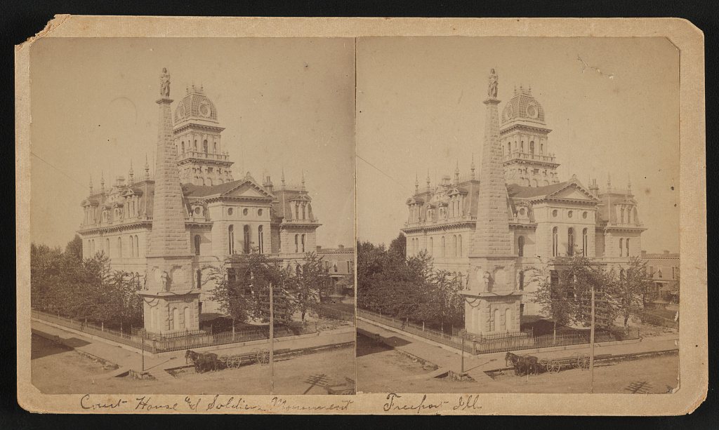


 1858
 1858
 1858
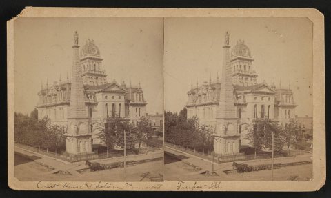 1860
 1885
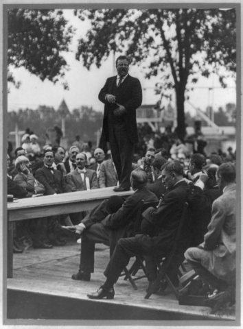 1885
 1885
 1885
 1900
 1903
 1903
 1906
 1909
 1910
 1911